198 Main St Epping, NH 03042
Estimated Value: $476,000 - $608,000
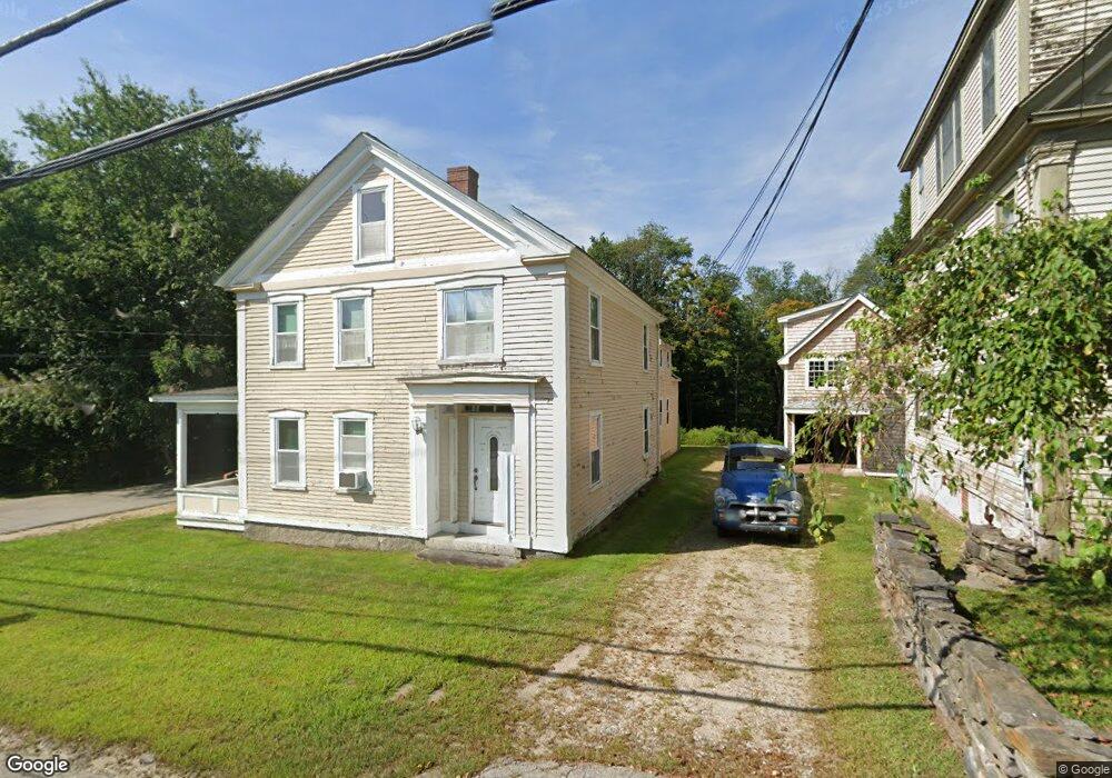
About This Home
This home is located at 198 Main St, Epping, NH 03042 and is currently estimated at $540,000, approximately $180 per square foot. 198 Main St is a home located in Rockingham County with nearby schools including Epping Elementary School, Epping Middle School, and Epping High School.
Ownership History
We collect this data history from publicly available records. To have your information removed, we recommend requesting removal directly through your county’s website.
Purchase Details
Purchase Details
Purchase Details
Home Financials for this Owner
Home Financials are based on the most recent Mortgage that was taken out on this home.Home Values in the Area
Average Home Value in this Area
Purchase History
We collect this data history from publicly available records. To have your information removed, we recommend requesting removal directly through your county’s website.
| Date | Buyer | Sale Price | Title Company |
|---|---|---|---|
| $47,500 | -- | ||
| $193,100 | -- | ||
| $169,900 | -- |
Mortgage History
We collect this data history from publicly available records. To have your information removed, we recommend requesting removal directly through your county’s website.
| Date | Status | Borrower | Loan Amount |
|---|---|---|---|
| Previous Owner | $173,000 | ||
| Previous Owner | $152,910 |
Tax History
We collect this data history from publicly available records. To have your information removed, we recommend requesting removal directly through your county’s website.
| Year | Tax Paid | Tax Assessment Tax Assessment Total Assessment is a certain percentage of the fair market value that is determined by local assessors to be the total taxable value of land and additions on the property. | Land | Improvement |
|---|---|---|---|---|
| 2025 | $7,749 | $516,600 | $136,500 | $380,100 |
| 2024 | $8,016 | $317,700 | $78,000 | $239,700 |
| 2023 | $7,434 | $317,700 | $78,000 | $239,700 |
| 2022 | $7,145 | $317,700 | $78,000 | $239,700 |
| 2021 | $7,123 | $317,700 | $78,000 | $239,700 |
| 2020 | $7,510 | $317,700 | $78,000 | $239,700 |
| 2019 | $6,476 | $233,800 | $71,700 | $162,100 |
| 2018 | $6,065 | $233,800 | $71,700 | $162,100 |
| 2017 | $6,065 | $233,800 | $71,700 | $162,100 |
| 2016 | $6,065 | $233,800 | $71,700 | $162,100 |
| 2015 | $6,065 | $233,800 | $71,700 | $162,100 |
| 2014 | $6,049 | $247,700 | $71,700 | $176,000 |
| 2013 | $6,012 | $247,700 | $71,700 | $176,000 |
Map
- 20 Center Ct
- 25 Mill St
- 13 Elm St
- 290 Calef Hwy Unit D-17
- 290 Calef Hwy Unit C12
- 27 Mulberry Ln
- 14 Mulberry Ln
- 7A Sunset Ridge Rd Unit A
- 10A Cardinal Ln
- 80 St Laurent St
- 20 Lamprey Village Dr
- 85 Coffin Rd Unit 20
- 1B Connor Ct Unit 1B
- 1A Connor Ct Unit 1A
- 65 Sunset Ridge Rd Unit 65B
- 60 Sunset Ridge Rd Unit 60A
- 55 Sunset Ridge Rd Unit 55A
- 55 Sunset Ridge Rd Unit 55B
- 54 Sunset Ridge Rd Unit 54B
- 3B Connor Ct Unit 3B
- 33 Prescott Rd
- 200 Main St
- 193 Main St
- 201 Main St
- 4 High St
- 184B Main St Unit 184B
- 184A Main St Unit 184A
- 184A Main St Unit A
- 184B Main St Unit B
- 204 Main St
- 5 Center Ct
- Unit 67 Canterbury Commons Unit 67
- Unit 68 Canterbury Commons Unit 68
- 5 Center Ct Unit 5
- 8 Center Ct
- 8 Center Ct Unit 8
- 46 Mulberry Ln Unit 19
- 13B Balsam Dr Unit 95
- 11B Balsam Dr Unit 97
- 11A Balsam Dr Unit 98
Ask me questions while you tour the home.