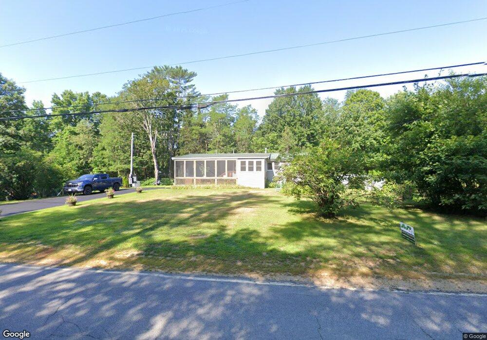
198 Stow Rd Stow, ME 04037
Estimated Value: $149,000 - $383,000
--
Bed
--
Bath
--
Sq Ft
1
Acres
About This Home
This home is located at 198 Stow Rd, Stow, ME 04037 and is currently estimated at $214,621. 198 Stow Rd is a home with nearby schools including New Suncook School, Molly Ockett School, and Molly Ockett Middle School.
Ownership History
Date
Name
Owned For
Owner Type
Purchase Details
Closed on
Aug 24, 2007
Sold by
Parmenter Joyce and Eastman Barbara
Bought by
Luongo James R and Luongo Michelle L
Current Estimated Value
Home Financials for this Owner
Home Financials are based on the most recent Mortgage that was taken out on this home.
Original Mortgage
$52,000
Outstanding Balance
$33,125
Interest Rate
6.78%
Mortgage Type
Purchase Money Mortgage
Estimated Equity
$181,496
Purchase Details
Closed on
May 24, 2006
Sold by
Kimball Mary E and Kimball Walter E
Bought by
Kimball Mary E and Kimball Walter E
Create a Home Valuation Report for This Property
The Home Valuation Report is an in-depth analysis detailing your home's value as well as a comparison with similar homes in the area
Home Values in the Area
Average Home Value in this Area
Purchase History
| Date | Buyer | Sale Price | Title Company |
|---|---|---|---|
| Luongo James R | -- | -- | |
| Kimball Mary E | -- | -- |
Source: Public Records
Mortgage History
| Date | Status | Borrower | Loan Amount |
|---|---|---|---|
| Open | Luongo James R | $52,000 |
Source: Public Records
Tax History Compared to Growth
Tax History
| Year | Tax Paid | Tax Assessment Tax Assessment Total Assessment is a certain percentage of the fair market value that is determined by local assessors to be the total taxable value of land and additions on the property. | Land | Improvement |
|---|---|---|---|---|
| 2024 | $1,677 | $105,803 | $41,000 | $64,803 |
| 2023 | $1,587 | $105,803 | $41,000 | $64,803 |
| 2022 | $1,476 | $105,803 | $41,000 | $64,803 |
| 2021 | $1,412 | $105,803 | $41,000 | $64,803 |
| 2020 | $1,061 | $70,237 | $30,000 | $40,237 |
| 2019 | $1,040 | $70,237 | $30,000 | $40,237 |
| 2018 | $955 | $70,237 | $30,000 | $40,237 |
| 2017 | $853 | $70,237 | $30,000 | $40,237 |
| 2016 | $818 | $70,237 | $30,000 | $40,237 |
| 2015 | $794 | $70,237 | $30,000 | $40,237 |
| 2013 | $811 | $70,237 | $30,000 | $40,237 |
Source: Public Records
Map
Nearby Homes
- 172 N Fryeburg Rd
- 23 Union Hill Rd
- 337 Union Hill Rd
- 0 Union Hill Rd Unit 23
- 94 Province Brook Estates Rd
- 145 Mcneil Rd
- 41 Federal Rd
- 7 Raven Ln
- 21-8 Raven Ln
- 92 Boot Hill Rd
- 179 Conifer Rd
- 247 Main St
- 231 Main St
- Lot 25 W Fryeburg Rd
- 145 Pleasant Point Rd
- 149 Pleasant Point Rd
- 82 Pleasant Point Rd
- 247 Smarts Hill Rd
- M:18L:20-4 Main St
- Lot B Mine Rd
- 384 Route 113 Stow Rd
- RT113 Stow Rd
- 00 S Old Stow Rd
- 214 Stow Rd
- 327 N Fryeburg Rd
- 235 Stow Rd
- 318 N Fryeburg Rd
- 7 Wildwoods Rd
- 300 N Fryeburg Rd
- 38 Wildwoods Rd
- 0 New Hampshire 113
- 277 Stow Rd
- 266 Stow Rd
- 265 N Fryeburg Rd
- 282 Stow Rd
- 289 Stow Rd
- 295 Stow Rd
- 302 Stow Rd
- 236 N Fryeburg Rd
- 235 N Fryeburg Rd