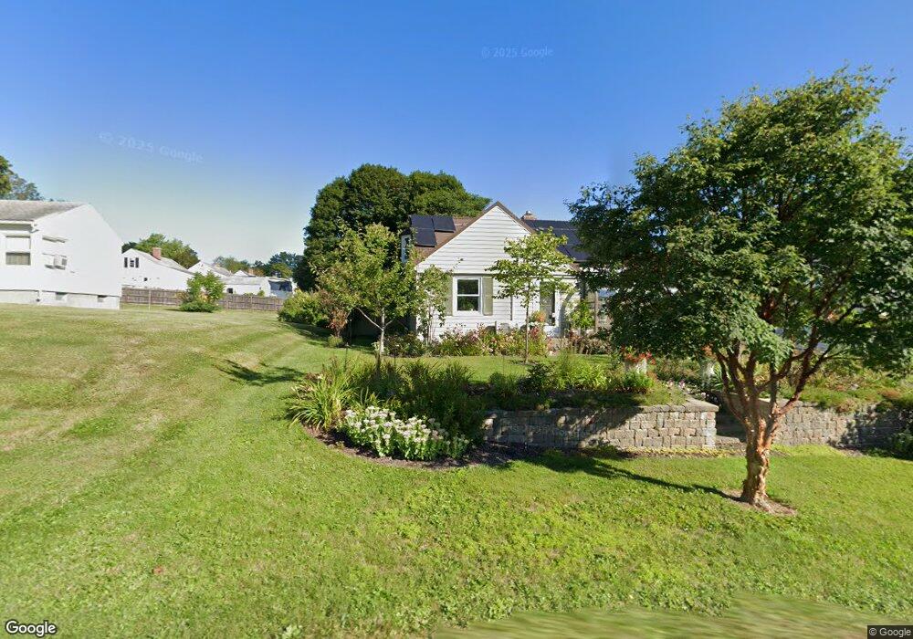
198 Windsor Ave Pittsfield, MA 01201
Estimated Value: $279,418 - $337,000
3
Beds
1
Bath
1,545
Sq Ft
$201/Sq Ft
Est. Value
About This Home
This home is located at 198 Windsor Ave, Pittsfield, MA 01201 and is currently estimated at $310,605, approximately $201 per square foot. 198 Windsor Ave is a home located in Berkshire County with nearby schools including Allendale Elementary School, Theodore Herberg Middle School, and Pittsfield High School.
Ownership History
Date
Name
Owned For
Owner Type
Purchase Details
Closed on
Aug 27, 2014
Sold by
Camyre Mary R
Bought by
Camyre Suzanne E and Camyre Mary R
Current Estimated Value
Purchase Details
Closed on
Nov 30, 1981
Bought by
Camyre Mary R and Tyree Michelle E
Create a Home Valuation Report for This Property
The Home Valuation Report is an in-depth analysis detailing your home's value as well as a comparison with similar homes in the area
Home Values in the Area
Average Home Value in this Area
Purchase History
| Date | Buyer | Sale Price | Title Company |
|---|---|---|---|
| Camyre Suzanne E | -- | -- | |
| Camyre Suzanne E | -- | -- | |
| Camyre Suzanne E | -- | -- | |
| Camyre Mary R | $34,000 | -- |
Source: Public Records
Mortgage History
| Date | Status | Borrower | Loan Amount |
|---|---|---|---|
| Previous Owner | Camyre Mary R | $97,600 | |
| Previous Owner | Camyre Mary R | $4,625 | |
| Previous Owner | Camyre Mary R | $15,250 |
Source: Public Records
Tax History Compared to Growth
Tax History
| Year | Tax Paid | Tax Assessment Tax Assessment Total Assessment is a certain percentage of the fair market value that is determined by local assessors to be the total taxable value of land and additions on the property. | Land | Improvement |
|---|---|---|---|---|
| 2025 | $4,388 | $244,600 | $69,900 | $174,700 |
| 2024 | $4,057 | $219,900 | $69,900 | $150,000 |
| 2023 | $3,798 | $207,300 | $69,900 | $137,400 |
| 2022 | $3,448 | $185,800 | $64,900 | $120,900 |
| 2021 | $3,196 | $166,000 | $64,900 | $101,100 |
| 2020 | $3,378 | $171,400 | $51,900 | $119,500 |
| 2019 | $2,866 | $147,600 | $47,900 | $99,700 |
| 2018 | $2,913 | $145,600 | $47,900 | $97,700 |
| 2017 | $2,831 | $144,200 | $49,900 | $94,300 |
| 2016 | $2,681 | $142,900 | $49,900 | $93,000 |
| 2015 | $2,581 | $142,900 | $49,900 | $93,000 |
Source: Public Records
Map
Nearby Homes
- 326 Dalton Ave
- 38 Allengate Ave
- 11 Stanley Ave
- 40 Roland St
- 81 Dartmouth St Unit 205
- 81 Dartmouth St Unit 102
- 25 Kensington Ave
- 41 Perrine Ave
- 46 Bossidy Dr
- 52 Bossidy Dr
- 156 Draper Ave
- 330 Connecticut Ave
- LOT 20 Plunkett St
- 52 Brown St
- 24 Glenwood Ave
- 48 Brown St
- 14 Allessio St
- 29 Glenwood Ave
- 26 Springside Ave
- 98 Oak Hill Rd
- 194 Windsor Ave
- 206 Windsor Ave
- 143 Brighton Ave
- 142 Ridgeway Ave
- 123 Brighton Ave
- 147 Brighton Ave
- 148 Ridgeway Ave
- 201 Windsor Ave
- 118 Ridgeway Ave
- 119 Brighton Ave
- 153 Brighton Ave
- 154 Ridgeway Ave
- 159 Brighton Ave
- 131 Ridgeway Ave
- 113 Brighton Ave
- 110 Ridgeway Ave
- 135 Ridgeway Ave
- 160 Ridgeway Ave
- 144 Brighton Ave
- 125 Ridgeway Ave