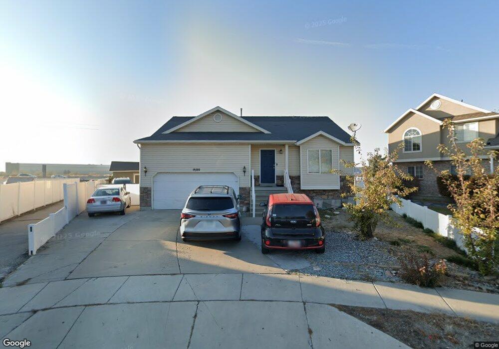
1980 Gander Ln Salt Lake City, UT 84116
Westpointe NeighborhoodEstimated Value: $506,000 - $563,000
3
Beds
3
Baths
1,207
Sq Ft
$440/Sq Ft
Est. Value
About This Home
This home is located at 1980 Gander Ln, Salt Lake City, UT 84116 and is currently estimated at $530,839, approximately $439 per square foot. 1980 Gander Ln is a home located in Salt Lake County with nearby schools including North Star Elementary School, Northwest Middle School, and West High.
Ownership History
Date
Name
Owned For
Owner Type
Purchase Details
Closed on
Mar 30, 2022
Sold by
Tavui Maisa R and Tavui Susi R
Bought by
Maynes Randall R and Maynes Heitonga Maile
Current Estimated Value
Home Financials for this Owner
Home Financials are based on the most recent Mortgage that was taken out on this home.
Original Mortgage
$526,782
Outstanding Balance
$493,064
Interest Rate
3.92%
Mortgage Type
FHA
Estimated Equity
$37,775
Purchase Details
Closed on
Mar 29, 2022
Sold by
Tavui Maisa R and Tavui Susi R
Bought by
Maynes Randall R and Maynes Heitonga Maile
Home Financials for this Owner
Home Financials are based on the most recent Mortgage that was taken out on this home.
Original Mortgage
$526,782
Outstanding Balance
$493,064
Interest Rate
3.92%
Mortgage Type
FHA
Estimated Equity
$37,775
Purchase Details
Closed on
Aug 30, 2001
Sold by
Ivory Homes Ltd
Bought by
Tavui Maisa and Tavui Susi R
Home Financials for this Owner
Home Financials are based on the most recent Mortgage that was taken out on this home.
Original Mortgage
$159,210
Interest Rate
9.25%
Create a Home Valuation Report for This Property
The Home Valuation Report is an in-depth analysis detailing your home's value as well as a comparison with similar homes in the area
Home Values in the Area
Average Home Value in this Area
Purchase History
| Date | Buyer | Sale Price | Title Company |
|---|---|---|---|
| Maynes Randall R | -- | Novation Title Insurance Agenc | |
| Maynes Randall R | -- | Novation Title Insurance Agenc | |
| Tavui Maisa | -- | Cottonwood Title Ins Agency |
Source: Public Records
Mortgage History
| Date | Status | Borrower | Loan Amount |
|---|---|---|---|
| Open | Maynes Randall R | $526,782 | |
| Previous Owner | Tavui Maisa | $159,210 |
Source: Public Records
Tax History Compared to Growth
Tax History
| Year | Tax Paid | Tax Assessment Tax Assessment Total Assessment is a certain percentage of the fair market value that is determined by local assessors to be the total taxable value of land and additions on the property. | Land | Improvement |
|---|---|---|---|---|
| 2025 | $2,668 | $573,900 | $134,000 | $439,900 |
| 2024 | $2,668 | $509,000 | $126,800 | $382,200 |
| 2023 | $2,783 | $511,900 | $101,600 | $410,300 |
| 2022 | $2,635 | $454,700 | $99,600 | $355,100 |
| 2021 | $2,046 | $319,600 | $78,200 | $241,400 |
| 2020 | $1,972 | $293,300 | $69,800 | $223,500 |
| 2019 | $2,011 | $281,400 | $65,000 | $216,400 |
| 2018 | $1,815 | $249,900 | $65,000 | $184,900 |
| 2017 | $1,852 | $239,100 | $65,000 | $174,100 |
| 2016 | $1,836 | $225,100 | $54,700 | $170,400 |
| 2015 | $1,668 | $193,100 | $53,600 | $139,500 |
| 2014 | $1,600 | $183,800 | $52,500 | $131,300 |
Source: Public Records
Map
Nearby Homes
- 238 N 2200 W
- 1888 W New York Dr
- 1770 W Trafalga Way Unit B
- 1178 N Reveille Cir
- 1281 Carousel St
- 1301 N 1500 W
- 1989 Sir Timothy Ave
- 1004 N Sir Michael Dr
- 1366 Dupont Ave
- 1379 Dupont Ave
- 1183 Catherine St W
- 1320 W Sunset Dr
- 1827 Omni Ave
- 949 Libby Way
- 2075 W 2670 N
- 1118 N 1400 W
- 1305 N Valentine St
- 1245 W Siena Cir
- 825 Star Crest Dr W
- 955 Catherine St W
- 1980 W Gander Ln
- 1981 Gander Ln
- 1974 W Gander Ln
- 1974 Gander Ln
- 1983 W Red Angus Dr
- 1968 Gander Ln
- 1975 W Red Angus Dr
- 1975 Gander Ln
- 1967 W Red Angus Dr
- 1969 W Gander Ln
- 1969 Gander Ln
- 1960 Gander Ln
- 1960 W Gander Ln
- 1961 W Gander Ln
- 1961 Gander Ln
- 1972 W Quarter Horse Ave
- 1961 W Red Angus Dr
- 1952 Gander Ln
- 1952 W Gander Ln
- 1964 W Quarter Horse Ave