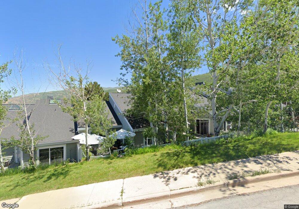
1980 High Pointe Dr Bountiful, UT 84010
Estimated Value: $397,000 - $652,000
4
Beds
3
Baths
2,333
Sq Ft
$223/Sq Ft
Est. Value
About This Home
This home is located at 1980 High Pointe Dr, Bountiful, UT 84010 and is currently estimated at $521,381, approximately $223 per square foot. 1980 High Pointe Dr is a home located in Davis County with nearby schools including Valley View School, Mueller Park Junior High School, and Bountiful High School.
Ownership History
Date
Name
Owned For
Owner Type
Purchase Details
Closed on
Jan 7, 2021
Sold by
Shannon Nunzia and Weston Nunzia
Bought by
Shannon Nunzia
Current Estimated Value
Home Financials for this Owner
Home Financials are based on the most recent Mortgage that was taken out on this home.
Original Mortgage
$195,150
Outstanding Balance
$173,742
Interest Rate
2.7%
Mortgage Type
New Conventional
Estimated Equity
$347,639
Purchase Details
Closed on
Jan 5, 2021
Sold by
Shannon Nunzia
Bought by
Shannon Nunzia and Shannon Patrick Edward
Home Financials for this Owner
Home Financials are based on the most recent Mortgage that was taken out on this home.
Original Mortgage
$195,150
Outstanding Balance
$173,742
Interest Rate
2.7%
Mortgage Type
New Conventional
Estimated Equity
$347,639
Purchase Details
Closed on
Apr 6, 2016
Sold by
Weston Nunzia and Biondo Marco
Bought by
Weston Nunzia
Purchase Details
Closed on
Oct 15, 2009
Sold by
Muir Donald J
Bought by
Becker Kristina
Purchase Details
Closed on
Apr 15, 2004
Sold by
Federal Home Loan Mortgage Corporation
Bought by
Muir Donald J
Home Financials for this Owner
Home Financials are based on the most recent Mortgage that was taken out on this home.
Original Mortgage
$139,425
Interest Rate
5.38%
Mortgage Type
Purchase Money Mortgage
Purchase Details
Closed on
Jul 25, 2003
Sold by
Washington Mutual Bank Fa
Bought by
Federal Home Loan Mortgage Corporation
Purchase Details
Closed on
Jul 16, 2003
Sold by
Dunford Kathryn A
Bought by
Washington Mutual Bank Fa and Washington Mutual Home Loans Inc
Purchase Details
Closed on
Dec 10, 2002
Sold by
Board Of Trustees Of The High Pointe Ass
Bought by
High Pointe Owners Assn
Purchase Details
Closed on
Jul 18, 1997
Sold by
Dunford Nicholas A
Bought by
Dunford Kathryn A
Create a Home Valuation Report for This Property
The Home Valuation Report is an in-depth analysis detailing your home's value as well as a comparison with similar homes in the area
Purchase History
| Date | Buyer | Sale Price | Title Company |
|---|---|---|---|
| Shannon Nunzia | -- | Meridian Title Company | |
| Shannon Nunzia | -- | Meridian Title Company | |
| Weston Nunzia | -- | First American Title | |
| Becker Kristina | -- | Advanced Title Ins Ag Slc | |
| Muir Donald J | -- | First American Title Co | |
| Federal Home Loan Mortgage Corporation | -- | First Southwestern Title Age | |
| Washington Mutual Bank Fa | $178,821 | First Southwestern Title Age | |
| High Pointe Owners Assn | -- | -- | |
| Dunford Kathryn A | -- | Associated Title Company |
Source: Public Records
Mortgage History
| Date | Status | Borrower | Loan Amount |
|---|---|---|---|
| Open | Shannon Nunzia | $195,150 | |
| Previous Owner | Muir Donald J | $139,425 | |
| Closed | Muir Donald J | $37,180 |
Source: Public Records
Tax History
| Year | Tax Paid | Tax Assessment Tax Assessment Total Assessment is a certain percentage of the fair market value that is determined by local assessors to be the total taxable value of land and additions on the property. | Land | Improvement |
|---|---|---|---|---|
| 2025 | $2,557 | $254,650 | $106,150 | $148,500 |
| 2024 | $2,473 | $250,250 | $88,550 | $161,700 |
| 2023 | $2,508 | $459,000 | $163,000 | $296,000 |
| 2022 | $2,463 | $246,950 | $92,400 | $154,550 |
| 2021 | $2,381 | $366,000 | $155,000 | $211,000 |
| 2020 | $2,167 | $337,000 | $125,000 | $212,000 |
| 2019 | $2,074 | $315,000 | $125,000 | $190,000 |
| 2018 | $1,784 | $268,000 | $139,120 | $128,880 |
| 2016 | $1,771 | $144,227 | $37,400 | $106,827 |
| 2015 | $1,629 | $125,455 | $37,400 | $88,055 |
| 2014 | $1,810 | $142,672 | $18,333 | $124,339 |
| 2013 | -- | $115,309 | $24,475 | $90,834 |
Source: Public Records
Map
Nearby Homes
- 1820 S High Pointe Dr
- 1475 Mueller Park Rd
- 1735 S Temple Ct Unit 203
- 1785 1450 E Unit 604
- 1878 E Ridge Point Dr
- 1596 E Millbrook Way
- 1676 E Mueller Park Rd
- 2091 Windsor Park Cir
- 0 Bountiful Blvd
- 1087 Arlington Way
- 2136 Elaine Dr
- 1014 Beverly Way
- 842 E 2150 S
- 1997 S 800 E
- 0 Lot Bountiful Blvd
- 771 E 1825 S
- 795 Abby Ln Unit 5
- 626 E 2150 S
- 861 E Millbrook Way
- 631 E 1700 S
- 1980 High Pointe Dr
- 1990 High Pointe Dr
- 1990 High Pointe Dr
- 1970 High Pointe Dr
- 1960 Cave Hollow Way
- 1960 High Pointe Dr Unit 22
- 1960 High Pointe Dr
- 1950 S High Pointe Dr
- 1950 High Pointe Dr
- 1855 High Pointe Dr Unit 16
- 1855 High Pointe Dr
- 1855 High Pointe Dr
- 1940 High Pointe Dr
- 1845 High Pointe Dr
- 1845 High Pointe Dr
- 1947 High Pointe Dr Unit 27
- 1947 High Pointe Dr
- 1959 High Pointe Dr
- 1835 High Pointe Dr
- 1835 High Pointe Dr Unit 14