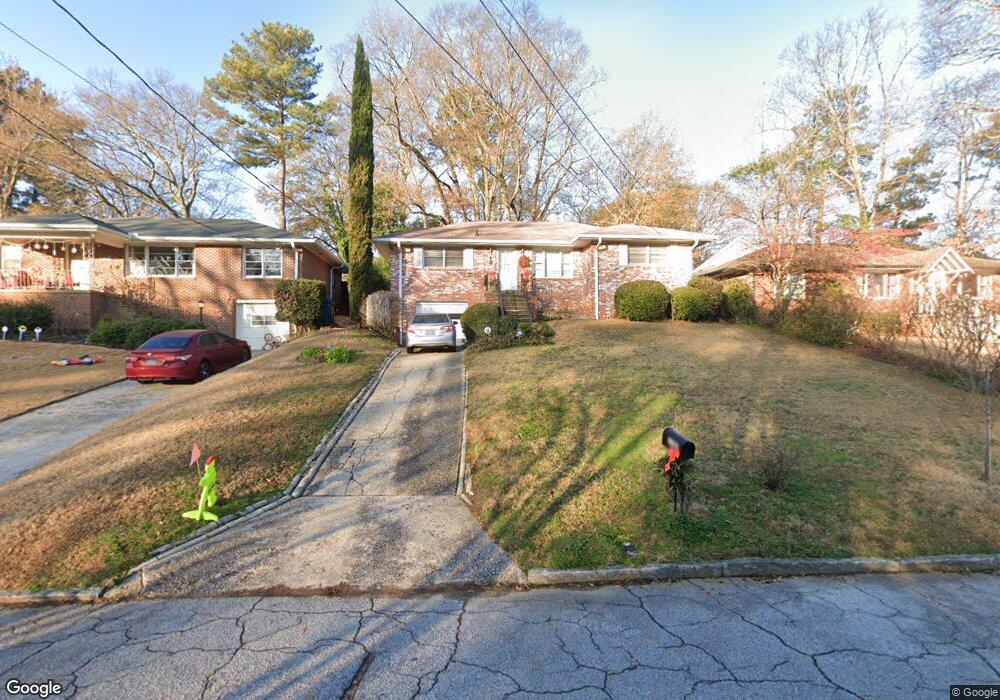
1980 Lebanon Dr NE Atlanta, GA 30324
Morningside NeighborhoodEstimated Value: $615,714 - $758,000
3
Beds
2
Baths
1,263
Sq Ft
$540/Sq Ft
Est. Value
About This Home
This home is located at 1980 Lebanon Dr NE, Atlanta, GA 30324 and is currently estimated at $681,679, approximately $539 per square foot. 1980 Lebanon Dr NE is a home located in Fulton County with nearby schools including Morningside Elementary School, Midtown High School, and Carlisle Montessori School of Buckhead.
Ownership History
Date
Name
Owned For
Owner Type
Purchase Details
Closed on
Dec 19, 2016
Sold by
Carrie
Bought by
Przybilla Carrie E and Barry Rogers P
Current Estimated Value
Home Financials for this Owner
Home Financials are based on the most recent Mortgage that was taken out on this home.
Original Mortgage
$250,000
Outstanding Balance
$204,444
Interest Rate
3.94%
Mortgage Type
New Conventional
Estimated Equity
$477,235
Purchase Details
Closed on
Dec 10, 2003
Sold by
Forster Ruth R
Bought by
Przybilla Carrie
Home Financials for this Owner
Home Financials are based on the most recent Mortgage that was taken out on this home.
Original Mortgage
$224,750
Interest Rate
5.77%
Mortgage Type
New Conventional
Create a Home Valuation Report for This Property
The Home Valuation Report is an in-depth analysis detailing your home's value as well as a comparison with similar homes in the area
Home Values in the Area
Average Home Value in this Area
Purchase History
| Date | Buyer | Sale Price | Title Company |
|---|---|---|---|
| Przybilla Carrie E | -- | -- | |
| Przybilla Carrie | $250,000 | -- |
Source: Public Records
Mortgage History
| Date | Status | Borrower | Loan Amount |
|---|---|---|---|
| Open | Przybilla Carrie E | $250,000 | |
| Previous Owner | Przybilla Carrie | $224,750 |
Source: Public Records
Tax History Compared to Growth
Tax History
| Year | Tax Paid | Tax Assessment Tax Assessment Total Assessment is a certain percentage of the fair market value that is determined by local assessors to be the total taxable value of land and additions on the property. | Land | Improvement |
|---|---|---|---|---|
| 2025 | $2,527 | $170,000 | $72,520 | $97,480 |
| 2023 | $6,624 | $160,000 | $70,520 | $89,480 |
| 2022 | $2,533 | $160,000 | $70,520 | $89,480 |
| 2021 | $4,885 | $173,360 | $70,520 | $102,840 |
| 2020 | $1,597 | $118,000 | $36,840 | $81,160 |
| 2019 | $351 | $118,000 | $36,840 | $81,160 |
| 2018 | $1,878 | $130,640 | $36,840 | $93,800 |
| 2017 | $1,954 | $91,520 | $25,800 | $65,720 |
| 2016 | $2,452 | $100,480 | $25,800 | $74,680 |
| 2015 | $2,982 | $86,400 | $25,280 | $61,120 |
| 2014 | $3,246 | $100,480 | $25,800 | $74,680 |
Source: Public Records
Map
Nearby Homes
- 1835 Rock Springs Ln NE
- 502 Ansley Villa Dr NE
- 534 Allen Rd NE
- 1803 White Oak Hollow NE
- 1761 Monroe Dr NE
- 518 Bismark Rd NE
- 618 NE Morning Glory Place NE
- 1993 Rockledge Rd NE
- 1822 N Rock Springs Rd NE Unit 24
- 2013 Rockledge Rd NE
- 558 Bismark Rd NE
- 590 Bismark Rd NE
- 1764 Morningtide Ln NE
- 2196 Niles Place NE
- 2188 Niles Place NE
- 705 Bismark Rd NE
- 2026 Manchester St NE
- 1986 Lebanon Dr NE
- 1974 Lebanon Dr NE
- 1968 Lebanon Dr NE
- 1975 Kilburn Dr NE
- 1981 Kilburn Dr NE
- 1962 Lebanon Dr NE
- 1969 Kilburn Dr NE
- 1979 Lebanon Dr NE
- 1987 Lebanon Dr NE
- 1969 Lebanon Dr NE
- 1957 Kilburn Dr NE
- 1956 Lebanon Dr NE
- 1963 Lebanon Dr NE
- 1950 Lebanon Dr NE
- 1950 Lebanon Dr NE Unit 1950
- 1980 Kilburn Dr NE
- 1951 Kilburn Dr NE
- 1974 Kilburn Dr NE
- 1984 Kilburn Dr NE
- 1944 Lebanon Dr NE