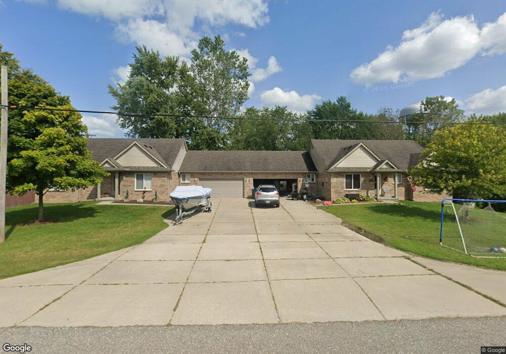
1980 Maple Rd Kimball, MI 48074
Estimated Value: $319,000 - $475,000
3
Beds
1
Bath
5,376
Sq Ft
$71/Sq Ft
Est. Value
About This Home
This home is located at 1980 Maple Rd, Kimball, MI 48074 and is currently estimated at $382,474, approximately $71 per square foot. 1980 Maple Rd is a home located in St. Clair County with nearby schools including Kimball Elementary School, Central Middle School, and Port Huron High School.
Ownership History
Date
Name
Owned For
Owner Type
Purchase Details
Closed on
Nov 8, 2013
Sold by
Stockwell Shawn M
Bought by
Lickwala David Pauyl
Current Estimated Value
Home Financials for this Owner
Home Financials are based on the most recent Mortgage that was taken out on this home.
Original Mortgage
$150,590
Outstanding Balance
$112,923
Interest Rate
4.37%
Mortgage Type
FHA
Estimated Equity
$269,551
Purchase Details
Closed on
Oct 26, 2007
Sold by
Mortgage Electronic Registrations System
Bought by
Stockwell Shawn M
Home Financials for this Owner
Home Financials are based on the most recent Mortgage that was taken out on this home.
Original Mortgage
$124,019
Interest Rate
6.3%
Mortgage Type
FHA
Purchase Details
Closed on
Aug 18, 2005
Sold by
Chestnut Homes Inc
Bought by
Ferranti Vernon
Purchase Details
Closed on
Feb 4, 2005
Sold by
Dimaggio Matt and Dimaggio Rosanna
Bought by
Chestnut Homes Inc
Create a Home Valuation Report for This Property
The Home Valuation Report is an in-depth analysis detailing your home's value as well as a comparison with similar homes in the area
Home Values in the Area
Average Home Value in this Area
Purchase History
| Date | Buyer | Sale Price | Title Company |
|---|---|---|---|
| Lickwala David Pauyl | $185,000 | Attorneys Title Agency Llc | |
| Stockwell Shawn M | $125,000 | None Available | |
| Ferranti Vernon | $340,000 | None Available | |
| Chestnut Homes Inc | -- | None Available |
Source: Public Records
Mortgage History
| Date | Status | Borrower | Loan Amount |
|---|---|---|---|
| Open | Lickwala David Pauyl | $150,590 | |
| Previous Owner | Stockwell Shawn M | $124,019 |
Source: Public Records
Tax History
| Year | Tax Paid | Tax Assessment Tax Assessment Total Assessment is a certain percentage of the fair market value that is determined by local assessors to be the total taxable value of land and additions on the property. | Land | Improvement |
|---|---|---|---|---|
| 2025 | $4,202 | $158,800 | $0 | $0 |
| 2024 | $4,008 | $146,700 | $0 | $0 |
| 2023 | $3,751 | $138,800 | $0 | $0 |
| 2022 | $5,370 | $137,000 | $0 | $0 |
| 2020 | $3,583 | $122,800 | $122,800 | $0 |
| 2019 | $3,504 | $102,400 | $0 | $0 |
| 2018 | $3,433 | $101,600 | $0 | $0 |
| 2017 | $3,482 | $108,000 | $0 | $0 |
| 2016 | $2,432 | $108,000 | $0 | $0 |
| 2015 | -- | $111,100 | $111,100 | $0 |
| 2014 | -- | $103,500 | $103,500 | $0 |
| 2013 | -- | $131,600 | $0 | $0 |
Source: Public Records
Map
Nearby Homes
- V/L Allen
- 1786 Omar Rd
- 0 Allen Rd Unit 20250008597
- 0 Allen Rd Unit 20250008612
- 1604 Allen Rd
- 00 Howard Rd
- 1906 Morningstar Ave
- 1948 Meadowlark Ln
- 0 Wadhams Rd Unit 50155021
- 2007 Edward Ln E
- 0000 Range Rd
- 2047 Edward Ln E
- 1405 Range Rd
- 0 Lapeer Rd Unit 50137357
- 00 Range Rd
- 00 Griswold Rd
- 1091 Allen Rd
- 2758 E Lake Dr
- 0 Wall Rd Unit 50185999
- 4911 Castlewood Dr
- 1976 Maple Rd
- 5155 Griswold Rd
- 5125 Griswold Rd
- 5135 Griswold Rd
- 5145 Griswold Rd
- 5159 Griswold Rd
- 5165 Griswold Rd
- 1934 Maple Rd
- 5117 Griswold Rd
- 5115 Griswold Rd
- 5173 Griswold Rd
- 1939 Maple Rd
- 1928 Maple Rd
- 1933 Maple Rd
- 5177 Griswold Rd
- 5105 Griswold Rd
- 5183 Griswold Rd
- 00 Vac Carman
- 1931 Maple Rd
- 5148 Griswold Rd
Your Personal Tour Guide
Ask me questions while you tour the home.