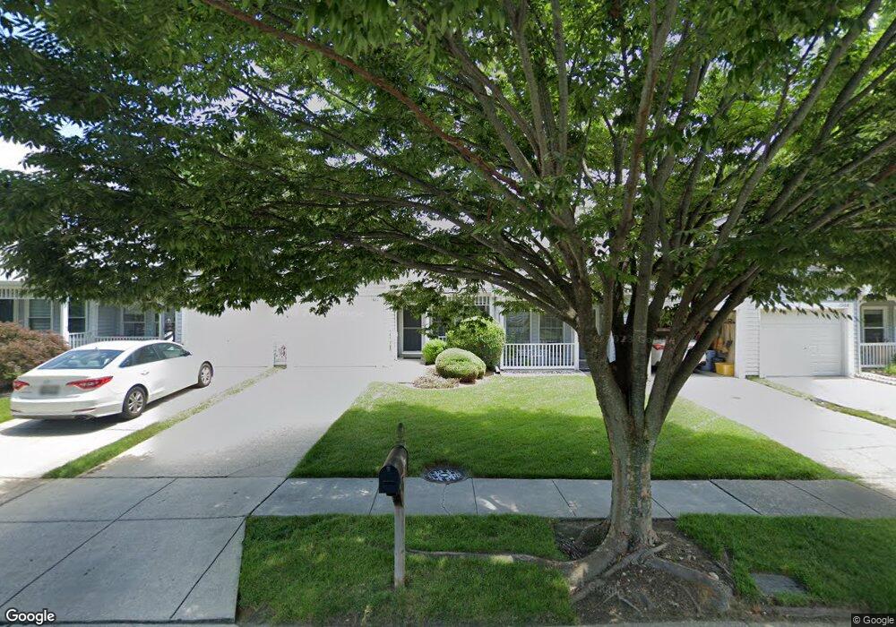
1980 Marconi Cir Annapolis, MD 21401
Parole NeighborhoodEstimated Value: $398,000 - $439,000
--
Bed
2
Baths
1,200
Sq Ft
$345/Sq Ft
Est. Value
About This Home
This home is located at 1980 Marconi Cir, Annapolis, MD 21401 and is currently estimated at $414,274, approximately $345 per square foot. 1980 Marconi Cir is a home located in Anne Arundel County with nearby schools including Rolling Knolls Elementary School, Wiley H. Bates Middle School, and Annapolis High School.
Ownership History
Date
Name
Owned For
Owner Type
Purchase Details
Closed on
Mar 11, 2004
Sold by
Aluisi Francis J
Bought by
Malloy James A
Current Estimated Value
Purchase Details
Closed on
Apr 9, 2001
Sold by
Aluisi Francis J
Bought by
Aluisi Francis J and Aluisi Patricia A
Purchase Details
Closed on
Jun 19, 2000
Sold by
Vargo Joseph W
Bought by
Aluisi Francis J
Create a Home Valuation Report for This Property
The Home Valuation Report is an in-depth analysis detailing your home's value as well as a comparison with similar homes in the area
Home Values in the Area
Average Home Value in this Area
Purchase History
| Date | Buyer | Sale Price | Title Company |
|---|---|---|---|
| Malloy James A | $224,000 | -- | |
| Aluisi Francis J | -- | -- | |
| Aluisi Francis J | $167,900 | -- |
Source: Public Records
Mortgage History
| Date | Status | Borrower | Loan Amount |
|---|---|---|---|
| Closed | Malloy James A | -- |
Source: Public Records
Tax History Compared to Growth
Tax History
| Year | Tax Paid | Tax Assessment Tax Assessment Total Assessment is a certain percentage of the fair market value that is determined by local assessors to be the total taxable value of land and additions on the property. | Land | Improvement |
|---|---|---|---|---|
| 2025 | $3,121 | $340,167 | -- | -- |
| 2024 | $3,121 | $315,833 | $0 | $0 |
| 2023 | $3,015 | $291,500 | $160,000 | $131,500 |
| 2022 | $2,815 | $284,433 | $0 | $0 |
| 2021 | $5,531 | $277,367 | $0 | $0 |
| 2020 | $2,676 | $270,300 | $140,000 | $130,300 |
| 2019 | $2,622 | $255,467 | $0 | $0 |
| 2018 | $2,440 | $240,633 | $0 | $0 |
| 2017 | $2,451 | $225,800 | $0 | $0 |
| 2016 | -- | $220,867 | $0 | $0 |
| 2015 | -- | $215,933 | $0 | $0 |
| 2014 | -- | $211,000 | $0 | $0 |
Source: Public Records
Map
Nearby Homes
- 2507 Tudo Ct
- 1945 Marconi Cir
- 1909 Marconi Cir
- 1007 Boom Ct
- 916 Sextant Way
- 1012 Mastline Dr
- 2664 Compass Dr
- 1003 Mastline Dr
- 2600 Compass Dr
- 2601 Compass Dr
- 2671 Cunningham Hole Rd
- 932 Riversedge Cir
- 2737 Yeomans Lantern Ct
- 940 Astern Way Unit 604
- 940 Astern Way Unit 309
- 930 Astern Way Unit 511
- 930 Astern Way Unit 405
- 930 Astern Way Unit 502
- 930 Astern Way Unit 609
- 1907 Mackiebeth Ct
- 1978 Marconi Cir
- 1982 Marconi Cir
- 1976 Marconi Cir
- 1984 Marconi Cir
- 1974 Marconi Cir
- 2528 Tudo Ct
- 2526 Tudo Ct
- 2524 Tudo Ct
- 2522 Tudo Ct
- 1972 Marconi Cir
- 2520 Tudo Ct
- 1970 Marconi Cir
- 1968 Marconi Cir
- 2518 Tudo Ct
- 1966 Marconi Cir
- 2516 Tudo Ct
- 999 Lanna Way
- 1964 Marconi Cir
- 997 Lanna Way
- 2514 Tudo Ct