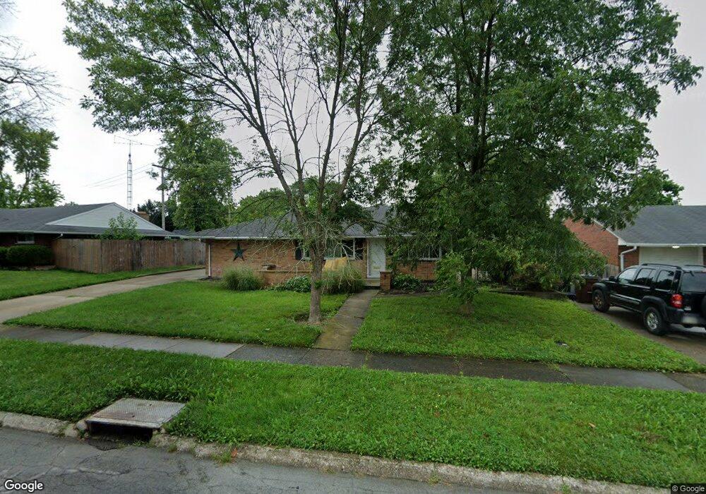
1980 Mattis Dr Dayton, OH 45439
Woodbourne-Hyde Park NeighborhoodEstimated Value: $190,000 - $203,000
3
Beds
2
Baths
1,410
Sq Ft
$139/Sq Ft
Est. Value
About This Home
This home is located at 1980 Mattis Dr, Dayton, OH 45439 and is currently estimated at $196,656, approximately $139 per square foot. 1980 Mattis Dr is a home located in Montgomery County with nearby schools including West Carrollton High School, Miami Valley Academies, and St. Albert the Great Catholic School.
Ownership History
Date
Name
Owned For
Owner Type
Purchase Details
Closed on
Nov 20, 2014
Sold by
Millard Donald C and Millard Jill Louise
Bought by
Roberts James D
Current Estimated Value
Home Financials for this Owner
Home Financials are based on the most recent Mortgage that was taken out on this home.
Original Mortgage
$73,625
Outstanding Balance
$56,337
Interest Rate
3.97%
Mortgage Type
Future Advance Clause Open End Mortgage
Estimated Equity
$140,319
Create a Home Valuation Report for This Property
The Home Valuation Report is an in-depth analysis detailing your home's value as well as a comparison with similar homes in the area
Home Values in the Area
Average Home Value in this Area
Purchase History
| Date | Buyer | Sale Price | Title Company |
|---|---|---|---|
| Roberts James D | $77,500 | Landmark Title Agency S Inc |
Source: Public Records
Mortgage History
| Date | Status | Borrower | Loan Amount |
|---|---|---|---|
| Open | Roberts James D | $73,625 |
Source: Public Records
Tax History Compared to Growth
Tax History
| Year | Tax Paid | Tax Assessment Tax Assessment Total Assessment is a certain percentage of the fair market value that is determined by local assessors to be the total taxable value of land and additions on the property. | Land | Improvement |
|---|---|---|---|---|
| 2024 | $3,530 | $50,230 | $7,820 | $42,410 |
| 2023 | $3,530 | $50,230 | $7,820 | $42,410 |
| 2022 | $3,066 | $33,710 | $5,250 | $28,460 |
| 2021 | $2,837 | $33,710 | $5,250 | $28,460 |
| 2020 | $2,834 | $33,710 | $5,250 | $28,460 |
| 2019 | $2,933 | $30,540 | $5,250 | $25,290 |
| 2018 | $2,743 | $30,540 | $5,250 | $25,290 |
| 2017 | $2,726 | $30,540 | $5,250 | $25,290 |
| 2016 | $2,778 | $30,040 | $5,250 | $24,790 |
| 2015 | $1,844 | $30,040 | $5,250 | $24,790 |
| 2014 | $1,844 | $30,040 | $5,250 | $24,790 |
| 2012 | -- | $34,480 | $7,000 | $27,480 |
Source: Public Records
Map
Nearby Homes
- 1673 W Stroop Rd
- 2090 Mattis Dr
- 4301 Tait Rd
- 1905 Tait Circle Rd
- 1952 Tait Circle Rd
- 3519 Waterbury Dr
- 4207 S Dixie Dr
- 3720 Ridgeleigh Rd Unit D
- 4519 Harbison St
- 2050 William Ln
- 4629 Richwood Dr
- 4661 Richwood Dr
- 1349 Tamerlane Rd
- 2639 Blanchard Ave
- 4792 Loxley Dr
- 2571 Cluster Ave
- 1955 Kresswood Cir
- 4400 Royal Ridge Way
- 1314 Ridgeview Ave
- 3225 Southdale Dr Unit 1
- 1994 Mattis Dr
- 1966 Mattis Dr
- 1975 Owendale Dr
- 1989 Owendale Dr
- 1963 Owendale Dr
- 1946 Mattis Dr
- 1973 Mattis Dr
- 4102 Cordell Dr
- 1987 Mattis Dr
- 1961 Mattis Dr
- 2001 Mattis Dr
- 1951 Owendale Dr
- 2005 Owendale Dr
- 1934 Mattis Dr
- 1945 Mattis Dr
- 4062 Cordell Dr
- 1935 Mattis Dr
- 1986 Owendale Dr
- 1935 Owendale Dr
- 1968 W Stroop Rd