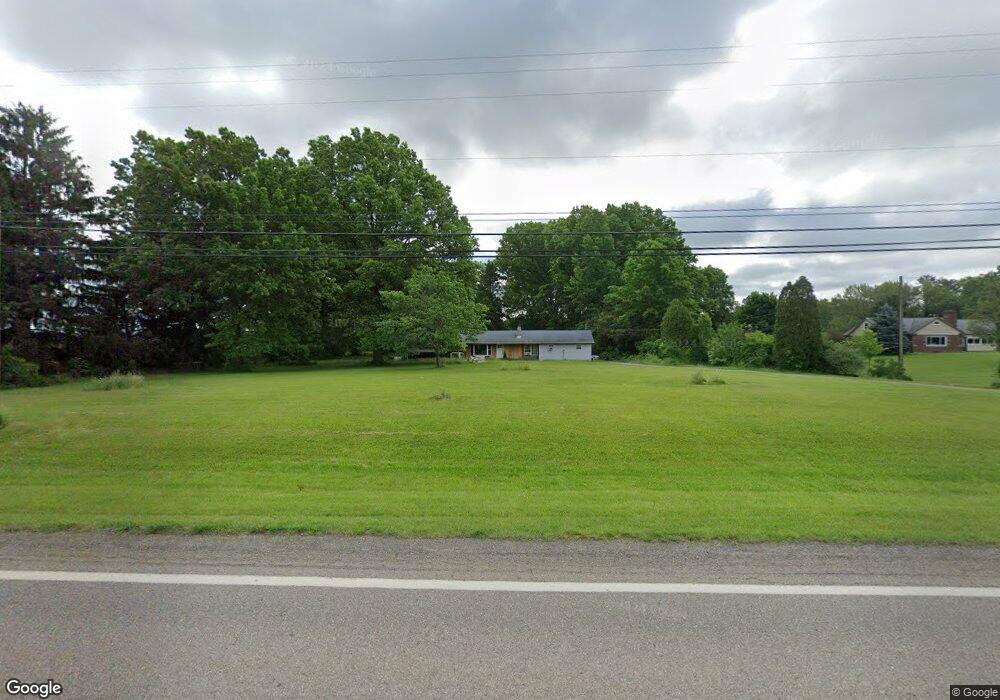
1980 State Route 170 East Palestine, OH 44413
Estimated Value: $183,000 - $227,000
3
Beds
1
Bath
1,664
Sq Ft
$120/Sq Ft
Est. Value
About This Home
This home is located at 1980 State Route 170, East Palestine, OH 44413 and is currently estimated at $200,144, approximately $120 per square foot. 1980 State Route 170 is a home with nearby schools including East Palestine Elementary School, East Palestine Middle School, and East Palestine High School.
Ownership History
Date
Name
Owned For
Owner Type
Purchase Details
Closed on
Apr 12, 2023
Sold by
Sherrill Edward and Sherrill Misty
Bought by
Sherrill Kelly J
Current Estimated Value
Purchase Details
Closed on
Aug 17, 2017
Sold by
Sherrill Edward and Sherrill Kelly
Bought by
Sherrill Edward and Bull Leslie
Purchase Details
Closed on
Aug 10, 2016
Bought by
Edward Sherrill and Sherrill
Home Financials for this Owner
Home Financials are based on the most recent Mortgage that was taken out on this home.
Interest Rate
3.43%
Purchase Details
Closed on
Feb 10, 2006
Sold by
Estate Of Florence C Hurd
Bought by
Livi Hurd Charles R and Florence C Hurd Revocable Living Trust
Purchase Details
Closed on
Oct 19, 1990
Bought by
Hurd Charles S and Hurd Florence
Create a Home Valuation Report for This Property
The Home Valuation Report is an in-depth analysis detailing your home's value as well as a comparison with similar homes in the area
Home Values in the Area
Average Home Value in this Area
Purchase History
| Date | Buyer | Sale Price | Title Company |
|---|---|---|---|
| Sherrill Kelly J | -- | None Listed On Document | |
| Sherrill Kelly J | -- | None Listed On Document | |
| Sherrill Edward | -- | None Available | |
| Edward Sherrill | $94,500 | -- | |
| Livi Hurd Charles R | -- | None Available | |
| Hurd Charles S | $50,000 | -- |
Source: Public Records
Mortgage History
| Date | Status | Borrower | Loan Amount |
|---|---|---|---|
| Previous Owner | Edward Sherrill | -- |
Source: Public Records
Tax History Compared to Growth
Tax History
| Year | Tax Paid | Tax Assessment Tax Assessment Total Assessment is a certain percentage of the fair market value that is determined by local assessors to be the total taxable value of land and additions on the property. | Land | Improvement |
|---|---|---|---|---|
| 2024 | $1,459 | $43,410 | $11,520 | $31,890 |
| 2023 | $1,460 | $43,410 | $11,520 | $31,890 |
| 2022 | $1,459 | $43,410 | $11,520 | $31,890 |
| 2021 | $1,284 | $36,400 | $10,920 | $25,480 |
| 2020 | $1,284 | $36,400 | $10,920 | $25,480 |
| 2019 | $1,284 | $36,400 | $10,920 | $25,480 |
| 2018 | $1,208 | $33,110 | $9,940 | $23,170 |
| 2017 | $1,181 | $33,110 | $9,940 | $23,170 |
| 2016 | $1,207 | $33,080 | $9,870 | $23,210 |
| 2015 | $1,198 | $33,080 | $9,870 | $23,210 |
| 2014 | $1,226 | $33,080 | $9,870 | $23,210 |
Source: Public Records
Map
Nearby Homes
- 49631 Foxwood Dr
- 49632 Foxwood Dr
- 49587 Foxwood Ln
- 49451 Foxwood Ln
- 1711 Waterford Rd
- 1939 Waterford Rd
- 2022 Waterford Rd
- 51155 Chain School Rd
- 51028 Ohio 14
- 1141 Howell Ave
- 51522 State Route 14
- 389 State Route 170
- 681 Grandview Ave
- 28 Poland Rd
- 51765 State Route 14
- 737 Moore Ln
- 51406 Cornerstone Dr
- 365 Lyons Ave
- 601 W North Ave
- 581 W North Ave Unit 2
- 1928 State Route 170
- 2012 State Route 170
- 2046 State Route 170
- 2027 State Route 170
- 1917 State Route 170
- 2069 State Route 170
- 2096 State Route 170
- 1977 State Route 170
- 2095 State Route 170
- 2122 State Route 170
- 1832 State Route 170
- 1909 State Route 170
- 1893 State Route 170
- 2145 State Route 170
- 2169 State Route 170
- 2268 State Route 170
- 2219 State Route 170
- 2267 State Route 170
- 2124 State Route 165
- 2298 State Route 170