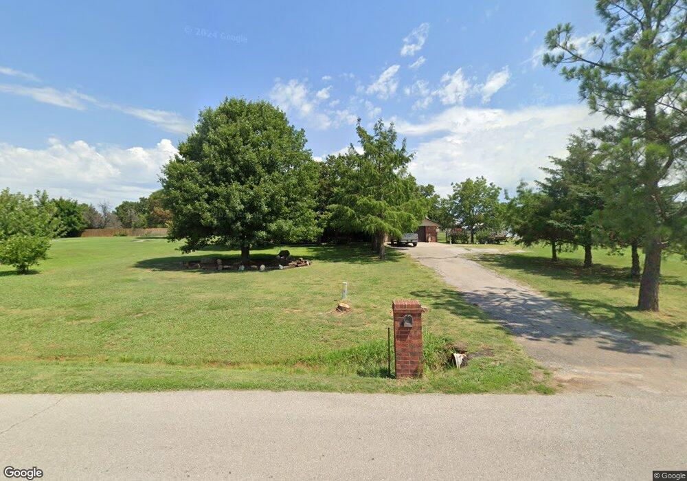
19801 Aaron Dr Harrah, OK 73045
Estimated Value: $254,000 - $284,000
3
Beds
2
Baths
1,551
Sq Ft
$175/Sq Ft
Est. Value
About This Home
This home is located at 19801 Aaron Dr, Harrah, OK 73045 and is currently estimated at $271,470, approximately $175 per square foot. 19801 Aaron Dr is a home located in Oklahoma County with nearby schools including Virginia Smith Elementary School, Clara Reynolds Elementary School, and Russell Babb Elementary School.
Ownership History
Date
Name
Owned For
Owner Type
Purchase Details
Closed on
Dec 14, 2004
Sold by
Cendant Mobility Government Fincl Svcs C
Bought by
Byrum Kenneth W and Byrum Susan M
Current Estimated Value
Home Financials for this Owner
Home Financials are based on the most recent Mortgage that was taken out on this home.
Original Mortgage
$100,415
Outstanding Balance
$48,134
Interest Rate
5.5%
Mortgage Type
Purchase Money Mortgage
Estimated Equity
$223,336
Purchase Details
Closed on
Nov 30, 2004
Sold by
Flaherty Christina M
Bought by
Cendant Mobility Government Fincl Svcs C
Home Financials for this Owner
Home Financials are based on the most recent Mortgage that was taken out on this home.
Original Mortgage
$100,415
Outstanding Balance
$48,134
Interest Rate
5.5%
Mortgage Type
Purchase Money Mortgage
Estimated Equity
$223,336
Create a Home Valuation Report for This Property
The Home Valuation Report is an in-depth analysis detailing your home's value as well as a comparison with similar homes in the area
Home Values in the Area
Average Home Value in this Area
Purchase History
| Date | Buyer | Sale Price | Title Company |
|---|---|---|---|
| Byrum Kenneth W | $106,000 | Oklahoma Title & Closing Co | |
| Cendant Mobility Government Fincl Svcs C | $106,000 | Oklahoma Title & Closing Co |
Source: Public Records
Mortgage History
| Date | Status | Borrower | Loan Amount |
|---|---|---|---|
| Open | Byrum Kenneth W | $100,415 | |
| Previous Owner | Cendant Mobility Government Fincl Svcs C | $100,415 |
Source: Public Records
Tax History
| Year | Tax Paid | Tax Assessment Tax Assessment Total Assessment is a certain percentage of the fair market value that is determined by local assessors to be the total taxable value of land and additions on the property. | Land | Improvement |
|---|---|---|---|---|
| 2025 | $2,529 | $24,006 | $5,647 | $18,359 |
| 2023 | $2,131 | $21,773 | $5,574 | $16,199 |
| 2022 | $2,063 | $20,737 | $4,150 | $16,587 |
| 2021 | $1,966 | $19,750 | $4,806 | $14,944 |
| 2020 | $1,922 | $18,810 | $5,019 | $13,791 |
| 2019 | $1,959 | $19,195 | $5,019 | $14,176 |
| 2018 | $1,954 | $18,811 | $0 | $0 |
| 2017 | $1,888 | $18,534 | $3,217 | $15,317 |
| 2016 | $1,871 | $18,039 | $3,217 | $14,822 |
| 2015 | $1,782 | $17,349 | $3,161 | $14,188 |
| 2014 | $1,693 | $16,523 | $3,217 | $13,306 |
Source: Public Records
Map
Nearby Homes
- 2801 Havenwood Dr
- 0 Dobbs Rd
- 1701 S Luther Rd
- 0000 SE 29th St
- 800 S Luther Rd
- 1201 Rolling Hills Dr
- 615 Yoachum Rd
- 4321 Winding Brook
- 4353 Winding Brook
- 20536 Tempe Ave
- 21118 Winding Brook
- 4353 Titan Terrace
- 1200 Cedar St
- 2117 Nixon St
- 20630 Frontier Place
- 0 S Harrah Rd
- 20611 Frontier Place
- 3342 Glastonbury Way
- 3382 Glastonbury Way
- 3322 Glastonbury Way
- 2289 Wagon Trail Blvd
- 19901 Aaron Dr
- 19802 Aaron Dr
- 19705 Aaron Dr
- 2290 Community Place
- 2201 Wagon Trail Blvd
- 19800 Aaron Dr
- 19904 Aaron Dr
- 2280 Wagon Trail Blvd
- 2250 Wagon Trail Blvd
- 2291 Community Place
- 19701 Aaron Dr
- 19704 Aaron Dr
- 2170 Community Place
- 2511 Ferguson Dr
- 2175 Wagon Trail Blvd
- 19903 Aaron Dr
- 19850 Ancestor Place
- 19601 Aaron Dr
- 2171 Community Place
