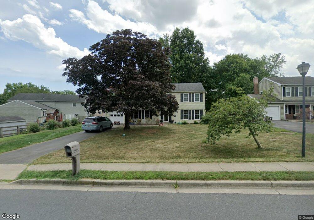
19804 Westerly Ave Poolesville, MD 20837
Estimated Value: $516,000 - $658,000
Studio
3
Baths
1,968
Sq Ft
$302/Sq Ft
Est. Value
About This Home
This home is located at 19804 Westerly Ave, Poolesville, MD 20837 and is currently estimated at $593,432, approximately $301 per square foot. 19804 Westerly Ave is a home located in Montgomery County with nearby schools including Poolesville Elementary School, John H. Poole Middle School, and Poolesville High School.
Ownership History
Date
Name
Owned For
Owner Type
Purchase Details
Closed on
Jun 2, 2021
Sold by
Frick Katherine S and The Wellborn Family Trust
Bought by
Davidoff Aaron T and Davidoff Caroline S
Current Estimated Value
Home Financials for this Owner
Home Financials are based on the most recent Mortgage that was taken out on this home.
Original Mortgage
$335,120
Outstanding Balance
$303,409
Interest Rate
2.9%
Mortgage Type
New Conventional
Estimated Equity
$290,023
Purchase Details
Closed on
Apr 9, 2014
Sold by
Wellborn Suzanne A
Bought by
Frick Katherine S and Wellborn Family Trust
Purchase Details
Closed on
Aug 11, 2004
Sold by
Hart Theodore A and Hart L R
Bought by
Wellborn Suzanne A
Create a Home Valuation Report for This Property
The Home Valuation Report is an in-depth analysis detailing your home's value as well as a comparison with similar homes in the area
Home Values in the Area
Average Home Value in this Area
Purchase History
| Date | Buyer | Sale Price | Title Company |
|---|---|---|---|
| Davidoff Aaron T | $418,900 | Lakeside Title Company | |
| Frick Katherine S | -- | None Available | |
| Wellborn Suzanne A | $381,000 | -- |
Source: Public Records
Mortgage History
| Date | Status | Borrower | Loan Amount |
|---|---|---|---|
| Open | Davidoff Aaron T | $335,120 |
Source: Public Records
Tax History
| Year | Tax Paid | Tax Assessment Tax Assessment Total Assessment is a certain percentage of the fair market value that is determined by local assessors to be the total taxable value of land and additions on the property. | Land | Improvement |
|---|---|---|---|---|
| 2025 | $5,174 | $431,167 | -- | -- |
| 2024 | $5,174 | $398,200 | $182,400 | $215,800 |
| 2023 | $5,560 | $379,167 | $0 | $0 |
| 2022 | $3,795 | $360,133 | $0 | $0 |
| 2021 | $3,579 | $341,100 | $182,400 | $158,700 |
| 2020 | $3,544 | $340,367 | $0 | $0 |
| 2019 | $3,542 | $339,633 | $0 | $0 |
| 2018 | $3,544 | $338,900 | $182,400 | $156,500 |
| 2017 | $3,404 | $328,167 | $0 | $0 |
| 2016 | $3,115 | $317,433 | $0 | $0 |
| 2015 | $3,115 | $306,700 | $0 | $0 |
| 2014 | $3,115 | $306,700 | $0 | $0 |
Source: Public Records
Map
Nearby Homes
- 17116 Chiswell Rd
- 17425 Hughes Rd
- 19656 Wootton Ave
- 19505 Fisher Ave Unit (LOT 1)
- 19507 Fisher Ave Unit (LOT 3)
- 19509 Fisher Ave Unit (LOT 2)
- 17403 Fyffe Rd
- 17100 Evans Way
- 19110 Tatie Way
- 19225 Walters Ave
- 17108 Wild Turkey Way
- 0 Wild Turkey Way
- 21331 Big Woods Rd
- 17112 Wild Turkey Way
- 0 Beallsville Rd Unit MDMC2136882
- 18524 Beallsville Rd
- 21100 W Offutt Rd
- 0 Peach Tree Rd Unit MDMC2210762
- 0 Hughes Rd Unit MDMC2212466
- 19601 Darnestown Rd
- 17132 Hoskinson Rd
- 17128 Hoskinson Rd
- 19801 Sumter Way
- 19812 Westerly Ave
- 17124 Hoskinson Rd
- 19805 Westerly Ave
- 19816 Westerly Ave
- 19801 Westerly Ave
- 19809 Westerly Ave
- 19805 Sumter Way
- 19800 Sumter Way
- 17120 Hoskinson Rd
- 19708 Westerly Ave
- 19820 Westerly Ave
- 17204 Hoskinson Rd
- 17116 Hoskinson Rd
- 19813 Westerly Ave
- 17205 Brown Rd
- 19709 Westerly Ave
- 17121 Hoskinson Rd
Your Personal Tour Guide
Ask me questions while you tour the home.