Estimated Value: $251,000 - $643,000
Studio
1
Bath
3,028
Sq Ft
$142/Sq Ft
Est. Value
About This Home
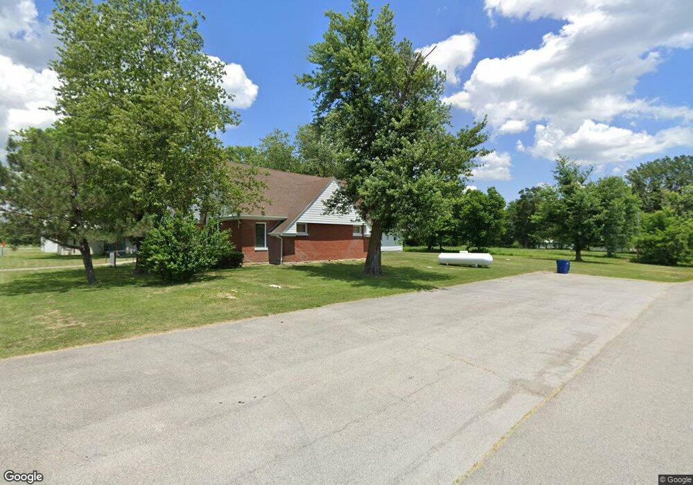
This home is located at 19808 Highway D, Eolia, MO 63344 and is currently estimated at $430,697, approximately $142 per square foot. 19808 Highway D is a home with nearby schools including Clopton Elementary School, Clopton High School, and Pike/Lincoln Technical Center.
Ownership History
Date
Name
Owned For
Owner Type
Purchase Details
Closed on
Jan 13, 2023
Sold by
Annette M Conrad Trust
Bought by
Schnicker Daniel A and Schnicker Ashtyn G
Current Estimated Value
Home Financials for this Owner
Home Financials are based on the most recent Mortgage that was taken out on this home.
Original Mortgage
$230,000
Outstanding Balance
$199,317
Interest Rate
5.76%
Mortgage Type
New Conventional
Estimated Equity
$231,380
Create a Home Valuation Report for This Property
The Home Valuation Report is an in-depth analysis detailing your home's value as well as a comparison with similar homes in the area
Purchase History
| Date | Buyer | Sale Price | Title Company |
|---|---|---|---|
| Schnicker Daniel A | -- | -- |
Source: Public Records
Mortgage History
| Date | Status | Borrower | Loan Amount |
|---|---|---|---|
| Open | Schnicker Daniel A | $230,000 |
Source: Public Records
Tax History
| Year | Tax Paid | Tax Assessment Tax Assessment Total Assessment is a certain percentage of the fair market value that is determined by local assessors to be the total taxable value of land and additions on the property. | Land | Improvement |
|---|---|---|---|---|
| 2025 | $2,101 | $33,150 | $3,370 | $29,780 |
| 2024 | $2,079 | $33,150 | $3,370 | $29,780 |
| 2023 | $2,079 | $32,920 | $3,370 | $29,550 |
| 2022 | $1,938 | $30,710 | $1,160 | $29,550 |
| 2021 | $1,936 | $30,710 | $1,160 | $29,550 |
| 2020 | $1,940 | $30,710 | $1,160 | $29,550 |
| 2019 | $1,942 | $30,710 | $1,160 | $29,550 |
| 2018 | $1,944 | $30,730 | $1,180 | $29,550 |
| 2017 | $1,936 | $30,730 | $1,180 | $29,550 |
| 2016 | $1,926 | $30,730 | $1,180 | $29,550 |
| 2015 | -- | $30,730 | $1,180 | $29,550 |
| 2011 | -- | $30,710 | $1,160 | $29,550 |
Source: Public Records
Map
Nearby Homes
- 21772 Highway D
- 00 Highway D (77 2 + - Acres ) Tract 1
- 0 Highway D - Tract 1 (77 2+ - Acres)
- State Highway D (22+ - Acres) Unit Tract 6
- 0 Highway D - Tract 6 (22+ - Acres) Unit MIS25073444
- 0 Highway D (15+ - Acres) Tract 11 Unit MIS25080783
- 0 Unit MIS25080681
- 0 Highway D - Tract 10 (14 4+ - Acres) Unit MIS25073139
- State Highway D (14 4+ - Acres)
- 0 Highway D - Tract 9 (24 7+ - Acres) Unit MIS25078045
- 26321 Highway H
- 612 N Main St
- 28 Ac + - Pike 224
- 0 Pike 224 Unit MAR25021843
- 214 College Cir
- 21505 Highway 61
- 120 Willow Ln
- 207 Golden Ct
- 17620 Highway F
- 16197 Highway Nn
- 19659 Highway D
- 19746 Highway D
- 19741 Highway D
- 19741 Highway D
- 19741 Highway D
- 19741 Highway D
- 20158 Highway D
- 19581 Highway D
- 19314 Pike 266
- 0 Hwy D Unit 10041437
- 0 Hwy D Unit MIS25069947
- 19490 Highway D
- 19469 Highway D
- 19411 Highway D
- 19889 Highway D
- 19637 Pike 266
- 19663 Pike 266
- 19607 Pike 266
- 19651 Pike 266
- 19675 Pike 266
Your Personal Tour Guide
Ask me questions while you tour the home.