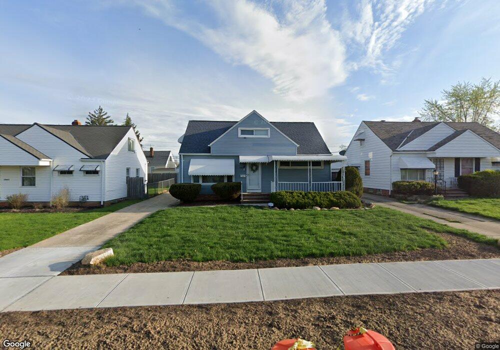
19809 Stockton Ave Maple Heights, OH 44137
Estimated Value: $116,958 - $154,000
3
Beds
1
Bath
1,224
Sq Ft
$107/Sq Ft
Est. Value
About This Home
This home is located at 19809 Stockton Ave, Maple Heights, OH 44137 and is currently estimated at $130,490, approximately $106 per square foot. 19809 Stockton Ave is a home located in Cuyahoga County with nearby schools including Abraham Lincoln Elementary School, Rockside/ J.F. Kennedy School, and Italy High School.
Ownership History
Date
Name
Owned For
Owner Type
Purchase Details
Closed on
Aug 23, 2001
Sold by
Lu Vinh Thanh
Bought by
Wilder Patricia A
Current Estimated Value
Home Financials for this Owner
Home Financials are based on the most recent Mortgage that was taken out on this home.
Original Mortgage
$86,006
Interest Rate
7.28%
Purchase Details
Closed on
Jun 12, 1992
Sold by
Kuzniakowski Michael John
Bought by
Lu Vinh Thanh
Purchase Details
Closed on
Nov 17, 1987
Sold by
Carol A Kuratko
Bought by
Kuzniakowski Michael John
Purchase Details
Closed on
Sep 28, 1982
Sold by
Kuzniakowski Ursula
Bought by
Carol A Kuratko
Purchase Details
Closed on
Jan 1, 1975
Bought by
Kuzniakowski Ursula
Create a Home Valuation Report for This Property
The Home Valuation Report is an in-depth analysis detailing your home's value as well as a comparison with similar homes in the area
Home Values in the Area
Average Home Value in this Area
Purchase History
| Date | Buyer | Sale Price | Title Company |
|---|---|---|---|
| Wilder Patricia A | $87,500 | -- | |
| Lu Vinh Thanh | $71,000 | -- | |
| Kuzniakowski Michael John | $43,200 | -- | |
| Carol A Kuratko | -- | -- | |
| Kuzniakowski Ursula | -- | -- |
Source: Public Records
Mortgage History
| Date | Status | Borrower | Loan Amount |
|---|---|---|---|
| Previous Owner | Wilder Patricia A | $86,006 |
Source: Public Records
Tax History Compared to Growth
Tax History
| Year | Tax Paid | Tax Assessment Tax Assessment Total Assessment is a certain percentage of the fair market value that is determined by local assessors to be the total taxable value of land and additions on the property. | Land | Improvement |
|---|---|---|---|---|
| 2024 | $2,757 | $40,670 | $7,070 | $33,600 |
| 2023 | $1,885 | $26,880 | $5,040 | $21,840 |
| 2022 | $1,916 | $26,880 | $5,040 | $21,840 |
| 2021 | $2,043 | $26,880 | $5,040 | $21,840 |
| 2020 | $1,520 | $20,370 | $3,820 | $16,560 |
| 2019 | $1,507 | $58,200 | $10,900 | $47,300 |
| 2018 | $1,023 | $20,370 | $3,820 | $16,560 |
| 2017 | $1,455 | $19,740 | $4,970 | $14,770 |
| 2016 | $1,402 | $19,740 | $4,970 | $14,770 |
| 2015 | $2,445 | $19,740 | $4,970 | $14,770 |
| 2014 | $2,445 | $21,700 | $5,460 | $16,240 |
Source: Public Records
Map
Nearby Homes
- 19812 Stockton Ave
- 19806 Mountville Dr
- 19289 Stafford Ave
- 20107 Libby Rd
- 19807 Gardenview Dr
- 19520 Maple Heights Blvd
- 19221 Stafford Ave
- 20510 Mountville Dr
- 5165 Camden Rd
- 20701 Kenyon Dr
- 5265 Bellview St
- 18909 Maple Heights Blvd
- 19309 Nitra Ave
- 5409 Hollywood Ave
- 20814 Kenyon Dr
- 20625 Centuryway Rd
- 5357 Beechwood Ave
- 5571 Oakwood Ave
- 20120 Mccracken Rd
- 20814 Watson Rd
- 19809 Stockton4ab
- 19813 Stockton Ave
- 19805 Stockton Ave
- 19817 Stockton Ave
- 19801 Stockton Ave
- 19812 Libby Rd
- 19808 Libby Rd
- 19816 Libby Rd
- 19804 Libby Rd
- 19820 Libby Rd
- 19821 Stockton Ave
- 19808 Stockton Ave
- 19800 Libby Rd
- 19804 Stockton Ave
- 19900 Libby Rd
- 19800 Stockton Ave
- 19317 Stockton Ave
- 19901 Stockton Ave
- 19901 Stockton 3 4fr
- 19904 Libby Rd