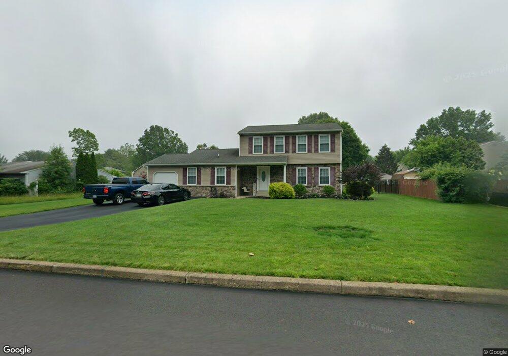
1981 Brook Ln Jamison, PA 18929
Estimated Value: $529,000 - $617,000
3
Beds
3
Baths
1,766
Sq Ft
$329/Sq Ft
Est. Value
About This Home
This home is located at 1981 Brook Ln, Jamison, PA 18929 and is currently estimated at $581,785, approximately $329 per square foot. 1981 Brook Ln is a home located in Bucks County with nearby schools including Jamison Elementary School, Tamanend Middle School, and Central Bucks High School - South.
Ownership History
Date
Name
Owned For
Owner Type
Purchase Details
Closed on
Jul 3, 2003
Sold by
Zupon Kathleen A
Bought by
Olszewski Douglas and Olszewski Tracey
Current Estimated Value
Home Financials for this Owner
Home Financials are based on the most recent Mortgage that was taken out on this home.
Original Mortgage
$210,000
Outstanding Balance
$89,820
Interest Rate
5.34%
Mortgage Type
Purchase Money Mortgage
Estimated Equity
$491,965
Purchase Details
Closed on
Nov 5, 2001
Sold by
Zupon Ronald A and Zupon Kathleen A
Bought by
Zupon Kathleen A
Create a Home Valuation Report for This Property
The Home Valuation Report is an in-depth analysis detailing your home's value as well as a comparison with similar homes in the area
Home Values in the Area
Average Home Value in this Area
Purchase History
| Date | Buyer | Sale Price | Title Company |
|---|---|---|---|
| Olszewski Douglas | $279,900 | -- | |
| Zupon Kathleen A | -- | -- |
Source: Public Records
Mortgage History
| Date | Status | Borrower | Loan Amount |
|---|---|---|---|
| Open | Olszewski Douglas | $210,000 |
Source: Public Records
Tax History
| Year | Tax Paid | Tax Assessment Tax Assessment Total Assessment is a certain percentage of the fair market value that is determined by local assessors to be the total taxable value of land and additions on the property. | Land | Improvement |
|---|---|---|---|---|
| 2025 | $6,099 | $35,040 | $8,640 | $26,400 |
| 2024 | $6,099 | $35,040 | $8,640 | $26,400 |
| 2023 | $5,906 | $35,040 | $8,640 | $26,400 |
| 2022 | $5,840 | $35,040 | $8,640 | $26,400 |
| 2021 | $5,775 | $35,040 | $8,640 | $26,400 |
| 2020 | $5,775 | $35,040 | $8,640 | $26,400 |
| 2019 | $5,740 | $35,040 | $8,640 | $26,400 |
| 2018 | $5,740 | $35,040 | $8,640 | $26,400 |
| 2017 | $5,696 | $35,040 | $8,640 | $26,400 |
| 2016 | $5,696 | $35,040 | $8,640 | $26,400 |
| 2015 | -- | $35,040 | $8,640 | $26,400 |
| 2014 | -- | $35,040 | $8,640 | $26,400 |
Source: Public Records
Map
Nearby Homes
- 1997 Brook Ln
- 1997 Sunrise Way
- 1868 Sunrise Way
- 2210 Club House Cir
- 1621 Yorktown Rd Unit 50
- 2010 Canterbury Ln
- 1646 Rockcress Dr
- 1644 Rockcress Dr
- 2128 Robin Dr
- 1990 York Rd
- Homesite 10102 Marquis Ln
- 1004 Marquis Ln
- 1001 Marquis Ln Unit WESTMONT MODEL
- 1003 Marquis Ln Unit NORTHBROOK MODEL
- 5005 Quartermaster Ln
- 5011 Quartermaster Ln
- 2016 Marquis Ln
- 4008 Marquis Ln
- 2091 Meetinghouse Rd
- 1821 Fox Run Terrace
- 1971 Brook Ln
- 2052 Pheasant Run
- 1982 Brook Ln
- 1992 Brook Ln
- 2011 Brook Ln
- 2050 Pheasant Run
- 1972 Brook Ln
- 1960 Heather Cir
- 2002 Brook Ln
- 2012 Brook Ln
- 1962 Heather Cir
- 1962 Brook Ln
- 2021 Brook Ln
- 2054 Pheasant Run
- 1957 Brook Ln
- 2048 Pheasant Run
- 1961 Heather Cir
- 2070 Sunrise Way
- 1964 Heather Cir
- 1952 Brook Ln
Your Personal Tour Guide
Ask me questions while you tour the home.