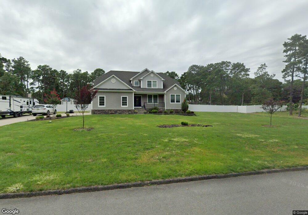
1981 Elizabeth Ave Whiting, NJ 08759
Manchester Township NeighborhoodEstimated Value: $622,000 - $783,000
4
Beds
3
Baths
5,663
Sq Ft
$131/Sq Ft
Est. Value
About This Home
This home is located at 1981 Elizabeth Ave, Whiting, NJ 08759 and is currently estimated at $740,090, approximately $130 per square foot. 1981 Elizabeth Ave is a home with nearby schools including Manchester Township High School.
Ownership History
Date
Name
Owned For
Owner Type
Purchase Details
Closed on
Sep 9, 2019
Sold by
Ksd Homes Llc
Bought by
Sliwowski Krzysitof and Sliwowski Dominika
Current Estimated Value
Purchase Details
Closed on
Aug 29, 2019
Sold by
Ksd Homes Llc
Bought by
Ksd Homes Llc
Purchase Details
Closed on
Nov 22, 2017
Sold by
Sliwowski Kryzystof and Sliwowski Dominika
Bought by
Ksd Homes Llc
Purchase Details
Closed on
Jul 14, 2017
Sold by
Suburban Agency Inc
Bought by
Sliwowski Kryzysztof and Sliwowski Dominika
Purchase Details
Closed on
May 24, 1984
Bought by
Suburban Agency Inc
Create a Home Valuation Report for This Property
The Home Valuation Report is an in-depth analysis detailing your home's value as well as a comparison with similar homes in the area
Home Values in the Area
Average Home Value in this Area
Purchase History
| Date | Buyer | Sale Price | Title Company |
|---|---|---|---|
| Sliwowski Krzysitof | -- | None Available | |
| Ksd Homes Llc | -- | None Available | |
| Ksd Homes Llc | -- | -- | |
| Sliwowski Kryzysztof | $79,000 | Two River Title | |
| Suburban Agency Inc | -- | -- |
Source: Public Records
Tax History Compared to Growth
Tax History
| Year | Tax Paid | Tax Assessment Tax Assessment Total Assessment is a certain percentage of the fair market value that is determined by local assessors to be the total taxable value of land and additions on the property. | Land | Improvement |
|---|---|---|---|---|
| 2025 | $11,109 | $766,600 | $195,000 | $571,600 |
| 2024 | $10,543 | $452,500 | $85,000 | $367,500 |
| 2023 | $10,023 | $452,500 | $85,000 | $367,500 |
| 2022 | $10,023 | $452,500 | $85,000 | $367,500 |
| 2021 | $9,806 | $452,500 | $85,000 | $367,500 |
| 2020 | $1,477 | $70,000 | $70,000 | $0 |
| 2019 | $1,796 | $70,000 | $70,000 | $0 |
| 2018 | $1,789 | $70,000 | $70,000 | $0 |
| 2017 | $1,796 | $70,000 | $70,000 | $0 |
| 2016 | $1,774 | $70,000 | $70,000 | $0 |
| 2015 | $1,741 | $70,000 | $70,000 | $0 |
| 2014 | $1,705 | $70,000 | $70,000 | $0 |
Source: Public Records
Map
Nearby Homes
- 70 Norwalk Ave Unit 73
- 1130 Monroe Ave
- 1 Chelsea Dr
- 11 Hartford Rd Unit 70
- 22 Hummingbird Ln Unit 73
- 23 Brentwood St Unit 73
- 58 St John Place Unit C
- 53 St John Place Unit B
- 2 Verbena Ct Unit B
- 85 Falmouth Ave Unit 72
- 81 Falmouth Ave Unit 72
- 81 Falmouth Ave
- 69 Chelsea Dr Unit 72
- 1901 Chilvers Ave
- 1751 Chilvers Ave
- 74 Chelsea Dr
- 43 S Chestnut Ave Unit 72
- 9 Apple Ln
- 6 N Chestnut Ave
- 24 Churchill Rd Sec 71
- 1961 Elizabeth Ave
- 1980 Paterson Ave
- 2001 Elizabeth Ave
- 750 Bloomfield Ave
- 1960 Paterson Ave
- 2000 Paterson Ave
- 1960 Elizabeth Ave
- 751 Bloomfield Ave
- 1941 Elizabeth Ave
- 2021 Elizabeth Ave
- 2040 Elizabeth Ave
- 1940 Paterson Ave
- 2020 Paterson Ave
- 1940 Elizabeth Ave
- 1981 Paterson Ave
- 1981 Perth Amboy Ave
- 2020 Elizabeth Ave
- 1961 Paterson Ave
- 1961 Perth Amboy Ave
- 2001 Paterson Ave