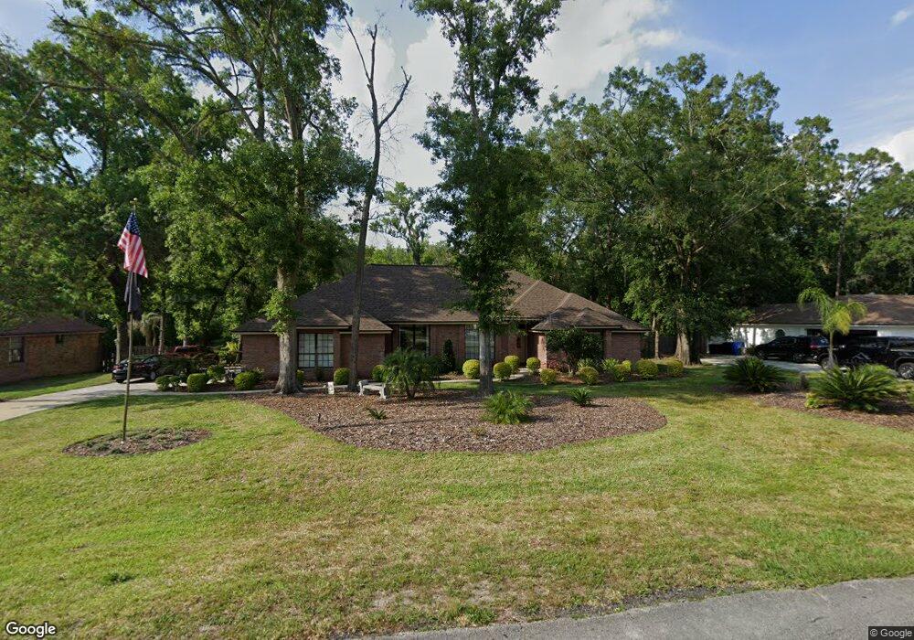
1981 Hawkcrest Dr Saint Johns, FL 32259
Estimated Value: $583,397 - $673,000
Studio
--
Bath
2,445
Sq Ft
$257/Sq Ft
Est. Value
About This Home
This home is located at 1981 Hawkcrest Dr, Saint Johns, FL 32259 and is currently estimated at $629,099, approximately $257 per square foot. 1981 Hawkcrest Dr is a home located in St. Johns County with nearby schools including Cunningham Creek Elementary School, Switzerland Point Middle School, and Bartram Trail High School.
Ownership History
Date
Name
Owned For
Owner Type
Purchase Details
Closed on
Jun 9, 2003
Sold by
Walker John C and Walker Dianne F
Bought by
Soluski Michael J and Soluski Sandra A
Current Estimated Value
Home Financials for this Owner
Home Financials are based on the most recent Mortgage that was taken out on this home.
Original Mortgage
$175,000
Outstanding Balance
$73,201
Interest Rate
5.16%
Mortgage Type
Purchase Money Mortgage
Estimated Equity
$555,898
Create a Home Valuation Report for This Property
The Home Valuation Report is an in-depth analysis detailing your home's value as well as a comparison with similar homes in the area
Home Values in the Area
Average Home Value in this Area
Purchase History
| Date | Buyer | Sale Price | Title Company |
|---|---|---|---|
| Soluski Michael J | $275,000 | Hartle Realty Title Ins Agen |
Source: Public Records
Mortgage History
| Date | Status | Borrower | Loan Amount |
|---|---|---|---|
| Open | Soluski Michael J | $175,000 |
Source: Public Records
Tax History
| Year | Tax Paid | Tax Assessment Tax Assessment Total Assessment is a certain percentage of the fair market value that is determined by local assessors to be the total taxable value of land and additions on the property. | Land | Improvement |
|---|---|---|---|---|
| 2025 | $3,306 | $296,495 | -- | -- |
| 2024 | $3,306 | $288,139 | -- | -- |
| 2023 | $3,306 | $279,747 | $0 | $0 |
| 2022 | $3,209 | $271,599 | $0 | $0 |
| 2021 | $3,187 | $263,688 | $0 | $0 |
| 2020 | $3,175 | $260,047 | $0 | $0 |
| 2019 | $3,233 | $254,200 | $0 | $0 |
| 2018 | $3,196 | $249,460 | $0 | $0 |
| 2017 | $3,184 | $244,329 | $0 | $0 |
| 2016 | $3,184 | $237,871 | $0 | $0 |
| 2015 | $3,232 | $241,467 | $0 | $0 |
| 2014 | $3,243 | $232,283 | $0 | $0 |
Source: Public Records
Map
Nearby Homes
- 1958 Hawkcrest Dr
- 1977 Falcon Ct
- 1113 Buckbean Branch Ln E
- 1314 Honeysuckle Dr
- 1220 Creek Bend Rd
- 321 Sweetbrier Branch Ln
- 1304 Hideaway Dr S
- 537 Dandelion Dr
- 1224 N Burgandy Trail
- 1217 N Burgandy Trail
- 1540 Lemonwood Rd
- 1416 Lemonwood Rd
- 1463 Mallard Landing Blvd
- 421 Chicopee Ct
- 316 Talwood Terrace
- 237 Twining Trace
- 345 Oakmoss Dr
- 34 Arrowwood Dr
- 1259 Fruit Cove Rd S
- 345 Lolly Ln
- 1969 Hawkcrest Dr Unit 2
- 2007 Hawkcrest Dr
- 1953 Hawkcrest Dr
- 1978 Hawkcrest Dr
- 1992 Hawkcrest Dr
- 2019 Hawkcrest Dr
- 1107 Perregrine Cir E
- 1939 Hawkcrest Dr
- 1946 Hawkcrest Dr
- 1119 Perregrine Cir E
- 1140 Perregrine Cir E
- 1930 Hawkcrest Dr
- 1927 Hawkcrest Dr
- 2031 Hawkcrest Dr E
- 1131 Perregrine Cir E
- 2038 Hawkcrest Dr E
- 1916 Hawkcrest Dr
- 0 Falcon Unit 112037
- LOT 45 Falcon Ct
- 0 Falcon Ct
Your Personal Tour Guide
Ask me questions while you tour the home.