Estimated Value: $489,000 - $560,000
--
Bed
--
Bath
3,067
Sq Ft
$172/Sq Ft
Est. Value
About This Home
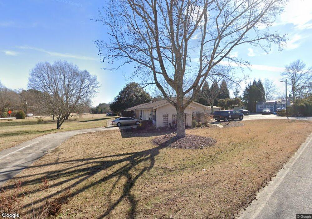
This home is located at 1981 Highway 161 S, York, SC 29745 and is currently estimated at $528,305, approximately $172 per square foot. 1981 Highway 161 S is a home located in York County with nearby schools including Cotton Belt Elementary School, York Middle School, and York Intermediate School.
Ownership History
Date
Name
Owned For
Owner Type
Purchase Details
Closed on
Aug 23, 2019
Sold by
Perry Kimberly A and Perry Daniel
Bought by
Mitchell John E and Mitchell Angelina
Current Estimated Value
Home Financials for this Owner
Home Financials are based on the most recent Mortgage that was taken out on this home.
Original Mortgage
$213,600
Outstanding Balance
$186,668
Interest Rate
3.7%
Mortgage Type
New Conventional
Estimated Equity
$341,637
Purchase Details
Closed on
Sep 29, 2011
Sold by
Sanders Delbert N
Bought by
Perry Daniel and Perry Kimberly A
Home Financials for this Owner
Home Financials are based on the most recent Mortgage that was taken out on this home.
Original Mortgage
$175,437
Interest Rate
4.26%
Mortgage Type
FHA
Create a Home Valuation Report for This Property
The Home Valuation Report is an in-depth analysis detailing your home's value as well as a comparison with similar homes in the area
Home Values in the Area
Average Home Value in this Area
Purchase History
| Date | Buyer | Sale Price | Title Company |
|---|---|---|---|
| Mitchell John E | $267,000 | None Available | |
| Perry Daniel | $180,000 | -- |
Source: Public Records
Mortgage History
| Date | Status | Borrower | Loan Amount |
|---|---|---|---|
| Open | Mitchell John E | $213,600 | |
| Previous Owner | Perry Daniel | $175,437 |
Source: Public Records
Tax History Compared to Growth
Tax History
| Year | Tax Paid | Tax Assessment Tax Assessment Total Assessment is a certain percentage of the fair market value that is determined by local assessors to be the total taxable value of land and additions on the property. | Land | Improvement |
|---|---|---|---|---|
| 2025 | $8,782 | $20,119 | $2,030 | $18,089 |
| 2024 | $7,543 | $17,494 | $2,040 | $15,454 |
| 2023 | $7,449 | $17,494 | $2,040 | $15,454 |
| 2022 | $7,153 | $17,497 | $2,040 | $15,457 |
| 2021 | -- | $17,497 | $2,040 | $15,457 |
| 2020 | $6,952 | $17,497 | $0 | $0 |
| 2019 | $1,348 | $16,260 | $0 | $0 |
| 2018 | $1,296 | $7,500 | $0 | $0 |
| 2017 | $1,232 | $7,500 | $0 | $0 |
| 2016 | $1,215 | $7,500 | $0 | $0 |
| 2014 | $4,184 | $7,640 | $1,200 | $6,440 |
| 2013 | $4,184 | $8,060 | $1,200 | $6,860 |
Source: Public Records
Map
Nearby Homes
- 2119 Smith Rd
- 4036 Deerstone Ln Unit 22
- 4018 Deerstone Ln Unit 24
- 206 Covey Ct
- 3065 Meadowcrest Dr Unit 25
- 3046 Meadowcrest Dr Unit 69
- 3070 Meadowcrest Dr Unit 68
- 533 Mason Dickson Rd
- 484 Mason Dickson Rd
- 484 Mason Dickson Rd Unit 3
- 1258 Willow Grove Ln Unit 101
- 1014 Willow Grove Ln
- 1565 Autumn Ln Unit 132
- 1532 Autumn Ln Unit 120
- 1657 Springlake Rd
- Black Hwy
- 1151 Estate Dr
- 5019 Star Magnolia Ct
- McDowell Plan at SpringLake
- Edgefield Plan at SpringLake
- 1981 S Carolina 161
- 1981 Sc-161
- 900 Mason Dickson Rd
- 1967 Highway 161 S
- 2021 Highway 161 S
- 892 Mason Dickson Rd
- 874 Mason Dickson Rd
- 2033 Highway 161 S
- 2033 S Carolina 161
- 868 Mason Dickson Rd
- 1921 Highway 161 S
- 1984 Highway 161 S
- 860 Mason Dickson Rd
- 1000 Owens Rd
- 2173 State Road S-46-1474
- 2151 State Road S-46-1474 Unit 7
- 2173 State Road S-46-1474 Unit 10
- 2159 State Road S-46-1474 Unit 8
- 2143 State Road S-46-1474 Unit 6
- 2135 State Road S-46-1474