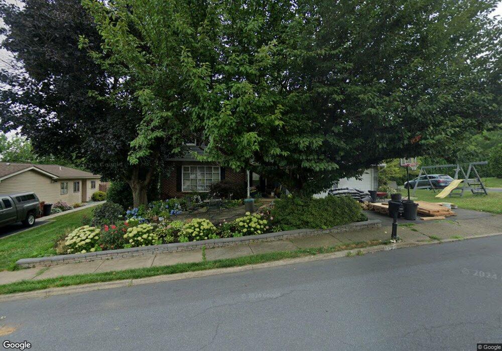
1981 Linden Ln Whitehall, PA 18052
Fullerton NeighborhoodEstimated Value: $437,000 - $521,000
4
Beds
3
Baths
2,124
Sq Ft
$222/Sq Ft
Est. Value
About This Home
This home is located at 1981 Linden Ln, Whitehall, PA 18052 and is currently estimated at $471,627, approximately $222 per square foot. 1981 Linden Ln is a home located in Lehigh County with nearby schools including Zephyr Elementary School, Clarence M Gockley Elementary School, and George D Steckel Elementary School.
Ownership History
Date
Name
Owned For
Owner Type
Purchase Details
Closed on
Nov 17, 2021
Sold by
Slough Audrey M and Slough Kurt Steven
Bought by
Slough Audrey M
Current Estimated Value
Purchase Details
Closed on
Jul 22, 2020
Sold by
Slough Audrey M
Bought by
Slough Audrey M and Slough Kurt Steven
Purchase Details
Closed on
Oct 20, 2008
Sold by
Bauman Lydia Redman
Bought by
Slough Audrey M
Home Financials for this Owner
Home Financials are based on the most recent Mortgage that was taken out on this home.
Original Mortgage
$203,200
Interest Rate
5.52%
Mortgage Type
New Conventional
Purchase Details
Closed on
Nov 11, 1991
Sold by
Bauman Donald S and Bauman Lydia R
Bought by
Bauman Lydia Redman
Create a Home Valuation Report for This Property
The Home Valuation Report is an in-depth analysis detailing your home's value as well as a comparison with similar homes in the area
Home Values in the Area
Average Home Value in this Area
Purchase History
| Date | Buyer | Sale Price | Title Company |
|---|---|---|---|
| Slough Audrey M | -- | None Available | |
| Slough Audrey M | -- | None Available | |
| Slough Audrey M | $254,000 | -- | |
| Bauman Lydia Redman | -- | -- |
Source: Public Records
Mortgage History
| Date | Status | Borrower | Loan Amount |
|---|---|---|---|
| Previous Owner | Slough Audrey M | $203,200 |
Source: Public Records
Tax History Compared to Growth
Tax History
| Year | Tax Paid | Tax Assessment Tax Assessment Total Assessment is a certain percentage of the fair market value that is determined by local assessors to be the total taxable value of land and additions on the property. | Land | Improvement |
|---|---|---|---|---|
| 2025 | $7,444 | $253,900 | $36,100 | $217,800 |
| 2024 | $7,194 | $253,900 | $36,100 | $217,800 |
| 2023 | $7,046 | $253,900 | $36,100 | $217,800 |
| 2022 | $6,886 | $253,900 | $217,800 | $36,100 |
| 2021 | $6,772 | $253,900 | $36,100 | $217,800 |
| 2020 | $6,499 | $253,400 | $35,600 | $217,800 |
| 2019 | $5,993 | $253,400 | $35,600 | $217,800 |
| 2018 | $5,836 | $253,400 | $35,600 | $217,800 |
| 2017 | $5,730 | $253,400 | $35,600 | $217,800 |
| 2016 | -- | $253,400 | $35,600 | $217,800 |
| 2015 | -- | $253,400 | $35,600 | $217,800 |
| 2014 | -- | $253,400 | $35,600 | $217,800 |
Source: Public Records
Map
Nearby Homes
- 1733 Elmhurst Dr
- 1924 Alberta Dr
- 2101 Van Buren Dr
- 109 Johnson Ct
- 36 Peachtree Cir
- 1844 Schadt Ave
- 195 Shiloh Ct
- 2 Grantarthur #Franklin Ct
- 1 Grantartur #Taylor Ct
- 4 Grantarthur #Morris Ct
- 3 Grantarthur #Liberty Ct
- 1 Grantarthur #Taylor Ct
- 1590 Abigail Ln Unit LOT 59
- 1573 Abigail Ln
- 1313 Hemlock Dr
- 2020 Whitehall Ave
- 1640 Alta Dr
- 1739 N 21st St
- 1575 Creekside Rd Unit 21
- 1553 Creekside Rd Unit B23