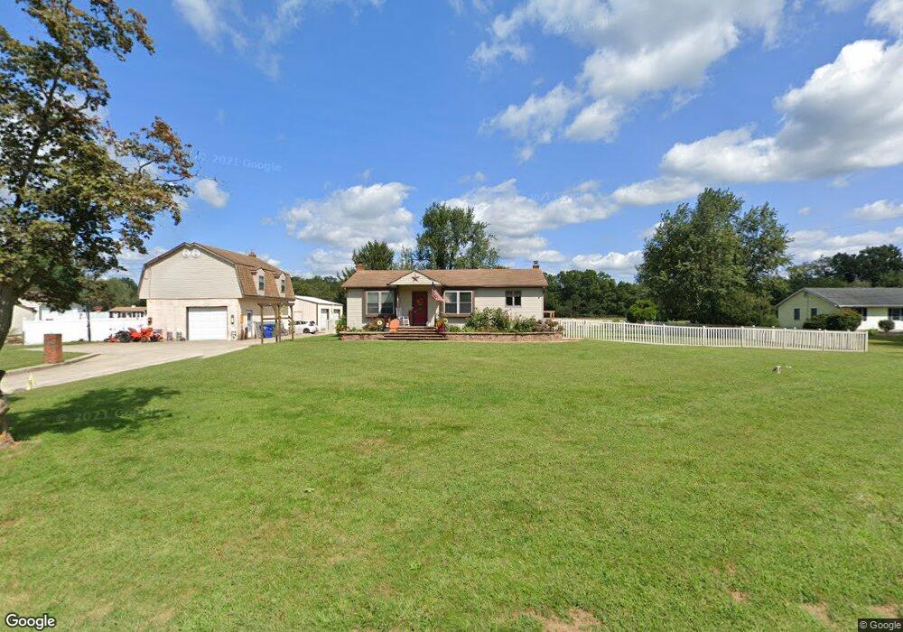
1981 Monroeville Rd Monroeville, NJ 08343
Franklin Township NeighborhoodEstimated Value: $296,743 - $377,000
--
Bed
--
Bath
1,008
Sq Ft
$322/Sq Ft
Est. Value
About This Home
This home is located at 1981 Monroeville Rd, Monroeville, NJ 08343 and is currently estimated at $324,936, approximately $322 per square foot. 1981 Monroeville Rd is a home located in Gloucester County with nearby schools including Delsea Regional Middle School, Delsea Regional High School, and St Michael The Archangel Regional School.
Ownership History
Date
Name
Owned For
Owner Type
Purchase Details
Closed on
Aug 1, 2018
Sold by
Ruppert Matthew D and Ruppert Michael D
Bought by
Ruppert Michael D
Current Estimated Value
Purchase Details
Closed on
Nov 1, 2005
Sold by
Garron Rick
Bought by
Ruppert Michael D and Ruppert Matthew D
Purchase Details
Closed on
May 13, 2005
Sold by
Freeman Daniel and Freeman Catherine L
Bought by
Garron Rick and Garron Jennifer
Purchase Details
Closed on
Feb 9, 1994
Sold by
Burbank Charles
Bought by
Freeman Daniel and Freeman Catherine
Home Financials for this Owner
Home Financials are based on the most recent Mortgage that was taken out on this home.
Original Mortgage
$105,000
Interest Rate
7.18%
Create a Home Valuation Report for This Property
The Home Valuation Report is an in-depth analysis detailing your home's value as well as a comparison with similar homes in the area
Home Values in the Area
Average Home Value in this Area
Purchase History
| Date | Buyer | Sale Price | Title Company |
|---|---|---|---|
| Ruppert Michael D | -- | None Available | |
| Ruppert Michael D | $150,000 | -- | |
| Garron Rick | $175,000 | Homestead Title Agency | |
| Freeman Daniel | $112,000 | -- |
Source: Public Records
Mortgage History
| Date | Status | Borrower | Loan Amount |
|---|---|---|---|
| Previous Owner | Freeman Daniel | $105,000 |
Source: Public Records
Tax History Compared to Growth
Tax History
| Year | Tax Paid | Tax Assessment Tax Assessment Total Assessment is a certain percentage of the fair market value that is determined by local assessors to be the total taxable value of land and additions on the property. | Land | Improvement |
|---|---|---|---|---|
| 2025 | $6,224 | $162,800 | $29,800 | $133,000 |
| 2024 | $6,081 | $162,800 | $29,800 | $133,000 |
| 2023 | $6,081 | $162,800 | $29,800 | $133,000 |
| 2022 | $5,916 | $162,800 | $29,800 | $133,000 |
| 2021 | $5,695 | $162,800 | $29,800 | $133,000 |
| 2020 | $5,771 | $162,800 | $29,800 | $133,000 |
| 2019 | $5,695 | $162,800 | $29,800 | $133,000 |
| 2018 | $5,620 | $162,800 | $29,800 | $133,000 |
| 2017 | $5,516 | $162,800 | $29,800 | $133,000 |
| 2016 | $5,490 | $162,800 | $29,800 | $133,000 |
| 2015 | $5,276 | $162,800 | $29,800 | $133,000 |
| 2014 | $5,081 | $162,800 | $29,800 | $133,000 |
Source: Public Records
Map
Nearby Homes
- 48 Pine St
- 124 Idle Lake Rd
- 595 Royal Ave
- 3071 Delsea Dr
- Lot 89 Delsea Dr
- 900 Delsea Dr
- 919 Little Mill Rd
- 3198 Delsea Dr
- 295 Blackwood Ave
- 51 Elmer St
- 1780 Coles Mill Rd
- 2165 Delsea Dr
- 1800 Coles Mill Rd
- 32 5th St
- 0 Fries Mill Rd
- 755 Buck Rd
- 30 2nd St
- 893 Fries Mill Rd
- 904 Pine Ave
- 211 Hollywood Ave
- 1967 Monroeville Rd
- 1989 Monroeville Rd
- 1974 Monroeville Rd
- 1960 Monroeville Rd
- 1955 Monroeville Rd
- 1946 Monroeville Rd
- 1986 Monroeville Rd
- 2019 Monroeville Rd
- 1941 Monroeville Rd
- 2033 Monroeville Rd
- 2002 Monroeville Rd
- 1934 Monroeville Rd
- 2045 Monroeville Rd
- 677 Swedesboro Rd
- 1896 Monroeville Rd
- 2061 Monroeville Rd
- 1921 Monroeville Rd
- 1882 Monroeville Rd
- 623 Swedesboro Rd
- 1891 Monroeville Rd