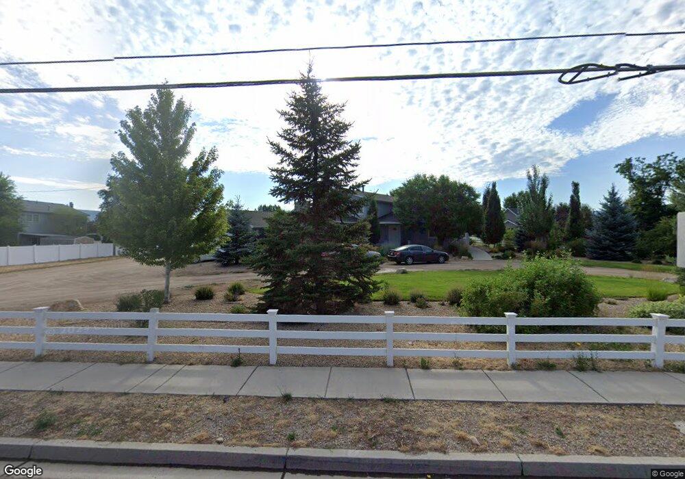
1981 S Daniels Rd Heber City, UT 84032
Estimated Value: $1,278,693 - $1,411,000
6
Beds
5
Baths
4,400
Sq Ft
$302/Sq Ft
Est. Value
About This Home
This home is located at 1981 S Daniels Rd, Heber City, UT 84032 and is currently estimated at $1,327,173, approximately $301 per square foot. 1981 S Daniels Rd is a home located in Wasatch County with nearby schools including Daniels Canyon Elementary School and Wasatch High School.
Ownership History
Date
Name
Owned For
Owner Type
Purchase Details
Closed on
Feb 23, 2022
Sold by
Lujan and Norma
Bought by
Lujan Mario and Lujan Norma
Current Estimated Value
Purchase Details
Closed on
Sep 26, 2012
Sold by
Meeker Kenneth
Bought by
Lujan Mario and Lujan Norma
Home Financials for this Owner
Home Financials are based on the most recent Mortgage that was taken out on this home.
Original Mortgage
$387,600
Interest Rate
3.59%
Mortgage Type
New Conventional
Purchase Details
Closed on
May 7, 2010
Sold by
Fieldsted Kevin and Fieldsted Tawnya R
Bought by
Bank Of The West
Purchase Details
Closed on
Aug 26, 2005
Sold by
Fieldsted Kevin
Bought by
Fieldsted Kevin and Fieldsted Tawnya R
Home Financials for this Owner
Home Financials are based on the most recent Mortgage that was taken out on this home.
Original Mortgage
$264,000
Interest Rate
5.64%
Mortgage Type
New Conventional
Create a Home Valuation Report for This Property
The Home Valuation Report is an in-depth analysis detailing your home's value as well as a comparison with similar homes in the area
Home Values in the Area
Average Home Value in this Area
Purchase History
| Date | Buyer | Sale Price | Title Company |
|---|---|---|---|
| Lujan Mario | -- | New Title Company Name | |
| Lujan Mario | -- | Provo Land Title Co | |
| Bank Of The West | $344,100 | Etitle Insurance Agency | |
| Fieldsted Kevin | -- | Atlas Title Insurance |
Source: Public Records
Mortgage History
| Date | Status | Borrower | Loan Amount |
|---|---|---|---|
| Previous Owner | Lujan Mario | $387,600 | |
| Previous Owner | Fieldsted Kevin | $264,000 |
Source: Public Records
Tax History Compared to Growth
Tax History
| Year | Tax Paid | Tax Assessment Tax Assessment Total Assessment is a certain percentage of the fair market value that is determined by local assessors to be the total taxable value of land and additions on the property. | Land | Improvement |
|---|---|---|---|---|
| 2025 | $4,631 | $851,050 | $428,750 | $422,300 |
| 2024 | $4,631 | $848,050 | $425,750 | $422,300 |
| 2023 | $4,631 | $932,950 | $350,750 | $582,200 |
| 2022 | $4,820 | $845,761 | $275,000 | $570,761 |
| 2021 | $5,401 | $750,634 | $275,000 | $475,634 |
| 2020 | $4,090 | $548,080 | $145,000 | $403,080 |
| 2019 | $3,875 | $312,694 | $0 | $0 |
| 2018 | $3,152 | $254,345 | $0 | $0 |
| 2017 | $2,770 | $222,323 | $0 | $0 |
| 2016 | $2,845 | $222,323 | $0 | $0 |
| 2015 | $2,713 | $222,323 | $0 | $0 |
| 2014 | $2,681 | $222,323 | $0 | $0 |
Source: Public Records
Map
Nearby Homes
- 114 Mountain Valley Ct
- 74 Horizon Ave
- 2029 S 150 E
- 175 E 1985 S
- 12 Skyline Dr
- 12 Skyline Dr Unit 2
- 13 Skyline Dr
- 2185 S 150 E
- 2198 S 390 W Unit 13
- 2444 S Orchard Cir E Unit 5
- 2403 S Orchard Cir E Unit 11
- 327 E 2260 S
- 2280 S 330 E
- 488 E Acord Way
- 2520 S 260 E
- 237 E Heber Pkwy
- 2071 S 500 E
- 1380 S Daniels Rd W
- 2586 E Water Wheel Ct
- 364 W 3000 S
- 17 W Rainbow Way
- 31 W Rainbow Way
- 4 E Rainbow Way
- 1995 S Daniels Rd
- 1 Airport Rd
- 13 Airport Rd
- 7 Airport Rd
- 83 E Rainbow Way
- 16 E Rainbow Way
- 27 Airport Rd Unit E
- 1875 S Daniels Rd
- 26 E Rainbow Way
- 59 Airport Rd Unit E
- 59 Airport Rd Unit 203
- 1912 Sunset Rd
- 3 E Rainbow Way
- 111 Airport Rd
- 0 Airport Rd
- 2301 S Daniels Rd
- 2030 S Daniels Rd