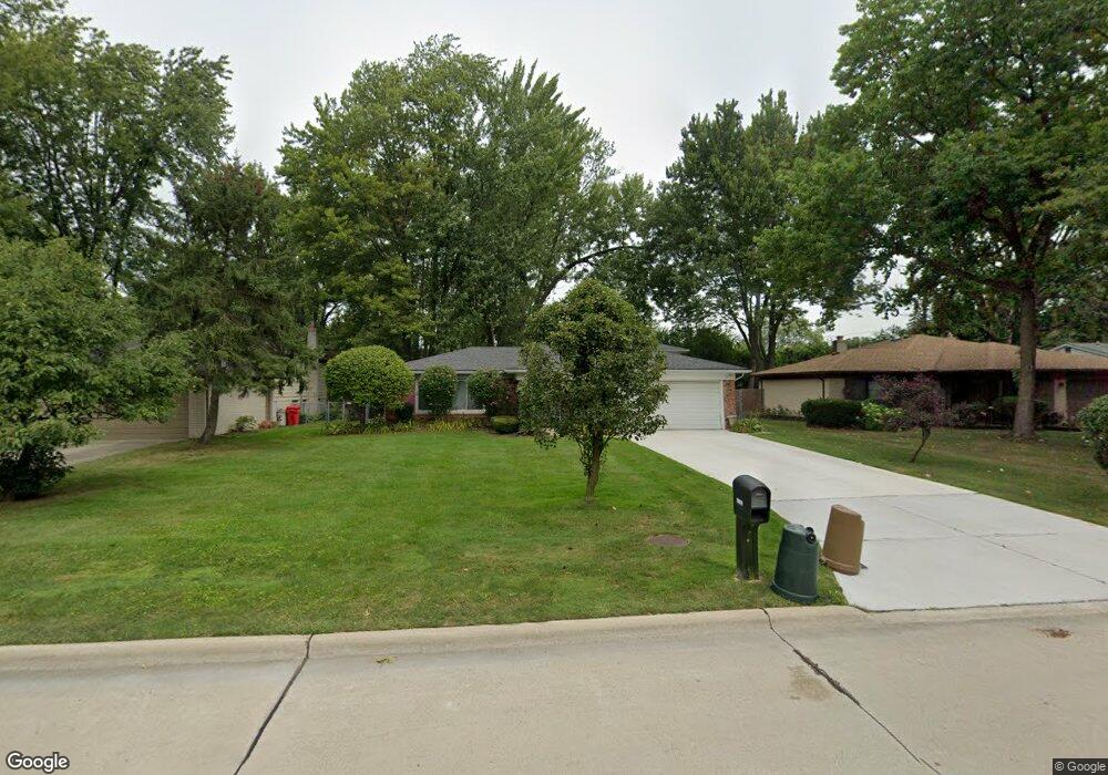
19810 Butternut Ln Southfield, MI 48076
Estimated Value: $355,587 - $403,000
--
Bed
3
Baths
2,129
Sq Ft
$177/Sq Ft
Est. Value
About This Home
This home is located at 19810 Butternut Ln, Southfield, MI 48076 and is currently estimated at $376,897, approximately $177 per square foot. 19810 Butternut Ln is a home located in Oakland County with nearby schools including Wylie E. Groves High School, Bingham Farms Elementary School, and Berkshire Middle School.
Ownership History
Date
Name
Owned For
Owner Type
Purchase Details
Closed on
May 15, 2019
Sold by
Banks Grasty Linoa C and Grasty Terry A
Bought by
Banks Grasty Linda C
Current Estimated Value
Purchase Details
Closed on
Nov 27, 2002
Sold by
Williams Darrell and Williams Anitha
Bought by
Grasty Terry A and Grasty Linda C Banks
Purchase Details
Closed on
Jan 21, 2000
Sold by
Warren Lynda M
Bought by
Williams Darrell
Purchase Details
Closed on
Jun 24, 1997
Sold by
Goodman Brian K
Bought by
Warren Lynda M
Home Financials for this Owner
Home Financials are based on the most recent Mortgage that was taken out on this home.
Original Mortgage
$140,000
Interest Rate
8.01%
Mortgage Type
Purchase Money Mortgage
Create a Home Valuation Report for This Property
The Home Valuation Report is an in-depth analysis detailing your home's value as well as a comparison with similar homes in the area
Home Values in the Area
Average Home Value in this Area
Purchase History
| Date | Buyer | Sale Price | Title Company |
|---|---|---|---|
| Banks Grasty Linda C | -- | None Available | |
| Grasty Terry A | $219,900 | Metropolitan Title Co | |
| Williams Darrell | $195,000 | -- | |
| Warren Lynda M | $175,000 | -- |
Source: Public Records
Mortgage History
| Date | Status | Borrower | Loan Amount |
|---|---|---|---|
| Previous Owner | Warren Lynda M | $140,000 |
Source: Public Records
Tax History Compared to Growth
Tax History
| Year | Tax Paid | Tax Assessment Tax Assessment Total Assessment is a certain percentage of the fair market value that is determined by local assessors to be the total taxable value of land and additions on the property. | Land | Improvement |
|---|---|---|---|---|
| 2022 | $4,014 | $140,630 | $23,380 | $117,250 |
| 2021 | $3,964 | $128,680 | $23,380 | $105,300 |
| 2020 | $3,567 | $126,260 | $17,980 | $108,280 |
| 2018 | $3,798 | $96,130 | $17,980 | $78,150 |
| 2015 | -- | $78,770 | $0 | $0 |
| 2014 | -- | $63,500 | $0 | $0 |
| 2011 | -- | $65,380 | $0 | $0 |
Source: Public Records
Map
Nearby Homes
- 29662 Westbrook Pkwy
- 30130 Woodgate Dr
- 29743 Chelmsford Rd
- 19601 W 12 Mile Rd Unit 102
- 29807 Spring Hill Dr
- 29484 Spring Hill Dr
- 29140 Candlewood Ln
- 19245 Eldridge Ln
- 20141 Lacrosse Ave
- 29214 Candlewood Ln
- 29848 Rambling Rd
- 20351 Lacrosse Ave
- 28450 Tapert Dr
- 21650 W 11 Mile Rd
- 29239 Somerset Dr
- 30301 Spring River Dr
- 31018 Pickwick Ln
- 20120 Covington Pkwy
- 19710 W 13 Mile Rd Unit 201
- 19710 W 13 Mile Rd Unit 108
- 19780 Butternut Ln
- 19840 Butternut Ln
- 19821 Silver Spring St
- 19750 Butternut Ln
- 19841 Silver Spring St
- 19801 Silver Spring St
- 19870 Butternut Ln
- 19700 Butternut Ln
- 19861 Silver Spring St
- 19815 Butternut Ln
- 19845 Butternut Ln
- 19785 Butternut Ln
- 19900 Butternut Ln
- 19781 Silver Spring St
- 19875 Butternut Ln
- 19755 Butternut Ln
- 19761 Silver Spring St
- 19670 Butternut Ln
- 19905 Butternut Ln
- 19705 Butternut Ln