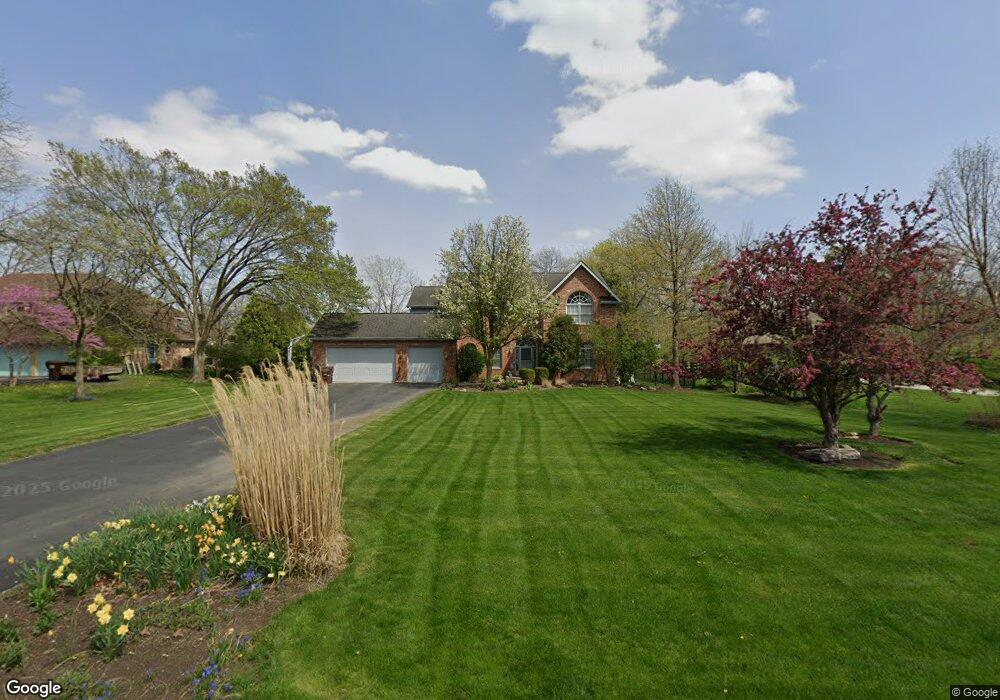
19811 Woodside Dr New Lenox, IL 60451
Estimated Value: $534,000 - $675,000
--
Bed
--
Bath
--
Sq Ft
0.96
Acres
About This Home
This home is located at 19811 Woodside Dr, New Lenox, IL 60451 and is currently estimated at $616,434. 19811 Woodside Dr is a home located in Will County with nearby schools including Oster-Oakview School, Haines Elementary School, and Lincoln Way West.
Ownership History
Date
Name
Owned For
Owner Type
Purchase Details
Closed on
May 28, 1999
Sold by
Evans Bernard J and Evans Jacquelynn R
Bought by
Feehan Paul M and Feehan Donna M
Current Estimated Value
Home Financials for this Owner
Home Financials are based on the most recent Mortgage that was taken out on this home.
Original Mortgage
$240,000
Outstanding Balance
$63,818
Interest Rate
7.15%
Estimated Equity
$552,616
Purchase Details
Closed on
Dec 20, 1994
Sold by
Stein Elliot S and Stein Leslie K
Bought by
Evans Bernard J and Evans Jacquelynn R
Home Financials for this Owner
Home Financials are based on the most recent Mortgage that was taken out on this home.
Original Mortgage
$265,500
Interest Rate
8.65%
Create a Home Valuation Report for This Property
The Home Valuation Report is an in-depth analysis detailing your home's value as well as a comparison with similar homes in the area
Home Values in the Area
Average Home Value in this Area
Purchase History
| Date | Buyer | Sale Price | Title Company |
|---|---|---|---|
| Feehan Paul M | $315,000 | Chicago Title Insurance Co | |
| Evans Bernard J | $285,000 | Attorneys Title Guaranty Fun |
Source: Public Records
Mortgage History
| Date | Status | Borrower | Loan Amount |
|---|---|---|---|
| Open | Feehan Paul M | $240,000 | |
| Previous Owner | Evans Bernard J | $265,500 |
Source: Public Records
Tax History Compared to Growth
Tax History
| Year | Tax Paid | Tax Assessment Tax Assessment Total Assessment is a certain percentage of the fair market value that is determined by local assessors to be the total taxable value of land and additions on the property. | Land | Improvement |
|---|---|---|---|---|
| 2024 | $16,271 | $215,953 | $47,225 | $168,728 |
| 2023 | $16,271 | $196,858 | $43,049 | $153,809 |
| 2022 | $14,626 | $181,352 | $39,658 | $141,694 |
| 2021 | $13,906 | $170,556 | $37,297 | $133,259 |
| 2020 | $13,620 | $164,470 | $35,966 | $128,504 |
| 2019 | $12,940 | $159,370 | $34,851 | $124,519 |
| 2018 | $12,649 | $153,876 | $33,649 | $120,227 |
| 2017 | $12,014 | $149,453 | $32,682 | $116,771 |
| 2016 | $11,669 | $145,453 | $31,807 | $113,646 |
| 2015 | $11,228 | $140,875 | $30,806 | $110,069 |
| 2014 | $11,228 | $139,136 | $30,426 | $108,710 |
| 2013 | $11,228 | $141,011 | $30,836 | $110,175 |
Source: Public Records
Map
Nearby Homes
- 1261 S Regan Rd
- 1108 Plaza Dr
- 807 Picardy Place
- 1125 Georgias Way
- 1139 Georgias Way
- 821 Chatfield Rd
- 12932 Carrington Ct
- 1193 Georgias Way
- 1931 Tessington Ct
- 1245 Georgias Way
- 1212 Georgias Way
- 621 Chatfield Rd
- 1920 Tessington Ct
- 1920 Edmonds Ave
- 12752 Berkshire Dr
- 224 Hauser Ct
- 208 Redwood Ave
- 200 Redwood Ave
- Lot 108 S Richard Ave
- 0000 W Regan Rd
- 19763 Woodside Dr
- 19823 Woodside Dr
- 19751 Woodside Dr
- 1125 Lakeside Dr
- 19831 Woodside Dr
- 19843 Woodside Dr
- 19737 Woodside Dr
- 1100 Lakeside Dr
- 1145 Lakeside Dr
- 19715 Woodside Dr
- 19852 Woodside Dr
- 1110 Lakeside Dr
- 19720 Woodside Dr
- 19707 Woodside Dr
- 19750 Woodside Dr
- 19661 Woodside Dr
- 1120 Lakeside Dr
- 1225 Lakeside Dr
- 19641 Woodside Dr
- 19654 Woodside Dr