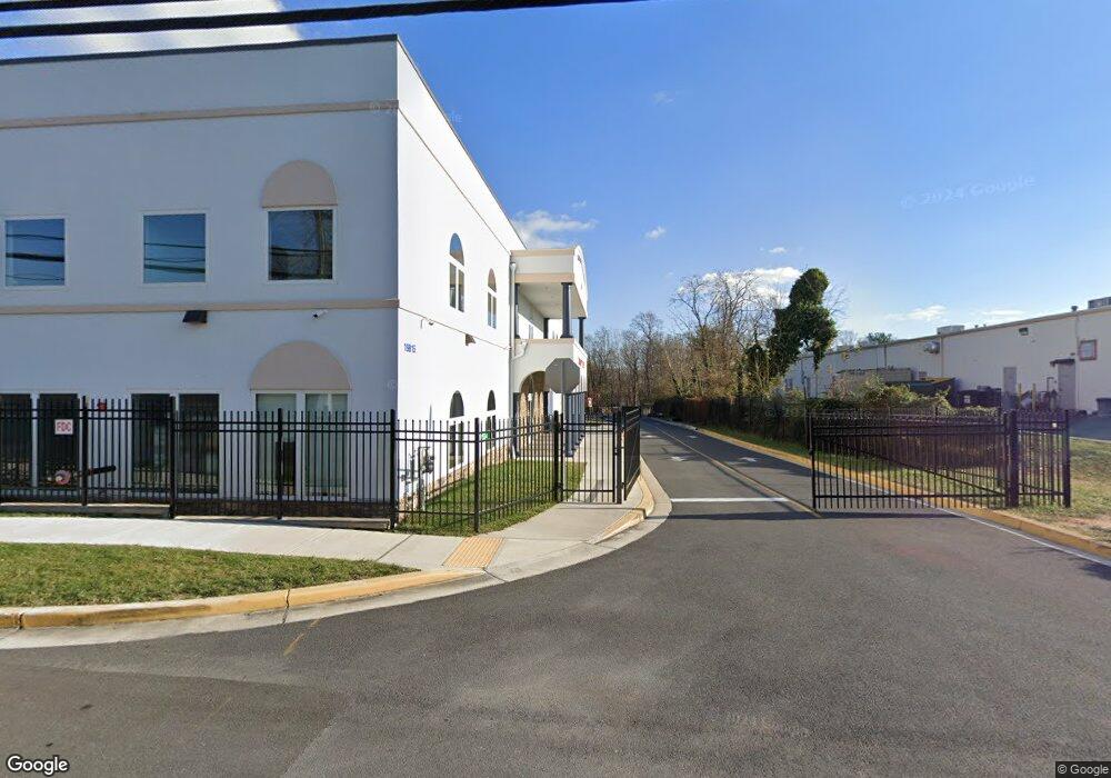
19815 Blunt Rd Germantown, MD 20876
Estimated Value: $1,406,825
--
Bed
--
Bath
12,000
Sq Ft
$117/Sq Ft
Est. Value
About This Home
This home is located at 19815 Blunt Rd, Germantown, MD 20876 and is currently priced at $1,406,825, approximately $117 per square foot. 19815 Blunt Rd is a home located in Montgomery County with nearby schools including Captain James E. Daly Elementary School, Rocky Hill Middle School, and Clarksburg High.
Ownership History
Date
Name
Owned For
Owner Type
Purchase Details
Closed on
Jan 30, 2017
Sold by
Ybm Construction Inc
Bought by
Islamic Society Of Germantown
Current Estimated Value
Home Financials for this Owner
Home Financials are based on the most recent Mortgage that was taken out on this home.
Original Mortgage
$720,000
Outstanding Balance
$594,791
Interest Rate
4.12%
Mortgage Type
Purchase Money Mortgage
Purchase Details
Closed on
Aug 10, 2004
Sold by
Boy Scouts Of America Ncac
Bought by
Ybm Construction Inc
Purchase Details
Closed on
Sep 27, 2001
Sold by
Blunt Rd Partners
Bought by
Boy Scouts Of America Ncac
Create a Home Valuation Report for This Property
The Home Valuation Report is an in-depth analysis detailing your home's value as well as a comparison with similar homes in the area
Home Values in the Area
Average Home Value in this Area
Purchase History
| Date | Buyer | Sale Price | Title Company |
|---|---|---|---|
| Islamic Society Of Germantown | $990,000 | None Available | |
| Ybm Construction Inc | $750,000 | -- | |
| Boy Scouts Of America Ncac | -- | -- |
Source: Public Records
Mortgage History
| Date | Status | Borrower | Loan Amount |
|---|---|---|---|
| Open | Islamic Society Of Germantown | $720,000 |
Source: Public Records
Tax History Compared to Growth
Tax History
| Year | Tax Paid | Tax Assessment Tax Assessment Total Assessment is a certain percentage of the fair market value that is determined by local assessors to be the total taxable value of land and additions on the property. | Land | Improvement |
|---|---|---|---|---|
| 2025 | $758 | $3,725,833 | -- | -- |
| 2024 | $758 | $3,513,567 | $0 | $0 |
| 2023 | $0 | $3,301,300 | $982,500 | $2,318,800 |
| 2022 | $0 | $976,533 | $0 | $0 |
| 2021 | $0 | $970,567 | $0 | $0 |
| 2020 | $0 | $964,600 | $964,600 | $0 |
| 2019 | $0 | $964,600 | $964,600 | $0 |
| 2018 | $10,656 | $964,600 | $964,600 | $0 |
| 2017 | $11,376 | $1,011,300 | $0 | $0 |
| 2016 | -- | $967,333 | $0 | $0 |
| 2015 | $9,651 | $923,367 | $0 | $0 |
| 2014 | $9,651 | $879,400 | $0 | $0 |
Source: Public Records
Map
Nearby Homes
- 19922 Gateshead Cir
- 19970 Appledowre Cir
- 19540 Scenery Dr
- 19323 Moon Ridge Dr
- 19900 Appledowre Cir
- 11407 Stoney Point Place
- 11303 Appledowre Way
- 19932 Dunstable Cir
- 19621 Gunners Branch Rd Unit G
- 19621 Gunners Branch Rd Unit L
- 19625 Gunners Branch Rd Unit 912
- 19810 Madrigal Dr
- 11427 Hawks Ridge Terrace
- 11418 Appledowre Way
- 19513 Gunners Branch Rd
- 19521 Gunners Branch Rd Unit 314
- 19605 Gunners Branch Rd Unit 214
- 19525 Gunners Branch Rd Unit G
- 20113 Locustdale Dr
- 20172 Locustdale Dr
- 11246 Minstrel Tune Dr
- 11248 Minstrel Tune Dr
- 11244 Minstrel Tune Dr
- 19825 Blunt Rd
- 11242 Minstrel Tune Dr
- 11247 Minstrel Tune Dr
- 11245 Minstrel Tune Dr
- 11240 Minstrel Tune Dr
- 11243 Minstrel Tune Dr
- 167 Princess Ave Unit 167
- 19820 Blunt Rd
- 11241 Minstrel Tune Dr
- 11238 Minstrel Tune Dr
- 19731 Frederick Rd
- 11440 Middlebrook Rd
- 11239 Minstrel Tune Dr
- 11236 Minstrel Tune Dr
- 19809 Frederick Rd
- 11234 Minstrel Tune Dr
- 19651 Frederick Rd