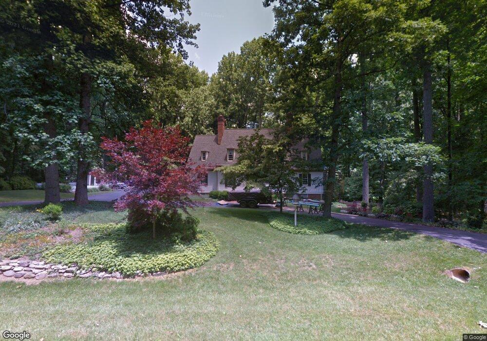
19817 Pinebark Way Brinklow, MD 20862
Estimated Value: $750,000 - $960,969
Studio
4
Baths
4,192
Sq Ft
$202/Sq Ft
Est. Value
About This Home
This home is located at 19817 Pinebark Way, Brinklow, MD 20862 and is currently estimated at $848,492, approximately $202 per square foot. 19817 Pinebark Way is a home located in Montgomery County with nearby schools including Sherwood Elementary School, William H. Farquhar Middle School, and Sherwood High School.
Ownership History
Date
Name
Owned For
Owner Type
Purchase Details
Closed on
Sep 24, 2014
Sold by
Pearce Donald W and Pearce Joann M
Bought by
The Pearce Family Trust
Current Estimated Value
Purchase Details
Closed on
May 5, 1998
Sold by
M Donald W and M Pearce J
Bought by
M Donald W and M Pearce J
Create a Home Valuation Report for This Property
The Home Valuation Report is an in-depth analysis detailing your home's value as well as a comparison with similar homes in the area
Purchase History
| Date | Buyer | Sale Price | Title Company |
|---|---|---|---|
| The Pearce Family Trust | -- | None Available | |
| M Donald W | -- | -- |
Source: Public Records
Tax History
| Year | Tax Paid | Tax Assessment Tax Assessment Total Assessment is a certain percentage of the fair market value that is determined by local assessors to be the total taxable value of land and additions on the property. | Land | Improvement |
|---|---|---|---|---|
| 2025 | $9,106 | $784,667 | -- | -- |
| 2024 | $9,106 | $723,233 | $0 | $0 |
| 2023 | $7,665 | $661,800 | $287,800 | $374,000 |
| 2022 | $7,318 | $661,800 | $287,800 | $374,000 |
| 2021 | $7,227 | $661,800 | $287,800 | $374,000 |
| 2020 | $7,227 | $662,900 | $287,800 | $375,100 |
| 2019 | $7,121 | $655,433 | $0 | $0 |
| 2018 | $7,044 | $647,967 | $0 | $0 |
| 2017 | $7,091 | $640,500 | $0 | $0 |
| 2016 | -- | $611,667 | $0 | $0 |
| 2015 | $6,956 | $582,833 | $0 | $0 |
| 2014 | $6,956 | $554,000 | $0 | $0 |
Source: Public Records
Map
Nearby Homes
- 31 Haviland Mill Rd
- 660 Greenbridge Rd
- 19230 Chandlee Mill Rd
- 18901 Chandlee Mill Rd
- 13499 Villadest Dr
- 6876 Mink Hollow Rd
- 7033 Mink Hollow Rd
- 18540 Brooke Rd
- 21151 New Hampshire Ave
- 18515 Brooke Rd
- 6735 Mink Hollow Rd
- 7102 Deer Valley Rd
- 18465 Brooke Rd
- 1625 Ashton Rd
- 1210 Ashton Rd
- 17922 Ashton Club Way
- 13773 Lakeside Dr
- 13414 Good Times Ct
- 13576 Highland Rd
- 13951 Hallowell Ct
- 19813 Pinebark Way
- 19821 Pinebark Way
- 19809 Pinebark Way
- 19816 Pinebark Way
- 19800 Pinebark Way
- 7654 Mris-Prod-respepa Ave
- 19901 Pinebark Way
- 19808 Pinebark Way
- 19801 Pinebark Way
- 19820 Pinebark Way
- 19805 Pinebark Way
- 9 Pinebark Ct
- 13 Pinebark Ct
- 19900 Pinebark Way
- 18 Pinebark Ct
- 19817 Tanbark Way
- 1 Pinebark Ct
- 405 Windswept Ln
- 19904 Pinebark Way
Your Personal Tour Guide
Ask me questions while you tour the home.