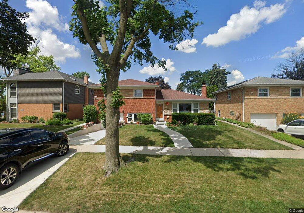
1982 Birch St Des Plaines, IL 60018
Estimated Value: $376,000 - $544,000
4
Beds
3
Baths
1,769
Sq Ft
$248/Sq Ft
Est. Value
About This Home
This home is located at 1982 Birch St, Des Plaines, IL 60018 and is currently estimated at $438,889, approximately $248 per square foot. 1982 Birch St is a home located in Cook County with nearby schools including South Elementary School, Algonquin Middle School, and Maine West High School.
Ownership History
Date
Name
Owned For
Owner Type
Purchase Details
Closed on
Oct 12, 1995
Sold by
Kowalski Henryk and Kowalski Barbara
Bought by
Plaza Laurencio and Plaza Teresa
Current Estimated Value
Home Financials for this Owner
Home Financials are based on the most recent Mortgage that was taken out on this home.
Original Mortgage
$130,000
Interest Rate
7.65%
Purchase Details
Closed on
Aug 2, 1994
Sold by
Community Svgs Bank
Bought by
Kowalski Henryk
Create a Home Valuation Report for This Property
The Home Valuation Report is an in-depth analysis detailing your home's value as well as a comparison with similar homes in the area
Home Values in the Area
Average Home Value in this Area
Purchase History
| Date | Buyer | Sale Price | Title Company |
|---|---|---|---|
| Plaza Laurencio | $178,500 | -- | |
| Kowalski Henryk | -- | -- |
Source: Public Records
Mortgage History
| Date | Status | Borrower | Loan Amount |
|---|---|---|---|
| Closed | Plaza Laurencio | $130,000 |
Source: Public Records
Tax History
| Year | Tax Paid | Tax Assessment Tax Assessment Total Assessment is a certain percentage of the fair market value that is determined by local assessors to be the total taxable value of land and additions on the property. | Land | Improvement |
|---|---|---|---|---|
| 2025 | $5,162 | $43,000 | $6,435 | $36,565 |
| 2024 | $5,162 | $36,001 | $5,363 | $30,638 |
| 2023 | $5,197 | $36,001 | $5,363 | $30,638 |
| 2022 | $5,197 | $36,001 | $5,363 | $30,638 |
| 2021 | $6,045 | $30,331 | $4,468 | $25,863 |
| 2020 | $5,536 | $30,331 | $4,468 | $25,863 |
| 2019 | $5,450 | $34,080 | $4,468 | $29,612 |
| 2018 | $6,067 | $30,136 | $3,932 | $26,204 |
| 2017 | $5,856 | $31,766 | $3,932 | $27,834 |
| 2016 | $6,449 | $31,766 | $3,932 | $27,834 |
| 2015 | $7,370 | $28,875 | $3,396 | $25,479 |
| 2014 | $7,242 | $28,875 | $3,396 | $25,479 |
| 2013 | $7,574 | $28,875 | $3,396 | $25,479 |
Source: Public Records
Map
Nearby Homes
- 1922 Fargo Ave
- 1721 Prospect Ave
- 1640 S River Rd
- 38 E Touhy Ave
- 1641 E Touhy Ave
- 1629 E Touhy Ave
- 2469 Parkwood Ln
- 1445 Everett Ave
- 1645 Illinois St
- 1689 S Elm St
- 2600 S Scott St
- 2220 S Chestnut St
- 1696 S Elm St
- 1370 Fargo Ave Unit E
- 2609 Eisenhower Dr
- 1990 Berry Ln
- 700 Florence Dr
- 2646 Maple St
- 1700 E Forest Ave
- 22 Park Ln Unit 220
- 1974 Birch St
- 1990 Birch St
- 1870 Howard Ave
- 1966 Birch St
- 1860 Howard Ave
- 1871 Stockton Ave
- 1958 Birch St
- 1861 Stockton Ave
- 1983 Birch St
- 2004 Birch St
- 1991 Birch St
- 1975 Birch St
- 1850 Howard Ave
- 1967 Birch St
- 1895 Howard Ave
- 1851 Stockton Ave
- 2014 Birch St
- 1875 Howard Ave
- 1959 Birch St
- 1840 Howard Ave
Your Personal Tour Guide
Ask me questions while you tour the home.