Estimated Value: $1,060,631 - $1,133,000
5
Beds
4
Baths
4,350
Sq Ft
$254/Sq Ft
Est. Value
About This Home
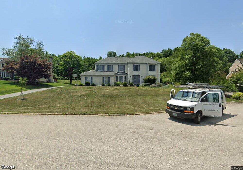
This home is located at 1982 Black Rock Ln, Paoli, PA 19301 and is currently estimated at $1,103,158, approximately $253 per square foot. 1982 Black Rock Ln is a home located in Chester County with nearby schools including Hillside Elementary School, Valley Forge Middle School, and Conestoga Senior High School.
Ownership History
Date
Name
Owned For
Owner Type
Purchase Details
Closed on
Jun 22, 2018
Sold by
Khan Nasir H and Hafeez Huma
Bought by
Xu Lijun and Li Jing
Current Estimated Value
Home Financials for this Owner
Home Financials are based on the most recent Mortgage that was taken out on this home.
Original Mortgage
$596,000
Outstanding Balance
$516,594
Interest Rate
4.6%
Mortgage Type
New Conventional
Estimated Equity
$586,564
Purchase Details
Closed on
May 18, 1998
Sold by
Hollis Douglas L and Hollis Glenna
Bought by
Khan Nasir H and Hafeez Huma
Home Financials for this Owner
Home Financials are based on the most recent Mortgage that was taken out on this home.
Original Mortgage
$227,000
Interest Rate
7.05%
Create a Home Valuation Report for This Property
The Home Valuation Report is an in-depth analysis detailing your home's value as well as a comparison with similar homes in the area
Home Values in the Area
Average Home Value in this Area
Purchase History
| Date | Buyer | Sale Price | Title Company |
|---|---|---|---|
| Xu Lijun | $745,000 | Quest Abstract Corporation | |
| Khan Nasir H | $349,000 | -- |
Source: Public Records
Mortgage History
| Date | Status | Borrower | Loan Amount |
|---|---|---|---|
| Open | Xu Lijun | $596,000 | |
| Previous Owner | Khan Nasir H | $227,000 |
Source: Public Records
Tax History Compared to Growth
Tax History
| Year | Tax Paid | Tax Assessment Tax Assessment Total Assessment is a certain percentage of the fair market value that is determined by local assessors to be the total taxable value of land and additions on the property. | Land | Improvement |
|---|---|---|---|---|
| 2025 | $11,265 | $319,810 | $83,930 | $235,880 |
| 2024 | $11,265 | $319,810 | $83,930 | $235,880 |
| 2023 | $10,581 | $319,810 | $83,930 | $235,880 |
| 2022 | $10,308 | $319,810 | $83,930 | $235,880 |
| 2021 | $10,112 | $319,810 | $83,930 | $235,880 |
| 2020 | $9,834 | $319,810 | $83,930 | $235,880 |
| 2019 | $9,523 | $319,810 | $83,930 | $235,880 |
| 2018 | $9,334 | $319,810 | $83,930 | $235,880 |
| 2017 | $9,112 | $319,810 | $83,930 | $235,880 |
| 2016 | -- | $319,810 | $83,930 | $235,880 |
| 2015 | -- | $319,810 | $83,930 | $235,880 |
| 2014 | -- | $319,810 | $83,930 | $235,880 |
Source: Public Records
Map
Nearby Homes
- 1 Whitworth Ave
- 106 N Valley Rd
- 2175 Swedesford Rd
- 109 Vincent Rd
- 21 Manor Rd
- 12 Moreland Rd
- 29 Manor Rd
- 202 Shoreline Dr
- 201 Penns Ln
- 104 Lynbrook Rd
- 114 Manor Rd
- 1250 Swedesford Rd
- 10 Arlington Rd
- 3 Bryan Ave
- 313 Central Ave
- 0000 the Willis Elite
- 0000 the Vesper Elite Model
- 2102 Quail Ridge Dr
- 276 Valley View Rd
- 229 Miner St
- 1968 Black Rock Ln
- 1996 Black Rock Ln
- 1954 Black Rock Ln
- 1929 Black Rock Ln
- 1983 Black Rock Ln
- 1947 Black Rock Ln
- 1965 Black Rock Ln
- 1948 Black Rock Ln
- 1911 Black Rock Ln
- 632 Lyndale Ct
- 1926 Black Rock Ln
- 608 Lyndale Ct
- 644 Lyndale Ct
- 620 Lyndale Ct
- 1912 Black Rock Ln
- 656 Lyndale Ct
- 1916 Glenwold Dr
- 1898 Black Rock Ln
- 1900 Glenwold Dr
- 611 Lyndale Ct