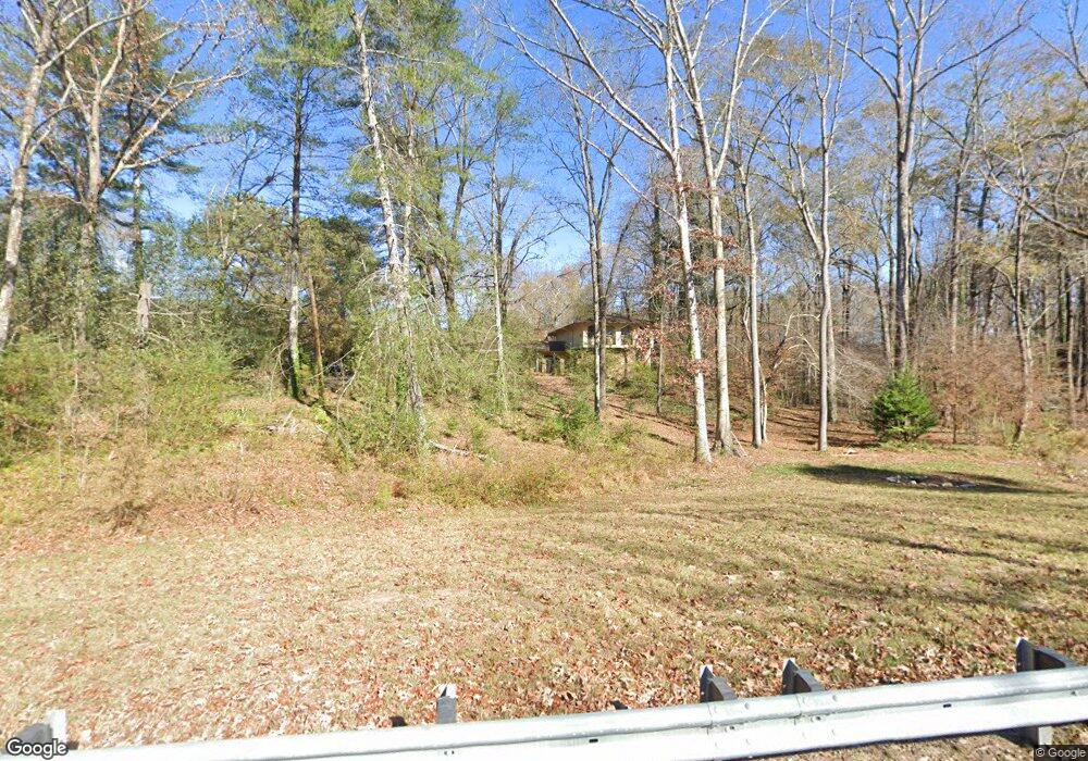
1982 Brooks Rd Dacula, GA 30019
Estimated Value: $374,747 - $417,000
3
Beds
3
Baths
2,967
Sq Ft
$136/Sq Ft
Est. Value
About This Home
This home is located at 1982 Brooks Rd, Dacula, GA 30019 and is currently estimated at $403,187, approximately $135 per square foot. 1982 Brooks Rd is a home located in Gwinnett County with nearby schools including Harbins Elementary School, McConnell Middle School, and Archer High School.
Ownership History
Date
Name
Owned For
Owner Type
Purchase Details
Closed on
Aug 15, 2011
Sold by
Favata Ulrike H
Bought by
Favata Timothy M
Current Estimated Value
Purchase Details
Closed on
Sep 6, 2008
Sold by
Favata Ulrike H
Bought by
Favata Ulrike H and Favata Timothy M
Purchase Details
Closed on
Jul 21, 1997
Sold by
Bell Gloria M
Bought by
Favata Ulrike H
Purchase Details
Closed on
Aug 25, 1995
Sold by
Williams Ernest G
Bought by
Bell Gloria M
Create a Home Valuation Report for This Property
The Home Valuation Report is an in-depth analysis detailing your home's value as well as a comparison with similar homes in the area
Home Values in the Area
Average Home Value in this Area
Purchase History
| Date | Buyer | Sale Price | Title Company |
|---|---|---|---|
| Favata Timothy M | -- | -- | |
| Favata Ulrike H | -- | -- | |
| Favata Ulrike H | $145,000 | -- | |
| Bell Gloria M | $128,600 | -- |
Source: Public Records
Mortgage History
| Date | Status | Borrower | Loan Amount |
|---|---|---|---|
| Closed | Bell Gloria M | $0 |
Source: Public Records
Tax History
| Year | Tax Paid | Tax Assessment Tax Assessment Total Assessment is a certain percentage of the fair market value that is determined by local assessors to be the total taxable value of land and additions on the property. | Land | Improvement |
|---|---|---|---|---|
| 2025 | -- | $96,880 | $24,680 | $72,200 |
| 2024 | $3,045 | $96,880 | $24,680 | $72,200 |
| 2023 | $3,045 | $104,360 | $24,680 | $79,680 |
| 2022 | $2,792 | $86,600 | $15,040 | $71,560 |
| 2021 | $2,834 | $86,600 | $15,040 | $71,560 |
| 2020 | $2,853 | $86,600 | $15,040 | $71,560 |
| 2019 | $2,344 | $65,920 | $14,480 | $51,440 |
| 2018 | $2,342 | $65,920 | $14,480 | $51,440 |
| 2016 | $2,365 | $65,920 | $14,480 | $51,440 |
| 2015 | $2,388 | $65,920 | $14,480 | $51,440 |
| 2014 | $1,930 | $48,000 | $12,880 | $35,120 |
Source: Public Records
Map
Nearby Homes
- 1556 Ewing Chapel Rd
- 1507 Ewing Chapel Rd
- 1656 Ewing Chapel Rd
- 1225 Ewing Ives Dr
- 1760 Mountain Ash Ct
- 1950 van Alen Ct
- 1909 van Alen Ct
- 2095 Uniwattee Trail
- 0 Luke Edwards Rd Unit 20134058
- 3370 Elkhorn Ridge Run
- 2282 Edgecombe Ln
- 1910 Van Allen Ct
- 1985 Chapel Estates Ln
- 2200 Spruce Lake Dr
- 1670 Leigh Meadow Dr
- 1730 Riverpark Dr SE
- 1755 Riverpark Dr
- 1070 Leighs Brook Way
- 1785 Campbell Ives Dr
- 1805 Campbell Ives Dr
- 1992 Brooks Rd
- 1971 Brooks Rd
- 1276 Brooks Rd SE
- 1540 Brooks Rd SE
- 1540 Brooks Rd SE Unit 5
- 1520 Brooks Rd SE Unit 4
- 2320 Brooks Rd SE
- 1950 Brooks Rd
- 2002 Brooks Rd
- 1978 Brooks Rd
- 2008 Brooks Rd
- 0 Brooks Rd SE Unit 9069286
- 1981 Brooks Rd
- 2012 Brooks Rd
- 2185 Givens Rd
- 2011 Brooks Rd
- 2022 Brooks Rd
- 2015 Brooks Rd
- 1902 Brooks Rd
- 1330 Ewing Chapel Rd
Your Personal Tour Guide
Ask me questions while you tour the home.