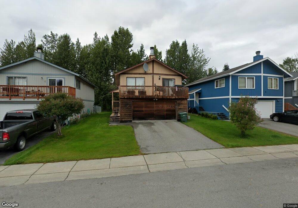
1982 Commodore Dr Anchorage, AK 99507
Abbott Loop NeighborhoodEstimated Value: $388,031 - $475,000
3
Beds
2
Baths
1,008
Sq Ft
$427/Sq Ft
Est. Value
About This Home
This home is located at 1982 Commodore Dr, Anchorage, AK 99507 and is currently estimated at $430,758, approximately $427 per square foot. 1982 Commodore Dr is a home located in Anchorage Municipality with nearby schools including Bowman Elementary School, Hanshew Middle School, and Service High School.
Ownership History
Date
Name
Owned For
Owner Type
Purchase Details
Closed on
Aug 14, 2025
Sold by
Lau Clayton Kamun
Bought by
Lau Jenny Lee and Lau Jenny
Current Estimated Value
Purchase Details
Closed on
May 4, 2012
Sold by
Lau Clayton K M
Bought by
Lau Clayton
Home Financials for this Owner
Home Financials are based on the most recent Mortgage that was taken out on this home.
Original Mortgage
$180,500
Interest Rate
3.94%
Create a Home Valuation Report for This Property
The Home Valuation Report is an in-depth analysis detailing your home's value as well as a comparison with similar homes in the area
Home Values in the Area
Average Home Value in this Area
Purchase History
| Date | Buyer | Sale Price | Title Company |
|---|---|---|---|
| Lau Jenny Lee | -- | Atga (Alyeska Title Guaranty A | |
| Lau Clayton | -- | Auta |
Source: Public Records
Mortgage History
| Date | Status | Borrower | Loan Amount |
|---|---|---|---|
| Previous Owner | Lau Clayton | $180,500 |
Source: Public Records
Tax History
| Year | Tax Paid | Tax Assessment Tax Assessment Total Assessment is a certain percentage of the fair market value that is determined by local assessors to be the total taxable value of land and additions on the property. | Land | Improvement |
|---|---|---|---|---|
| 2025 | $4,492 | $379,900 | $85,200 | $294,700 |
| 2024 | $4,492 | $353,200 | $85,200 | $268,000 |
| 2023 | $5,536 | $325,100 | $85,200 | $239,900 |
| 2022 | $4,476 | $315,800 | $85,200 | $230,600 |
| 2021 | $5,123 | $284,300 | $85,200 | $199,100 |
| 2020 | $4,046 | $288,300 | $85,200 | $203,100 |
| 2019 | $3,791 | $281,700 | $85,200 | $196,500 |
| 2018 | $3,636 | $271,700 | $80,900 | $190,800 |
| 2017 | $4,173 | $286,500 | $80,900 | $205,600 |
| 2016 | $3,410 | $272,500 | $77,800 | $194,700 |
| 2015 | $3,410 | $263,500 | $77,800 | $185,700 |
| 2014 | $3,410 | $258,100 | $77,800 | $180,300 |
Source: Public Records
Map
Nearby Homes
- 1935 Commodore Dr
- 1962 Commodore Dr
- 1900-1941 Marthas Vineyard Cir
- 8000 Independence Park Dr
- 10282 Jamestown Dr Unit 5A
- 10229 Jamestown Dr Unit 605
- 9599 Brayton Dr Unit 422
- 9750 Vanguard Dr Unit 44
- 9751 Newhaven Loop
- 9710 Vanguard Dr Unit 80
- 9715 Independence Dr Unit B306
- 2211 Sentry Dr Unit B6
- 10240 Old Seward Hwy
- 2300 Sentry Dr Unit E102
- 2300 Sentry Dr Unit E106
- NHN Red Sky Cir
- 11205 Willene Dr
- 11501 Hawkins Ln
- 11135 Red Sky Cir
- 11418 Moonrise Ridge Place Unit 19
- L7 Elcadore Dr
- 1980 Commodore Dr
- 1984 Commodore Dr
- 1986 Commodore Dr
- 1978 Commodore Dr
- 1976 Commodore Dr
- 1988 Commodore Dr
- 1974 Commodore Dr
- 10511 Jamestown Dr
- 1987 Commodore Dr
- 1985 Commodore Dr
- 1983 Commodore Dr
- 10521 Jamestown Dr
- 1972 Commodore Dr
- 1981 Commodore Dr
- 10531 Jamestown Dr
- 1979 Commodore Dr
- 1970 Commodore Dr
- I-32 Hollybrook Cir Unit 32
- 10541 Jamestown Dr
Your Personal Tour Guide
Ask me questions while you tour the home.