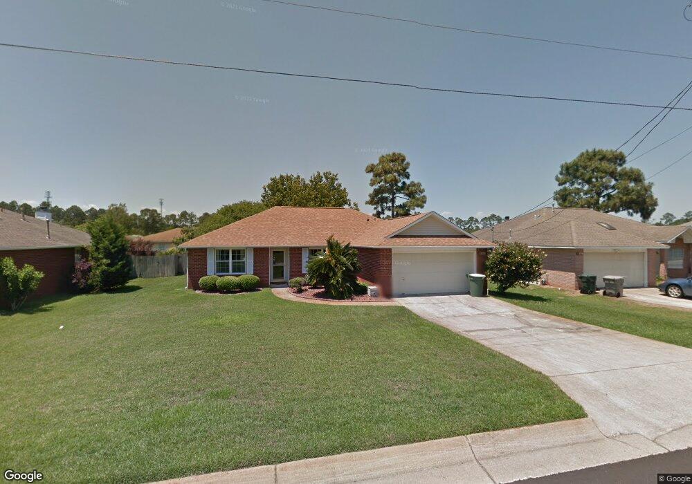
1982 Coral Reef Rd Unit 2 Pensacola, FL 32506
Southwest Pensacola NeighborhoodEstimated Value: $286,000 - $303,000
--
Bed
3
Baths
1,893
Sq Ft
$154/Sq Ft
Est. Value
About This Home
This home is located at 1982 Coral Reef Rd Unit 2, Pensacola, FL 32506 and is currently estimated at $290,656, approximately $153 per square foot. 1982 Coral Reef Rd Unit 2 is a home located in Escambia County with nearby schools including Pleasant Grove Elementary School, Jim C. Bailey Middle School, and Escambia High School.
Ownership History
Date
Name
Owned For
Owner Type
Purchase Details
Closed on
Jan 21, 2005
Sold by
Mcgarry Robert T and Mcgarry Sandra D
Bought by
Robinson Edward G and Robinson Shirley M
Current Estimated Value
Home Financials for this Owner
Home Financials are based on the most recent Mortgage that was taken out on this home.
Original Mortgage
$116,000
Outstanding Balance
$58,295
Interest Rate
5.68%
Mortgage Type
Purchase Money Mortgage
Estimated Equity
$232,361
Purchase Details
Closed on
Mar 25, 1996
Sold by
Henry Co Homes Inc
Bought by
Mcgarry Robert T and Mcgarry Sandra G
Home Financials for this Owner
Home Financials are based on the most recent Mortgage that was taken out on this home.
Original Mortgage
$102,850
Interest Rate
6.9%
Mortgage Type
VA
Create a Home Valuation Report for This Property
The Home Valuation Report is an in-depth analysis detailing your home's value as well as a comparison with similar homes in the area
Home Values in the Area
Average Home Value in this Area
Purchase History
| Date | Buyer | Sale Price | Title Company |
|---|---|---|---|
| Robinson Edward G | $145,000 | Lawyers Title Agency Of N Fl | |
| Mcgarry Robert T | $99,900 | -- |
Source: Public Records
Mortgage History
| Date | Status | Borrower | Loan Amount |
|---|---|---|---|
| Open | Robinson Edward G | $116,000 | |
| Previous Owner | Mcgarry Robert T | $102,850 | |
| Closed | Robinson Edward G | $29,000 |
Source: Public Records
Tax History Compared to Growth
Tax History
| Year | Tax Paid | Tax Assessment Tax Assessment Total Assessment is a certain percentage of the fair market value that is determined by local assessors to be the total taxable value of land and additions on the property. | Land | Improvement |
|---|---|---|---|---|
| 2024 | $1,319 | $131,151 | -- | -- |
| 2023 | $1,319 | $127,332 | $0 | $0 |
| 2022 | $1,284 | $123,624 | $0 | $0 |
| 2021 | $1,274 | $120,024 | $0 | $0 |
| 2020 | $1,242 | $118,367 | $0 | $0 |
| 2019 | $1,216 | $115,706 | $0 | $0 |
| 2018 | $1,209 | $113,549 | $0 | $0 |
| 2017 | $1,203 | $111,214 | $0 | $0 |
| 2016 | $1,188 | $108,927 | $0 | $0 |
| 2015 | $1,171 | $108,170 | $0 | $0 |
| 2014 | $1,160 | $107,312 | $0 | $0 |
Source: Public Records
Map
Nearby Homes
- 1978 Coral Reef Rd
- 1101 Antigua Cir
- 1060 Antigua Cir
- 1958 Coral Island Rd
- 911 Vonna Jo Cir
- The Alabaster Plan at Martin Preserve
- The Camilla Plan at Martin Preserve
- The Delilah Plan at Martin Preserve
- 940 Vonna Jo Cir
- 9907 Starling Dr
- 9865 Starling Dr
- 9903 Starling Dr
- 2041 Marquesas Ln
- 9839 Starling Dr
- 9827 Starling Dr
- 9835 Starling Dr
- 9854 Starling Dr
- 418 S Blue Angel Pkwy
- 9861 Starling Dr
- 9869 Starling Dr
- 1980 Coral Reef Rd
- 1984 Coral Reef Rd
- 1007 Antigua Cir
- 1009 Antigua Cir
- 1005 Antigua Cir
- 1011 Antigua Cir
- 1986 Coral Reef Rd
- 0 Coral Reef Rd
- 1003 Antigua Cir
- 1013 Antigua Cir
- 1979 Coral Reef Rd
- 1981 Coral Reef Rd
- 1001 Antigua Cir
- 1015 Antigua Cir
- 0 Antigua Cir
- 0 Antigua Cir
- 1985 Coral Reef Rd
- 1017 Antigua Cir
- 1976 Coral Reef Rd
- 1973 Coral Reef Rd
