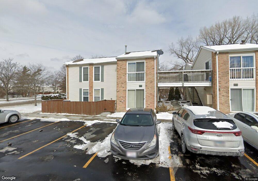
1982 Kenilworth Cir Unit 1982H Hoffman Estates, IL 60169
South Hoffman Estates NeighborhoodEstimated Value: $181,000 - $222,000
2
Beds
1
Bath
980
Sq Ft
$209/Sq Ft
Est. Value
About This Home
This home is located at 1982 Kenilworth Cir Unit 1982H, Hoffman Estates, IL 60169 and is currently estimated at $205,095, approximately $209 per square foot. 1982 Kenilworth Cir Unit 1982H is a home located in Cook County with nearby schools including John Muir Literacy Academy, Dwight D Eisenhower Junior High School, and Hoffman Estates High School.
Ownership History
Date
Name
Owned For
Owner Type
Purchase Details
Closed on
Apr 5, 2004
Sold by
Dsouza Joel and Dsouza Miriam S
Bought by
Olson John M and Olson Nicole M
Current Estimated Value
Home Financials for this Owner
Home Financials are based on the most recent Mortgage that was taken out on this home.
Original Mortgage
$98,900
Outstanding Balance
$45,956
Interest Rate
5.48%
Mortgage Type
Unknown
Estimated Equity
$159,139
Purchase Details
Closed on
Nov 1, 1995
Sold by
First Bank National Assn
Bought by
Maranto Miriam S
Home Financials for this Owner
Home Financials are based on the most recent Mortgage that was taken out on this home.
Original Mortgage
$58,150
Interest Rate
7.65%
Mortgage Type
FHA
Create a Home Valuation Report for This Property
The Home Valuation Report is an in-depth analysis detailing your home's value as well as a comparison with similar homes in the area
Home Values in the Area
Average Home Value in this Area
Purchase History
| Date | Buyer | Sale Price | Title Company |
|---|---|---|---|
| Olson John M | $110,000 | Pntn | |
| Maranto Miriam S | $66,500 | -- |
Source: Public Records
Mortgage History
| Date | Status | Borrower | Loan Amount |
|---|---|---|---|
| Open | Olson John M | $98,900 | |
| Previous Owner | Maranto Miriam S | $58,150 |
Source: Public Records
Tax History Compared to Growth
Tax History
| Year | Tax Paid | Tax Assessment Tax Assessment Total Assessment is a certain percentage of the fair market value that is determined by local assessors to be the total taxable value of land and additions on the property. | Land | Improvement |
|---|---|---|---|---|
| 2024 | $4,019 | $13,099 | $1,864 | $11,235 |
| 2023 | $3,890 | $13,099 | $1,864 | $11,235 |
| 2022 | $3,890 | $13,099 | $1,864 | $11,235 |
| 2021 | $3,389 | $10,116 | $2,935 | $7,181 |
| 2020 | $3,310 | $10,116 | $2,935 | $7,181 |
| 2019 | $3,307 | $11,297 | $2,935 | $8,362 |
| 2018 | $2,066 | $6,335 | $2,562 | $3,773 |
| 2017 | $2,029 | $6,335 | $2,562 | $3,773 |
| 2016 | $1,887 | $6,335 | $2,562 | $3,773 |
| 2015 | $1,665 | $5,184 | $2,236 | $2,948 |
| 2014 | $1,636 | $5,184 | $2,236 | $2,948 |
| 2013 | $1,594 | $5,184 | $2,236 | $2,948 |
Source: Public Records
Map
Nearby Homes
- 1977 Kenilworth Cir Unit D
- 1975 Kenilworth Cir Unit B
- 1738 Ardwick Dr
- 2004 E Parkview Cir
- 2079 E Parkview Cir
- 1886 Stockton Dr Unit 3253
- 1925 Georgetown Ln Unit 4
- 1800 Huntington Blvd Unit AE615
- 1840 Huntington Blvd Unit 412
- 1840 Huntington Blvd Unit 415
- 1704 Fayette Walk Unit B
- 1456 Della Dr
- 1445 Nottingham Ln
- 1800 Fayette Walk Unit E
- 1808 Fayette Walk Unit H
- 1420 Hassell Rd
- 1795 Marquette Ln Unit 5601
- 1763 Bristol Walk Unit 1763
- 1360 Mayfield Ln
- 1612 Islandview Ct
- 1982 Kenilworth Cir Unit 1982D
- 1982 Kenilworth Cir Unit 1982C
- 1982 Kenilworth Cir Unit 1982G
- 1982 Kenilworth Cir Unit D
- 1982 Kenilworth Cir Unit H
- 1980 Kenilworth Cir Unit A
- 1980 Kenilworth Cir Unit 1980E
- 1980 Kenilworth Cir Unit 1980B
- 1980 Kenilworth Cir Unit 1980F
- 1980 Kenilworth Cir Unit 1980A
- 1980 Kenilworth Cir Unit B
- 1980 Kenilworth Cir Unit E
- 1980 Kenilworth Cir Unit F
- 1978 Kenilworth Cir Unit G
- 1978 Kenilworth Cir Unit 1978D
- 1978 Kenilworth Cir Unit 1978C
- 1978 Kenilworth Cir Unit 1978G
- 1978 Kenilworth Cir Unit 1978H
- 1978 Kenilworth Cir Unit C
- 1978 Kenilworth Cir