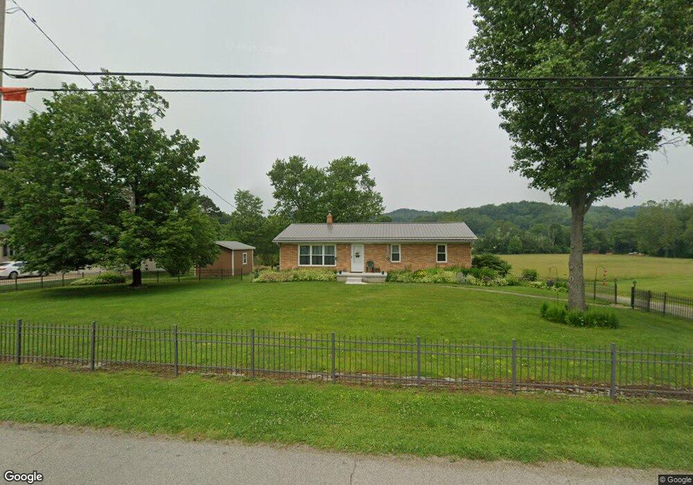
1982 Possum Hollow Rd SE New Philadelphia, OH 44663
Estimated Value: $178,000 - $264,000
3
Beds
2
Baths
1,260
Sq Ft
$182/Sq Ft
Est. Value
About This Home
This home is located at 1982 Possum Hollow Rd SE, New Philadelphia, OH 44663 and is currently estimated at $228,936, approximately $181 per square foot. 1982 Possum Hollow Rd SE is a home located in Tuscarawas County with nearby schools including New Philadelphia High School, Quaker Digital Academy, and Quaker Preparatory Academy.
Ownership History
Date
Name
Owned For
Owner Type
Purchase Details
Closed on
Jul 29, 1998
Sold by
Sparks Carl W
Bought by
Mcdonald Lawrence C and Mcdonald Valli J
Current Estimated Value
Home Financials for this Owner
Home Financials are based on the most recent Mortgage that was taken out on this home.
Original Mortgage
$86,000
Outstanding Balance
$18,113
Interest Rate
7.03%
Mortgage Type
New Conventional
Estimated Equity
$210,823
Purchase Details
Closed on
Apr 29, 1991
Sold by
Michael William E and Michael Vicki L
Bought by
Sparks Carl W and Sparks Darlene E
Purchase Details
Closed on
Oct 26, 1990
Sold by
Michael William E
Bought by
Mcdonald Lawrence C and Mcdonald Valli J
Purchase Details
Closed on
Aug 30, 1990
Bought by
Mcdonald Lawrence C and Mcdonald Valli J
Create a Home Valuation Report for This Property
The Home Valuation Report is an in-depth analysis detailing your home's value as well as a comparison with similar homes in the area
Home Values in the Area
Average Home Value in this Area
Purchase History
| Date | Buyer | Sale Price | Title Company |
|---|---|---|---|
| Mcdonald Lawrence C | $108,000 | -- | |
| Sparks Carl W | $66,500 | -- | |
| Mcdonald Lawrence C | -- | -- | |
| Mcdonald Lawrence C | $62,900 | -- |
Source: Public Records
Mortgage History
| Date | Status | Borrower | Loan Amount |
|---|---|---|---|
| Open | Mcdonald Lawrence C | $86,000 |
Source: Public Records
Tax History Compared to Growth
Tax History
| Year | Tax Paid | Tax Assessment Tax Assessment Total Assessment is a certain percentage of the fair market value that is determined by local assessors to be the total taxable value of land and additions on the property. | Land | Improvement |
|---|---|---|---|---|
| 2024 | $2,260 | $57,550 | $6,060 | $51,490 |
| 2023 | $2,260 | $164,420 | $17,300 | $147,120 |
| 2022 | $2,275 | $57,547 | $6,055 | $51,492 |
| 2021 | $2,054 | $49,249 | $5,411 | $43,838 |
| 2020 | $2,065 | $49,249 | $5,411 | $43,838 |
| 2019 | $2,063 | $49,249 | $5,411 | $43,838 |
| 2018 | $1,847 | $41,570 | $4,570 | $37,000 |
| 2017 | $1,818 | $41,570 | $4,570 | $37,000 |
| 2016 | $1,828 | $41,570 | $4,570 | $37,000 |
| 2014 | $1,697 | $36,140 | $3,580 | $32,560 |
| 2013 | $1,410 | $36,140 | $3,580 | $32,560 |
Source: Public Records
Map
Nearby Homes
- 1824 Oldtown Valley Rd SE
- 231 York Dr SE
- 161 York Dr SE
- 1354 Independence Cir SE
- 1166 S Broadway St
- 1149 Jefferson St SE
- 427 Sycamore Cir SE
- 611 Wainwright Rd SE
- 475 Lockport Ave SW
- 1024 Thomas Dr SW
- 0000 Wainwright Rd
- 3469 Oldtown Valley Rd SW
- 451 Mill Ave SE
- 221 Sea Gull Dr SE
- 231 4th St SE
- 247 Kent Cir NE
- 241 Saint Clair Ave SW
- 514 Front Ave SW
- 377 Schoenbrunn Dr NE
- 405 Front Ave SW
- 1996 Possum Hollow Rd SE
- 1956 Possum Hollow Rd SE
- 2012 Possum Hollow Rd SE
- 1961 Possum Hollow Rd SE
- 1977 Possum Hollow Rd SE
- 2020 Possum Hollow Rd SE
- 1936 Possum Hollow Rd SE
- 2036 Possum Hollow Rd SE
- 2050 Possum Hollow Rd SE
- 2067 Possum Hollow Rd SE
- 1904 Possum Hollow Rd SE
- 1887 Possum Hollow Rd SE
- 1858 Possum Hollow Rd SE
- 1814 Possum Hollow Rd SE
- 1729 Oldtown Valley Rd SE
- 2139 Possum Hollow Rd SE
- 1899 Possum Hollow Rd SE
- 2177 Possum Hollow Rd SE
- 1953 Oldtown Valley Rd SE
- 1790 Possum Hollow Rd SE
