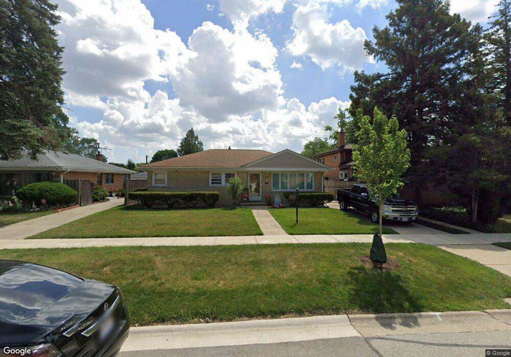
1983 Birch St Des Plaines, IL 60018
Estimated Value: $356,641 - $410,000
3
Beds
1
Bath
1,107
Sq Ft
$347/Sq Ft
Est. Value
About This Home
This home is located at 1983 Birch St, Des Plaines, IL 60018 and is currently estimated at $384,660, approximately $347 per square foot. 1983 Birch St is a home located in Cook County with nearby schools including South Elementary School, Algonquin Middle School, and Maine West High School.
Ownership History
Date
Name
Owned For
Owner Type
Purchase Details
Closed on
May 13, 1997
Sold by
Rozenkowski George and Rozenkowski Susan
Bought by
Sandoval Mario and Sandoval Patricia E
Current Estimated Value
Home Financials for this Owner
Home Financials are based on the most recent Mortgage that was taken out on this home.
Original Mortgage
$160,000
Outstanding Balance
$22,370
Interest Rate
8.24%
Estimated Equity
$362,290
Create a Home Valuation Report for This Property
The Home Valuation Report is an in-depth analysis detailing your home's value as well as a comparison with similar homes in the area
Home Values in the Area
Average Home Value in this Area
Purchase History
| Date | Buyer | Sale Price | Title Company |
|---|---|---|---|
| Sandoval Mario | $176,000 | -- |
Source: Public Records
Mortgage History
| Date | Status | Borrower | Loan Amount |
|---|---|---|---|
| Open | Sandoval Mario | $160,000 |
Source: Public Records
Tax History Compared to Growth
Tax History
| Year | Tax Paid | Tax Assessment Tax Assessment Total Assessment is a certain percentage of the fair market value that is determined by local assessors to be the total taxable value of land and additions on the property. | Land | Improvement |
|---|---|---|---|---|
| 2025 | $5,901 | $33,000 | $6,435 | $26,565 |
| 2024 | $5,901 | $25,699 | $5,363 | $20,336 |
| 2023 | $5,732 | $25,699 | $5,363 | $20,336 |
| 2022 | $5,732 | $25,699 | $5,363 | $20,336 |
| 2021 | $4,894 | $19,253 | $4,468 | $14,785 |
| 2020 | $4,881 | $19,253 | $4,468 | $14,785 |
| 2019 | $4,899 | $21,633 | $4,468 | $17,165 |
| 2018 | $5,164 | $20,703 | $3,932 | $16,771 |
| 2017 | $5,091 | $20,703 | $3,932 | $16,771 |
| 2016 | $5,059 | $20,703 | $3,932 | $16,771 |
| 2015 | $4,330 | $16,946 | $3,396 | $13,550 |
| 2014 | $4,255 | $16,946 | $3,396 | $13,550 |
| 2013 | $4,131 | $16,946 | $3,396 | $13,550 |
Source: Public Records
Map
Nearby Homes
- 1980 Howard Ave
- 1721 Prospect Ave
- 1845 Everett Ave
- 2091 Sherwin Ave
- 1640 S River Rd
- 1939 E Touhy Ave
- 1864 Illinois St
- 1641 E Touhy Ave
- 38 E Touhy Ave
- 1629 E Touhy Ave
- 2500 Maple St
- 1445 Everett Ave
- 1754 E Lincoln Ave
- 1689 S Elm St
- 1696 S Elm St
- 1686 Greenleaf Ave
- 1625 Estes Ave
- 2600 S Scott St
- 2609 Eisenhower Dr
- 2646 Maple St
- 1975 Birch St
- 1991 Birch St
- 1920 Howard Ave
- 1967 Birch St
- 1930 Howard Ave
- 1921 Stockton Ave
- 1959 Birch St
- 1982 Birch St
- 1931 Stockton Ave
- 1974 Birch St
- 1990 Birch St
- 1940 Howard Ave
- 1966 Birch St
- 1915 Howard Ave
- 2005 Birch St
- 1925 Howard Ave
- 1941 Stockton Ave
- 1935 Howard Ave
- 1958 Birch St
- 1950 Howard Ave