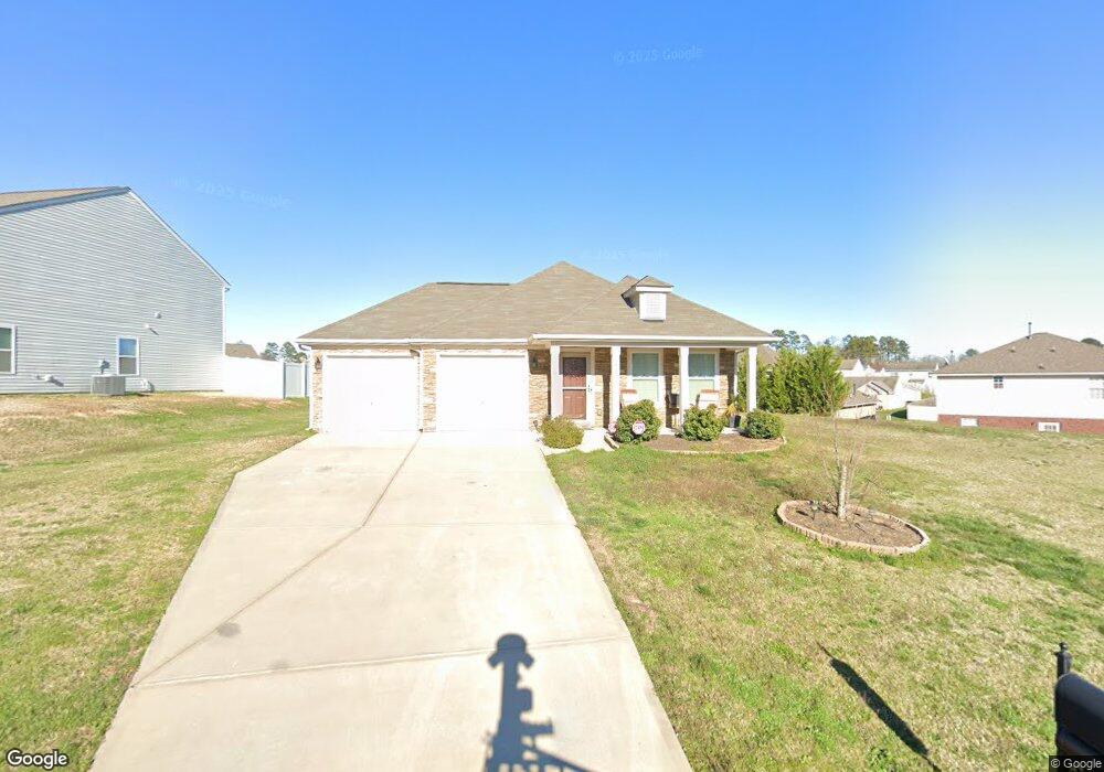
1983 Mallard Pointe Dr Kannapolis, NC 28083
Estimated Value: $293,000 - $345,000
3
Beds
2
Baths
1,291
Sq Ft
$248/Sq Ft
Est. Value
About This Home
This home is located at 1983 Mallard Pointe Dr, Kannapolis, NC 28083 and is currently estimated at $319,593, approximately $247 per square foot. 1983 Mallard Pointe Dr is a home located in Cabarrus County with nearby schools including Forest Park Elementary School, Kannapolis Middle, and A.L. Brown High School.
Ownership History
Date
Name
Owned For
Owner Type
Purchase Details
Closed on
Jun 28, 2013
Sold by
True Homes Llc
Bought by
Williams Sonja R
Current Estimated Value
Home Financials for this Owner
Home Financials are based on the most recent Mortgage that was taken out on this home.
Original Mortgage
$101,750
Outstanding Balance
$73,453
Interest Rate
3.75%
Mortgage Type
FHA
Estimated Equity
$246,140
Purchase Details
Closed on
Apr 17, 2013
Sold by
Bost Properties Inc
Bought by
True Homes Llc
Home Financials for this Owner
Home Financials are based on the most recent Mortgage that was taken out on this home.
Original Mortgage
$85,800
Interest Rate
3.55%
Mortgage Type
Construction
Create a Home Valuation Report for This Property
The Home Valuation Report is an in-depth analysis detailing your home's value as well as a comparison with similar homes in the area
Home Values in the Area
Average Home Value in this Area
Purchase History
| Date | Buyer | Sale Price | Title Company |
|---|---|---|---|
| Williams Sonja R | $115,000 | None Available | |
| True Homes Llc | $22,000 | Independence Title Group |
Source: Public Records
Mortgage History
| Date | Status | Borrower | Loan Amount |
|---|---|---|---|
| Open | Williams Sonja R | $101,750 | |
| Previous Owner | True Homes Llc | $85,800 |
Source: Public Records
Tax History Compared to Growth
Tax History
| Year | Tax Paid | Tax Assessment Tax Assessment Total Assessment is a certain percentage of the fair market value that is determined by local assessors to be the total taxable value of land and additions on the property. | Land | Improvement |
|---|---|---|---|---|
| 2025 | $3,810 | $335,550 | $69,000 | $266,550 |
| 2024 | $3,810 | $335,550 | $69,000 | $266,550 |
| 2023 | $2,436 | $177,780 | $41,000 | $136,780 |
| 2022 | $2,436 | $177,780 | $41,000 | $136,780 |
| 2021 | $2,436 | $177,780 | $41,000 | $136,780 |
| 2020 | $2,436 | $177,780 | $41,000 | $136,780 |
| 2019 | $1,625 | $118,620 | $17,000 | $101,620 |
| 2018 | $1,601 | $118,620 | $17,000 | $101,620 |
| 2017 | $1,578 | $118,620 | $17,000 | $101,620 |
| 2016 | $1,578 | $123,700 | $25,000 | $98,700 |
| 2015 | $315 | $123,700 | $25,000 | $98,700 |
| 2014 | $315 | $123,700 | $25,000 | $98,700 |
Source: Public Records
Map
Nearby Homes
- 00 Dixie Dr
- 252 Forest Pond Rd
- 2495 Centergrove Rd
- 108 S Little Texas Rd
- 1422 Midlake Rd
- 4750 J W Cline Rd
- 1517 Jamaica Rd
- 141 Beaumont Ave
- 1351 Ontario Dr
- 137 Beaumont Ave
- 2412 Brantley Rd
- 2211 Medlin Ct
- 2040 Brantley Creek Dr
- 2208 Brantley Rd
- 2122 Brantley Rd
- 2100 Brantley Rd
- 839 Anchor Way NE
- 132 Kennedy Ave
- 1422 Mitchell Glen St
- 915 Harbour View Cove NE
- 1983 Mallard Pointe Dr Unit 173
- 1977 Mallard Pointe Dr
- 222 Gumtree Dr
- 228 Gumtree Dr
- 218 Gumtree Dr
- 1986 Mallard Pointe Dr
- 1978 Mallard Pointe Dr
- 1990 Mallard Pointe Dr
- 1973 Mallard Pointe Dr Unit 65
- 1973 Mallard Pointe Dr
- 1974 Mallard Pointe Dr
- 214 Gumtree Dr
- 1982 Mallard Pointe Dr
- 1969 Mallard Pointe Dr
- 1970 Mallard Pointe Dr
- 210 Gumtree Dr
- 2009 Mallard Pointe Dr
- 223 Gumtree Dr
- 219 Gumtree Dr
- 1963 Mallard Pointe Dr