Estimated Value: $409,000 - $518,000
3
Beds
3
Baths
1,468
Sq Ft
$298/Sq Ft
Est. Value
About This Home
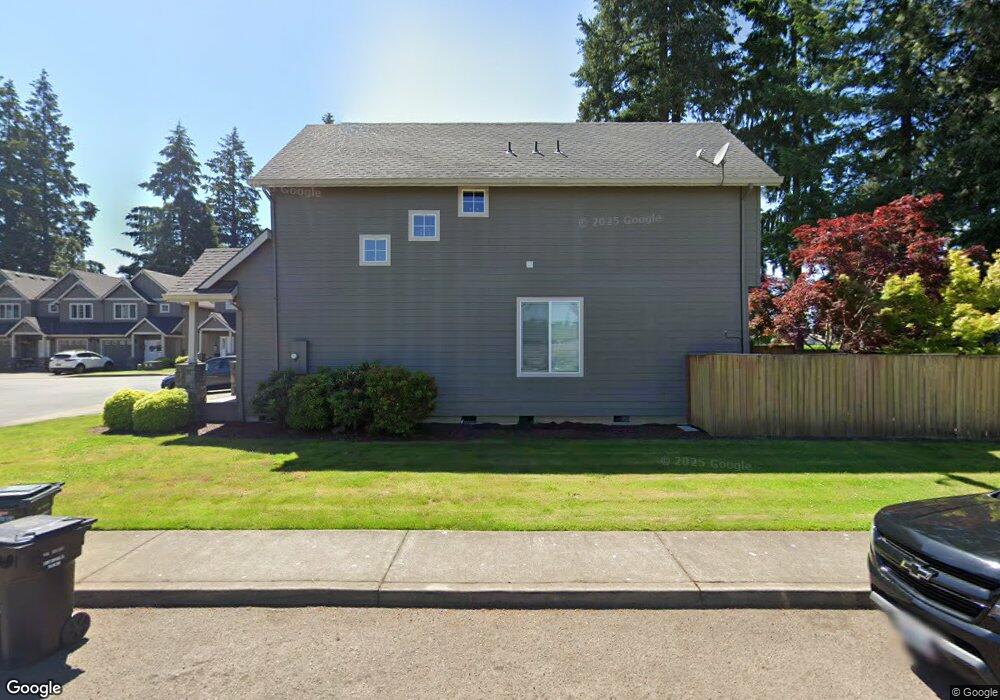
This home is located at 1983 N Pine St, Canby, OR 97013 and is currently estimated at $438,186, approximately $298 per square foot. 1983 N Pine St is a home located in Clackamas County with nearby schools including William Knight Elementary School, Baker Prairie Middle School, and Canby High School.
Ownership History
Date
Name
Owned For
Owner Type
Purchase Details
Closed on
Aug 18, 2014
Sold by
Kergil Norma F
Bought by
Smucker Karoline
Current Estimated Value
Home Financials for this Owner
Home Financials are based on the most recent Mortgage that was taken out on this home.
Original Mortgage
$190,800
Outstanding Balance
$145,060
Interest Rate
4.11%
Mortgage Type
New Conventional
Estimated Equity
$293,126
Purchase Details
Closed on
Jun 28, 2007
Sold by
L E S Inc
Bought by
Kergil Norma F
Home Financials for this Owner
Home Financials are based on the most recent Mortgage that was taken out on this home.
Original Mortgage
$121,500
Interest Rate
6.21%
Mortgage Type
Purchase Money Mortgage
Create a Home Valuation Report for This Property
The Home Valuation Report is an in-depth analysis detailing your home's value as well as a comparison with similar homes in the area
Home Values in the Area
Average Home Value in this Area
Purchase History
| Date | Buyer | Sale Price | Title Company |
|---|---|---|---|
| Smucker Karoline | $216,000 | Wfg Title | |
| Kergil Norma F | $251,500 | First American Title Insuran | |
| L E S Inc | $40,000 | First American Title Insuran |
Source: Public Records
Mortgage History
| Date | Status | Borrower | Loan Amount |
|---|---|---|---|
| Open | Smucker Karoline | $190,800 | |
| Previous Owner | Kergil Norma F | $121,500 |
Source: Public Records
Tax History
| Year | Tax Paid | Tax Assessment Tax Assessment Total Assessment is a certain percentage of the fair market value that is determined by local assessors to be the total taxable value of land and additions on the property. | Land | Improvement |
|---|---|---|---|---|
| 2025 | $4,053 | $228,796 | -- | -- |
| 2024 | $3,940 | $222,133 | -- | -- |
| 2023 | $3,940 | $215,664 | $0 | $0 |
| 2022 | $3,624 | $209,383 | $0 | $0 |
| 2021 | $3,490 | $203,285 | $0 | $0 |
| 2020 | $3,427 | $197,365 | $0 | $0 |
| 2019 | $3,264 | $191,617 | $0 | $0 |
| 2018 | $3,191 | $186,036 | $0 | $0 |
| 2017 | $3,110 | $180,617 | $0 | $0 |
| 2016 | $3,006 | $175,356 | $0 | $0 |
Source: Public Records
Map
Nearby Homes
- 1762 N Oak St
- 1753 N Oak St
- 1009 NE 17th Ave
- 844 NE 17th Ave
- 853 NE 17th Ave
- 2040 N Country Club Dr
- 1422 NE 18th Place
- 660 NE 20th Ave
- 2152 N Laurelwood St
- 229 NE 17th Ave
- 1316 N Locust St
- 1947 NE 21st Ave
- 1558 NE 10th Place
- 116 NE 19th Ave
- 2125 NE Spitz Rd
- 2123 NE Spitz Rd
- 1020 N Juniper St
- 2147 NE Spitz Rd
- 364 NE 9th Ave
- 318 NE 9th Ave
- 1975 N Pine St
- 1963 N Pine St
- 1957 N Pine St
- 1951 N Pine St
- 1919 N Pine St
- 1911 N Pine St
- 1945 N Pine St
- 1937 N Pine St
- 1101 NE 19th Ct
- 1102 NE 19th Ct
- 1921 N Pine St
- 1045 NE Territorial Rd
- 1825 N Pine St
- 1110 NE 19th Ct
- 1110 NE 19th Ct 1114 Ne 19th Ct
- 1109 NE 19th Ct
- 1027 NE Territorial Rd
- 1117 NE 19th Ct
- 1000 NE Territ0rial Rd
- 1159 NE Territorial Rd
Your Personal Tour Guide
Ask me questions while you tour the home.