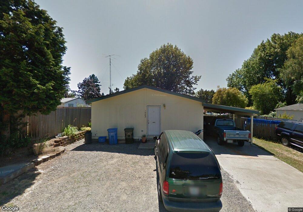
1983 SE Pappas Loss Ct Milwaukie, OR 97267
Estimated Value: $404,000 - $575,000
--
Bed
--
Bath
--
Sq Ft
9,148
Sq Ft Lot
About This Home
This home is located at 1983 SE Pappas Loss Ct, Milwaukie, OR 97267 and is currently estimated at $464,762. 1983 SE Pappas Loss Ct is a home located in Clackamas County with nearby schools including Oak Grove Elementary School, Alder Creek Middle School, and Rex Putnam High School.
Ownership History
Date
Name
Owned For
Owner Type
Purchase Details
Closed on
Jul 25, 2003
Sold by
Miller Kenneth A
Bought by
Miller Kenneth A and Miller Kelli
Current Estimated Value
Home Financials for this Owner
Home Financials are based on the most recent Mortgage that was taken out on this home.
Original Mortgage
$151,802
Outstanding Balance
$63,352
Interest Rate
5.13%
Mortgage Type
FHA
Estimated Equity
$401,410
Purchase Details
Closed on
Feb 7, 2002
Sold by
Pappas Alexander
Bought by
Miller Kenneth A
Home Financials for this Owner
Home Financials are based on the most recent Mortgage that was taken out on this home.
Original Mortgage
$150,727
Interest Rate
7.15%
Mortgage Type
FHA
Purchase Details
Closed on
Jan 12, 1999
Sold by
Bury Glenn and Bury Marva
Bought by
Bury David E
Create a Home Valuation Report for This Property
The Home Valuation Report is an in-depth analysis detailing your home's value as well as a comparison with similar homes in the area
Home Values in the Area
Average Home Value in this Area
Purchase History
| Date | Buyer | Sale Price | Title Company |
|---|---|---|---|
| Miller Kenneth A | -- | First American | |
| Miller Kenneth A | $52,500 | First American Title Ins Co | |
| Bury David E | -- | -- |
Source: Public Records
Mortgage History
| Date | Status | Borrower | Loan Amount |
|---|---|---|---|
| Open | Miller Kenneth A | $151,802 | |
| Closed | Miller Kenneth A | $150,727 |
Source: Public Records
Tax History Compared to Growth
Tax History
| Year | Tax Paid | Tax Assessment Tax Assessment Total Assessment is a certain percentage of the fair market value that is determined by local assessors to be the total taxable value of land and additions on the property. | Land | Improvement |
|---|---|---|---|---|
| 2025 | $3,454 | $180,703 | -- | -- |
| 2024 | $3,332 | $175,440 | -- | -- |
| 2023 | $3,332 | $170,331 | $0 | $0 |
| 2022 | $3,066 | $165,370 | $0 | $0 |
| 2021 | $2,955 | $160,554 | $0 | $0 |
| 2020 | $2,863 | $155,878 | $0 | $0 |
| 2019 | $2,822 | $151,338 | $0 | $0 |
| 2018 | $2,473 | $146,930 | $0 | $0 |
| 2017 | $2,395 | $142,650 | $0 | $0 |
| 2016 | $3,105 | $138,495 | $0 | $0 |
| 2015 | $2,246 | $134,461 | $0 | $0 |
| 2014 | $2,709 | $130,545 | $0 | $0 |
Source: Public Records
Map
Nearby Homes
- 15316 SE Lee Ave
- 15427 SE River Rd
- 0 SE Cedar Ave
- 14368 SE Lee Ave
- 15323 SE Fairoaks Ave
- 14222 SE Laurie Ave
- 15565 SE Wildwoods Ct
- 1875 SE River Glen Ct
- 2850 SE Oak Grove Blvd
- 14007 SE Cedar Ave
- 14411 SE Wagner Ln
- 15315 SE East Ave
- 985 SE Rim Rock Ln
- 15498 SE River Forest Dr
- 3200 SE Silver Leaf Ln Unit 33
- 14824 SE Kellogg Ave
- 13770 SE Linden Ln
- 135 Furnace St Unit 22
- 200 Burnham Rd Unit 200
- 5051 Foothills Dr Unit E
- 1973 SE Pappas Loss Ct
- 15105 SE Lee Ave
- 15105 SE Lee Ave
- 15107 SE Lee Ave
- 15037 SE Lee Ave
- 15111 SE Lee Ave
- 1963 SE Pappas Loss Ct
- 15020 SE Cedar Ave
- 15021 SE Lee Ave
- 15000 SE Cedar Ave
- 15050 SE Lee Ave
- 1883 SE Rosebrier Ct
- 15115 SE Lee Ave
- 15028 SE Lee Ave
- 14921 SE Lee Ave
- 14950 SE Cedar Ave
- 15112 SE Lee Ave
- 14927 SE Cedar Ave
- 1943 SE Sunny Slope Rd
- 1820 SE Rosebrier Ct