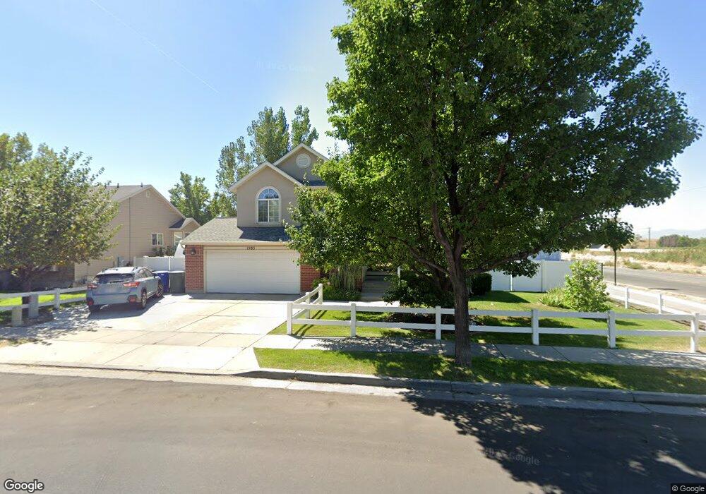
1983 W Red Angus Dr Salt Lake City, UT 84116
Westpointe NeighborhoodEstimated Value: $512,000 - $559,000
5
Beds
3
Baths
2,214
Sq Ft
$242/Sq Ft
Est. Value
About This Home
This home is located at 1983 W Red Angus Dr, Salt Lake City, UT 84116 and is currently estimated at $535,086, approximately $241 per square foot. 1983 W Red Angus Dr is a home located in Salt Lake County with nearby schools including North Star Elementary School, Northwest Middle School, and West High.
Ownership History
Date
Name
Owned For
Owner Type
Purchase Details
Closed on
Jun 22, 2006
Sold by
Germosen Jennifer R
Bought by
Robison Jay Thad and Robison Jennifer R
Current Estimated Value
Home Financials for this Owner
Home Financials are based on the most recent Mortgage that was taken out on this home.
Original Mortgage
$243,117
Outstanding Balance
$142,773
Interest Rate
6.55%
Mortgage Type
VA
Estimated Equity
$392,313
Purchase Details
Closed on
Oct 27, 2003
Sold by
Sundborn Llc
Bought by
Germosen Jennifer R
Home Financials for this Owner
Home Financials are based on the most recent Mortgage that was taken out on this home.
Original Mortgage
$90,000
Interest Rate
4.75%
Mortgage Type
Purchase Money Mortgage
Create a Home Valuation Report for This Property
The Home Valuation Report is an in-depth analysis detailing your home's value as well as a comparison with similar homes in the area
Home Values in the Area
Average Home Value in this Area
Purchase History
| Date | Buyer | Sale Price | Title Company |
|---|---|---|---|
| Robison Jay Thad | -- | Surety Title | |
| Germosen Jennifer R | -- | Cottonwood Title Ins Agency |
Source: Public Records
Mortgage History
| Date | Status | Borrower | Loan Amount |
|---|---|---|---|
| Open | Robison Jay Thad | $243,117 | |
| Previous Owner | Germosen Jennifer R | $90,000 |
Source: Public Records
Tax History Compared to Growth
Tax History
| Year | Tax Paid | Tax Assessment Tax Assessment Total Assessment is a certain percentage of the fair market value that is determined by local assessors to be the total taxable value of land and additions on the property. | Land | Improvement |
|---|---|---|---|---|
| 2025 | $2,613 | $563,900 | $106,800 | $457,100 |
| 2024 | $2,613 | $498,500 | $101,100 | $397,400 |
| 2023 | $2,547 | $468,400 | $97,200 | $371,200 |
| 2022 | $2,661 | $459,200 | $95,300 | $363,900 |
| 2021 | $2,076 | $324,300 | $74,800 | $249,500 |
| 2020 | $1,982 | $294,700 | $66,700 | $228,000 |
| 2019 | $2,023 | $283,000 | $62,200 | $220,800 |
| 2018 | $1,781 | $245,200 | $62,200 | $183,000 |
| 2017 | $1,820 | $235,000 | $62,200 | $172,800 |
| 2016 | $1,881 | $230,600 | $52,300 | $178,300 |
| 2015 | $1,766 | $204,400 | $51,300 | $153,100 |
| 2014 | $1,684 | $193,500 | $50,200 | $143,300 |
Source: Public Records
Map
Nearby Homes
- 238 N 2200 W
- 1888 W New York Dr
- 1770 W Trafalga Way Unit B
- 1793 W Trafalga Way Unit F
- 1178 N Reveille Cir
- 1281 Carousel St
- 1301 N 1500 W
- 1989 Sir Timothy Ave
- 1366 Dupont Ave
- 1379 Dupont Ave
- 1004 N Sir Michael Dr
- 1320 W Sunset Dr
- 1183 Catherine St W
- 1827 Omni Ave
- 949 Libby Way
- 2075 W 2670 N
- 1305 N Valentine St
- 1245 W Siena Cir
- 825 Star Crest Dr W
- 1260 W 1100 N
- 1975 W Red Angus Dr
- 1974 Gander Ln
- 1974 W Gander Ln
- 1980 Gander Ln
- 1980 W Gander Ln
- 1967 W Red Angus Dr
- 1984 W Red Angus Dr
- 1978 W Red Angus Dr
- 1968 Gander Ln
- 1981 Gander Ln
- 1970 W Red Angus Dr
- 1961 W Red Angus Dr
- 1960 Gander Ln
- 1960 W Gander Ln
- 1962 W Red Angus Dr
- 1971 W Black Angus Dr
- 1971 Black Angus Dr
- 1965 Black Angus Dr
- 1951 W Red Angus Dr
- 1952 Gander Ln