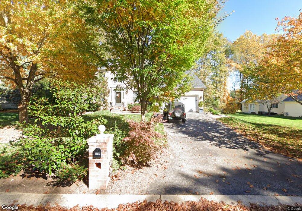
1984 Barley Rd Marriottsville, MD 21104
Estimated Value: $689,299 - $774,000
--
Bed
3
Baths
2,597
Sq Ft
$283/Sq Ft
Est. Value
About This Home
This home is located at 1984 Barley Rd, Marriottsville, MD 21104 and is currently estimated at $735,575, approximately $283 per square foot. 1984 Barley Rd is a home located in Carroll County with nearby schools including Carrolltowne Elementary School, Oklahoma Road Middle School, and Liberty High School.
Ownership History
Date
Name
Owned For
Owner Type
Purchase Details
Closed on
Jun 27, 2001
Sold by
Harper James R
Bought by
O'Toole Peter and O'Toole Kathleen
Current Estimated Value
Purchase Details
Closed on
Sep 28, 1994
Sold by
Patton Homes Inc
Bought by
Harper James R
Home Financials for this Owner
Home Financials are based on the most recent Mortgage that was taken out on this home.
Original Mortgage
$178,000
Interest Rate
8.5%
Create a Home Valuation Report for This Property
The Home Valuation Report is an in-depth analysis detailing your home's value as well as a comparison with similar homes in the area
Home Values in the Area
Average Home Value in this Area
Purchase History
| Date | Buyer | Sale Price | Title Company |
|---|---|---|---|
| O'Toole Peter | $316,000 | -- | |
| Harper James R | $238,000 | -- |
Source: Public Records
Mortgage History
| Date | Status | Borrower | Loan Amount |
|---|---|---|---|
| Previous Owner | Harper James R | $178,000 |
Source: Public Records
Tax History Compared to Growth
Tax History
| Year | Tax Paid | Tax Assessment Tax Assessment Total Assessment is a certain percentage of the fair market value that is determined by local assessors to be the total taxable value of land and additions on the property. | Land | Improvement |
|---|---|---|---|---|
| 2025 | $5,897 | $545,000 | $0 | $0 |
| 2024 | $5,897 | $506,700 | $180,000 | $326,700 |
| 2023 | $5,546 | $490,800 | $0 | $0 |
| 2022 | $5,541 | $474,900 | $0 | $0 |
| 2021 | $11,179 | $459,000 | $160,000 | $299,000 |
| 2020 | $5,307 | $451,800 | $0 | $0 |
| 2019 | $5,225 | $444,600 | $0 | $0 |
| 2018 | $5,099 | $437,400 | $160,000 | $277,400 |
| 2017 | $4,915 | $420,900 | $0 | $0 |
| 2016 | -- | $404,400 | $0 | $0 |
| 2015 | -- | $387,900 | $0 | $0 |
| 2014 | -- | $379,233 | $0 | $0 |
Source: Public Records
Map
Nearby Homes
- 7025 Macbeth Way
- 6819 Ridge Rd
- 7010 Macbeth Way
- 7090 Saddle Dr
- 1714 Botanical Ct Unit 23
- 1712 Botanical Ct Unit 22
- 7140 Brangles Rd
- 6670 Slacks Rd
- Lot 1 Carroll Highlands Rd
- 6741 Quad Ln
- 6565 Macbeth Way
- 1809 Fallstaff Ct
- 2010 Rudy Serra Dr Unit C
- 2023 Rudy Serra Dr Unit 2D
- 2016 Rudy Serra Dr Unit A
- 2016 Rudy Serra Dr Unit C
- 1909 Lennox Dr Unit 90
- 6515 Dundee Dr Unit 240
- 1696 Gemini Dr
- 1822 Cassandra Dr Unit 117
- 1982 Barley Rd
- 1986 Barley Rd
- 1987 Alfalfa Ct
- 1980 Barley Rd
- 1988 Barley Rd
- 1983 Barley Rd
- 1985 Alfalfa Ct
- 1981 Barley Rd
- 1985 Barley Rd
- 1989 Alfalfa Ct
- 1978 Barley Rd
- 1990 Barley Rd
- 1987 Barley Rd
- 1903 Canter Ln
- 1905 Canter Ln
- 6965 Cable Dr
- 1907 Canter Ln
- 6958 Cable Dr
- 1986 Alfalfa Ct
- 1989 Barley Rd