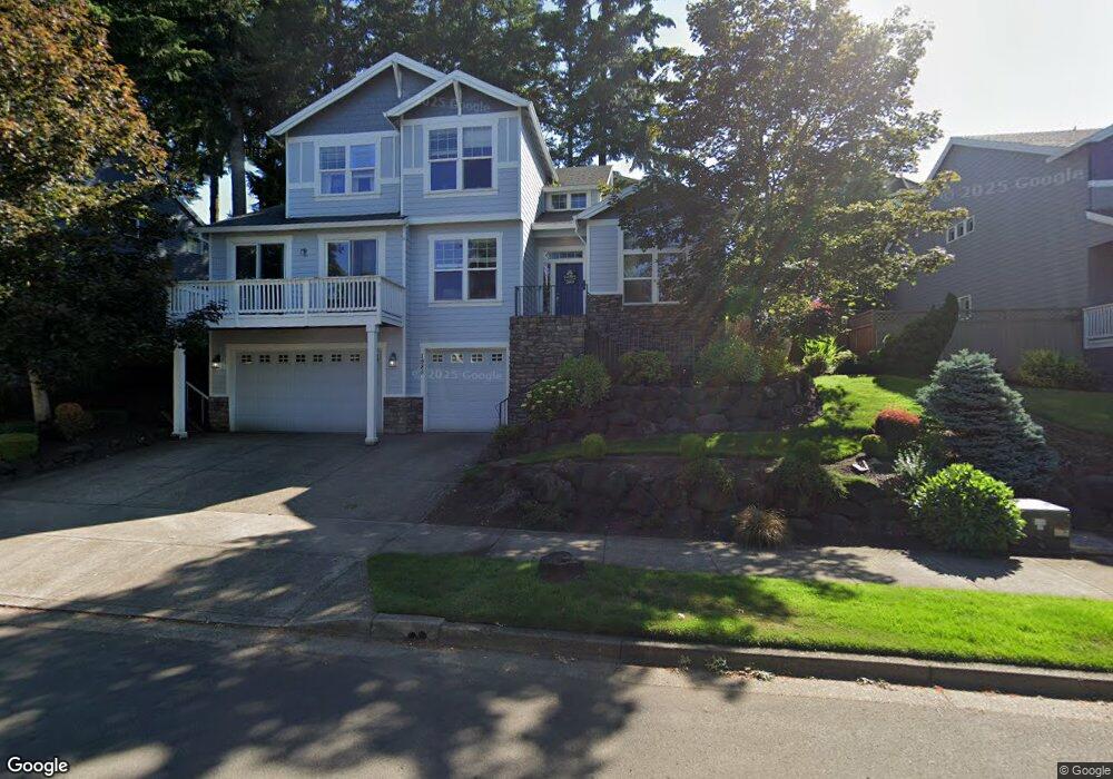
1985 Alpine Dr West Linn, OR 97068
Willamette NeighborhoodEstimated Value: $895,213 - $1,239,000
4
Beds
3
Baths
3,450
Sq Ft
$298/Sq Ft
Est. Value
About This Home
This home is located at 1985 Alpine Dr, West Linn, OR 97068 and is currently estimated at $1,028,303, approximately $298 per square foot. 1985 Alpine Dr is a home located in Clackamas County with nearby schools including Trillium Creek Primary School, Rosemont Ridge Middle School, and West Linn High School.
Ownership History
Date
Name
Owned For
Owner Type
Purchase Details
Closed on
Nov 26, 2007
Sold by
Flett Stephen and Flett Carmela
Bought by
Byrne Gregory W and Byrne Erin S
Current Estimated Value
Home Financials for this Owner
Home Financials are based on the most recent Mortgage that was taken out on this home.
Original Mortgage
$109,300
Outstanding Balance
$68,769
Interest Rate
6.36%
Mortgage Type
Stand Alone Second
Estimated Equity
$959,534
Purchase Details
Closed on
Jul 2, 2003
Sold by
Portland D R Horton Inc
Bought by
Flett Stephen and Flett Carmela
Home Financials for this Owner
Home Financials are based on the most recent Mortgage that was taken out on this home.
Original Mortgage
$306,020
Interest Rate
5.26%
Mortgage Type
Purchase Money Mortgage
Create a Home Valuation Report for This Property
The Home Valuation Report is an in-depth analysis detailing your home's value as well as a comparison with similar homes in the area
Home Values in the Area
Average Home Value in this Area
Purchase History
| Date | Buyer | Sale Price | Title Company |
|---|---|---|---|
| Byrne Gregory W | $554,000 | Ticor Title | |
| Flett Stephen | $382,500 | First American |
Source: Public Records
Mortgage History
| Date | Status | Borrower | Loan Amount |
|---|---|---|---|
| Open | Byrne Gregory W | $109,300 | |
| Open | Byrne Gregory W | $417,000 | |
| Previous Owner | Flett Stephen | $306,020 |
Source: Public Records
Tax History Compared to Growth
Tax History
| Year | Tax Paid | Tax Assessment Tax Assessment Total Assessment is a certain percentage of the fair market value that is determined by local assessors to be the total taxable value of land and additions on the property. | Land | Improvement |
|---|---|---|---|---|
| 2025 | $10,556 | $547,742 | -- | -- |
| 2024 | $10,161 | $531,789 | -- | -- |
| 2023 | $10,161 | $516,300 | $0 | $0 |
| 2022 | $9,591 | $501,263 | $0 | $0 |
| 2021 | $8,869 | $486,664 | $0 | $0 |
| 2020 | $8,807 | $472,490 | $0 | $0 |
| 2019 | $8,418 | $458,729 | $0 | $0 |
| 2018 | $8,020 | $445,368 | $0 | $0 |
| 2017 | $7,691 | $432,396 | $0 | $0 |
| 2016 | $7,381 | $419,802 | $0 | $0 |
| 2015 | $7,058 | $407,575 | $0 | $0 |
| 2014 | $6,660 | $395,704 | $0 | $0 |
Source: Public Records
Map
Nearby Homes
- 2134 Eleanor Rd
- 22998 Bland Cir
- 22994 Bland Cir
- 22990 Bland Cir
- Allstone Plan at Savannah Summit
- Milton Plan at Savannah Summit
- 2155 Alpine Dr
- 23000 Bland Cir
- 2050 Alpine Dr
- 2201 Satter St
- 2540 Kilkenny Ct
- 2285 Satter St
- 2258 Satter St
- 2485 Tipperary Ct
- 23073 Bland Cir
- 23019 Bland Cir
- 22872 Weatherhill Rd
- 2025 De Vries Way
- 2037 De Vries Way
- 6735 Summerlinn Way Unit 87
- 1995 Alpine Dr
- 1975 Alpine Dr
- 23020 Bland Cir
- 23016 Bland Cir
- 23016 S Bland Cr
- 23026 Bland Cir
- 2138 Eleanor Dr
- 2141 Eleanor Dr
- 23012 Bland Cir
- 2125 Alpine Dr
- 1990 Alpine Dr
- 1980 Alpine Dr
- 23030 Bland Cir
- 1970 Alpine Dr
- 23030 S Bland Cr
- 1960 Alpine Dr
- 23008 Bland Cir
- 2110 Alpine Dr
- 23036 Bland Cir
- 2135 Alpine Dr