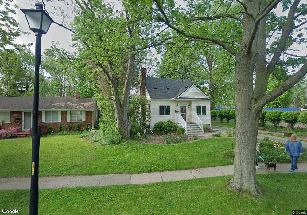
1985 Burns St Ypsilanti, MI 48197
Estimated Value: $259,000 - $288,000
3
Beds
2
Baths
1,193
Sq Ft
$225/Sq Ft
Est. Value
About This Home
This home is located at 1985 Burns St, Ypsilanti, MI 48197 and is currently estimated at $269,020, approximately $225 per square foot. 1985 Burns St is a home located in Washtenaw County with nearby schools including Estabrook Elementary School, Erickson Elementary School, and Holmes Elementary School.
Ownership History
Date
Name
Owned For
Owner Type
Purchase Details
Closed on
Dec 19, 2003
Sold by
Hicks James A and Hicks Rena M
Bought by
Weed Stanley and Weed Jennifer
Current Estimated Value
Home Financials for this Owner
Home Financials are based on the most recent Mortgage that was taken out on this home.
Original Mortgage
$138,400
Outstanding Balance
$56,182
Interest Rate
4.12%
Mortgage Type
Purchase Money Mortgage
Estimated Equity
$212,838
Purchase Details
Closed on
Jan 6, 1999
Sold by
Hicks Ricky L
Bought by
Ezell Clint
Purchase Details
Closed on
Oct 5, 1998
Sold by
Swope Barbara A
Bought by
Hicks James A and Hicks Rena M
Home Financials for this Owner
Home Financials are based on the most recent Mortgage that was taken out on this home.
Original Mortgage
$111,250
Interest Rate
6.98%
Mortgage Type
New Conventional
Create a Home Valuation Report for This Property
The Home Valuation Report is an in-depth analysis detailing your home's value as well as a comparison with similar homes in the area
Home Values in the Area
Average Home Value in this Area
Purchase History
| Date | Buyer | Sale Price | Title Company |
|---|---|---|---|
| Weed Stanley | $173,000 | Transnation Title | |
| Ezell Clint | $53,500 | -- | |
| Hicks James A | $112,000 | -- |
Source: Public Records
Mortgage History
| Date | Status | Borrower | Loan Amount |
|---|---|---|---|
| Open | Weed Stanley | $138,400 | |
| Previous Owner | Hicks James A | $111,250 | |
| Closed | Weed Stanley | $25,950 |
Source: Public Records
Tax History Compared to Growth
Tax History
| Year | Tax Paid | Tax Assessment Tax Assessment Total Assessment is a certain percentage of the fair market value that is determined by local assessors to be the total taxable value of land and additions on the property. | Land | Improvement |
|---|---|---|---|---|
| 2025 | -- | $103,500 | $0 | $0 |
| 2024 | $1,842 | $98,500 | $0 | $0 |
| 2023 | -- | $86,800 | $0 | $0 |
| 2022 | $0 | $85,400 | $0 | $0 |
| 2021 | $2,516 | $73,700 | $0 | $0 |
| 2020 | $2,873 | $71,200 | $0 | $0 |
| 2019 | $2,516 | $64,000 | $64,000 | $0 |
| 2018 | $0 | $71,700 | $0 | $0 |
| 2017 | $2,522 | $67,500 | $0 | $0 |
| 2016 | $1,508 | $50,832 | $0 | $0 |
| 2015 | $2,338 | $50,680 | $0 | $0 |
| 2014 | $2,338 | $49,097 | $0 | $0 |
| 2013 | -- | $49,097 | $0 | $0 |
Source: Public Records
Map
Nearby Homes
- 2017 Harding Ave
- 2002 Midvale Ave
- 224 N Hewitt Rd
- 2418 Draper Ave
- 259 Elmhurst Ave
- 2434 Harding Ave
- 1307 N Congress St
- 1221 S Congress St
- 95 S Mansfield St
- 1805 S Congress St
- 1133 S Congress St
- 246 Kirk St
- 1636 Washtenaw Ave
- 550 Brookside St
- 1621 Whittier Rd
- 2180 Ellsworth Rd
- 1355 Lathers Ave
- 1117 Pearl St
- 247 Aveline St
- 1211 Washtenaw Ave
- 1977 Burns St
- 1967 Burns St
- 2024 Harding Ave
- 2018 Harding Ave
- 2060 Harding Ave
- 2010 Harding Ave
- 1959 Burns St
- 2004 Harding Ave
- 1976 Burns St
- 1984 Burns St
- 1968 Burns St
- 1992 Burns St
- 1951 Burns St
- 1992 Harding Ave
- 1960 Burns St
- 2000 Burns St
- 1984 Harding Ave
- 1952 Burns St
- 2010 Burns St
- 1943 Burns Ave