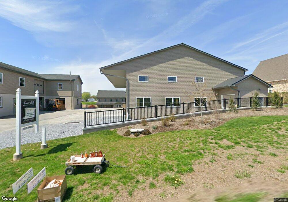
1985 Mine Rd Paradise, PA 17562
Estimated Value: $733,417 - $838,000
5
Beds
2
Baths
3,362
Sq Ft
$235/Sq Ft
Est. Value
About This Home
This home is located at 1985 Mine Rd, Paradise, PA 17562 and is currently estimated at $789,806, approximately $234 per square foot. 1985 Mine Rd is a home located in Lancaster County with nearby schools including Smith Middle School and Solanco High School.
Ownership History
Date
Name
Owned For
Owner Type
Purchase Details
Closed on
Jun 16, 2017
Sold by
Zook Isaac S and Zook Esther S
Bought by
Zook Isaac S and Zook Esther S
Current Estimated Value
Purchase Details
Closed on
Jun 14, 2017
Sold by
Fisher John S and Fisher Linda S
Bought by
Zook Isaac S and Zook Esther S
Purchase Details
Closed on
Mar 24, 2009
Sold by
Stoltzfus Daniel G and Stoltzfus Katie Z
Bought by
Zook Isaac S and Zook Esther S
Home Financials for this Owner
Home Financials are based on the most recent Mortgage that was taken out on this home.
Original Mortgage
$300,000
Interest Rate
5.12%
Mortgage Type
Purchase Money Mortgage
Purchase Details
Closed on
Apr 25, 2000
Sold by
Stoltzfus Moses S and Stoltzfus Barbara E
Bought by
Stoltzfus Daniel G and Stoltzfus Katie Z
Home Financials for this Owner
Home Financials are based on the most recent Mortgage that was taken out on this home.
Original Mortgage
$117,600
Interest Rate
8.23%
Create a Home Valuation Report for This Property
The Home Valuation Report is an in-depth analysis detailing your home's value as well as a comparison with similar homes in the area
Home Values in the Area
Average Home Value in this Area
Purchase History
| Date | Buyer | Sale Price | Title Company |
|---|---|---|---|
| Zook Isaac S | -- | None Available | |
| Zook Isaac S | $30,000 | None Available | |
| Zook Isaac S | $375,000 | None Available | |
| Stoltzfus Daniel G | $175,000 | -- |
Source: Public Records
Mortgage History
| Date | Status | Borrower | Loan Amount |
|---|---|---|---|
| Previous Owner | Zook Isaac S | $300,000 | |
| Previous Owner | Stoltzfus Daniel G | $117,600 |
Source: Public Records
Tax History Compared to Growth
Tax History
| Year | Tax Paid | Tax Assessment Tax Assessment Total Assessment is a certain percentage of the fair market value that is determined by local assessors to be the total taxable value of land and additions on the property. | Land | Improvement |
|---|---|---|---|---|
| 2025 | $7,420 | $458,600 | $83,000 | $375,600 |
| 2024 | $7,420 | $458,600 | $83,000 | $375,600 |
| 2023 | $6,479 | $426,700 | $83,000 | $343,700 |
| 2022 | $6,285 | $426,700 | $83,000 | $343,700 |
| 2021 | $6,064 | $426,700 | $83,000 | $343,700 |
| 2020 | $6,064 | $426,700 | $83,000 | $343,700 |
| 2019 | $5,908 | $426,700 | $83,000 | $343,700 |
| 2018 | $838 | $247,500 | $83,000 | $164,500 |
| 2017 | $3,936 | $234,500 | $49,400 | $185,100 |
| 2016 | $3,936 | $234,500 | $49,400 | $185,100 |
| 2015 | $1,017 | $240,400 | $49,400 | $191,000 |
| 2014 | $2,765 | $240,400 | $49,400 | $191,000 |
Source: Public Records
Map
Nearby Homes
- 771 Georgetown Rd
- 80 Paradise Ln
- 120 Ola Way
- 20 S Kinzer Rd
- 0 Ola Way Unit PALA2065804
- 11 Fernwood Dr
- 12 S Kinzer Rd
- 110 Dawn St
- 6 N Kinzer Rd
- 35 N Kinzer Rd
- 0 N Kinzer Rd
- 5412 Strasburg Rd
- 936 Gap Rd
- 5232 Meadow Ln
- 909 Hidden Hollow Dr
- 5325 Lincoln Hwy
- 125 Reservoir Rd
- 46 Rineer Dr
- 129 Creekview Dr
- 13 Linden Ave
- 1995 Mine Rd
- 1973 Mine Rd
- 1999 Mine Rd
- 2008 Mine Rd
- 1960 Mine Rd
- 1931 Mine Rd
- 1921 Mine Rd
- 2029 Mine Rd
- 1927 Mine Rd
- 2032 Mine Rd
- 1923 Mine Rd
- 2047 Mine Rd
- 1913 Mine Rd
- 1917 Mine Rd
- 1909 Mine Rd
- 5007 White Oak Rd Unit 50095009
- 5170 White Oak Rd
- 5130 White Oak Rd Unit 5132
- 5154 White Oak Rd
- 5068 White Oak Rd