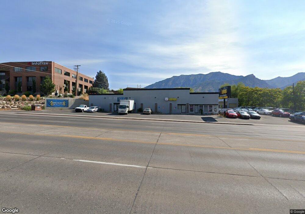
1985 S State St Orem, UT 84097
Hillcrest Neighborhood
Studio
--
Bath
7,300
Sq Ft
0.25
Acres Lot
About This Home
This home is located at 1985 S State St, Orem, UT 84097. 1985 S State St is a home located in Utah County with nearby schools including Centennial Elementary, Lakeridge Jr High School, and Orem High School.
Ownership History
Date
Name
Owned For
Owner Type
Purchase Details
Closed on
May 6, 2010
Sold by
Walker Brent D
Bought by
Oy Llc
Home Financials for this Owner
Home Financials are based on the most recent Mortgage that was taken out on this home.
Original Mortgage
$350,525
Outstanding Balance
$233,673
Interest Rate
4.94%
Mortgage Type
Commercial
Purchase Details
Closed on
Mar 10, 2010
Sold by
Walker Malinda
Bought by
Walker Brent D
Home Financials for this Owner
Home Financials are based on the most recent Mortgage that was taken out on this home.
Original Mortgage
$350,525
Outstanding Balance
$233,673
Interest Rate
4.94%
Mortgage Type
Commercial
Purchase Details
Closed on
Sep 1, 2000
Sold by
Walker Brent and Walker Malinda
Bought by
Walker Brent D
Create a Home Valuation Report for This Property
The Home Valuation Report is an in-depth analysis detailing your home's value as well as a comparison with similar homes in the area
Home Values in the Area
Average Home Value in this Area
Purchase History
We collect this data history from publicly available records. To have your information removed, we recommend requesting removal directly through your county’s website.
| Date | Buyer | Sale Price | Title Company |
|---|---|---|---|
| Oy Llc | -- | None Available | |
| Walker Brent D | -- | None Available | |
| Walker Brent D | -- | Us Title Insurance Agency | |
| Walker Brent D | -- | First American Title Co |
Source: Public Records
Mortgage History
We collect this data history from publicly available records. To have your information removed, we recommend requesting removal directly through your county’s website.
| Date | Status | Borrower | Loan Amount |
|---|---|---|---|
| Open | Oy Llc | $350,525 |
Source: Public Records
Tax History
| Year | Tax Paid | Tax Assessment Tax Assessment Total Assessment is a certain percentage of the fair market value that is determined by local assessors to be the total taxable value of land and additions on the property. | Land | Improvement |
|---|---|---|---|---|
| 2025 | $5,716 | $665,800 | $176,100 | $489,700 |
| 2024 | $5,716 | $698,900 | $0 | $0 |
| 2023 | $5,108 | $671,300 | $0 | $0 |
| 2022 | $5,172 | $658,500 | $173,000 | $485,500 |
| 2021 | $4,769 | $505,800 | $173,300 | $332,500 |
| 2020 | $5,390 | $561,900 | $173,300 | $388,600 |
| 2019 | $5,069 | $549,500 | $160,300 | $389,200 |
| 2018 | $5,033 | $521,300 | $152,700 | $368,600 |
| 2017 | $5,089 | $513,400 | $0 | $0 |
| 2016 | $5,445 | $506,500 | $0 | $0 |
| 2015 | $5,712 | $502,500 | $0 | $0 |
| 2014 | $5,666 | $496,200 | $0 | $0 |
Source: Public Records
Map
Nearby Homes
- 1863 Terrace Dr
- 1055 W 2100 N
- 1927 Columbia Ln
- 1009 W 2000 N
- 930 W 2100 N
- 1925 S 520 E
- 1659 S 800 E
- 628 E 1600 S
- 1362 W 1940 N
- 681 E 1600 S
- 720 E 1500 S
- 840 E 1550 S
- 1554 S 800 E
- 1990 S 424 E
- 1763 Willowbrook Dr Unit 4D1
- 431 W 2310 N
- 1731 Willowbrook Dr Unit B5
- 706 W 1800 N
- 1747 Cobblestone Dr
- 345 E 1830 S
- 2001 S State St Unit 2
- 2005 S State St
- 1889 Terrace Dr
- 1909 Terrace Dr
- 2127 N 1060 W
- 2147 N 1060 W
- 2117 N 1060 W
- 1925 Terrace Dr
- 2163 N 1060 W
- 2181 N 1060 W
- 2219 N 1060 W
- 1902 Terrace Dr
- 2109 N 1060 W
- 2109 N 1060 W
- 1910 Terrace Dr
- 1794 S 750 E
- 1941 Terrace Dr
- 2126 N 1060 St W Unit 1
- 2124 N 1060 W 1
- 2140 N 1060 W
Your Personal Tour Guide
Ask me questions while you tour the home.