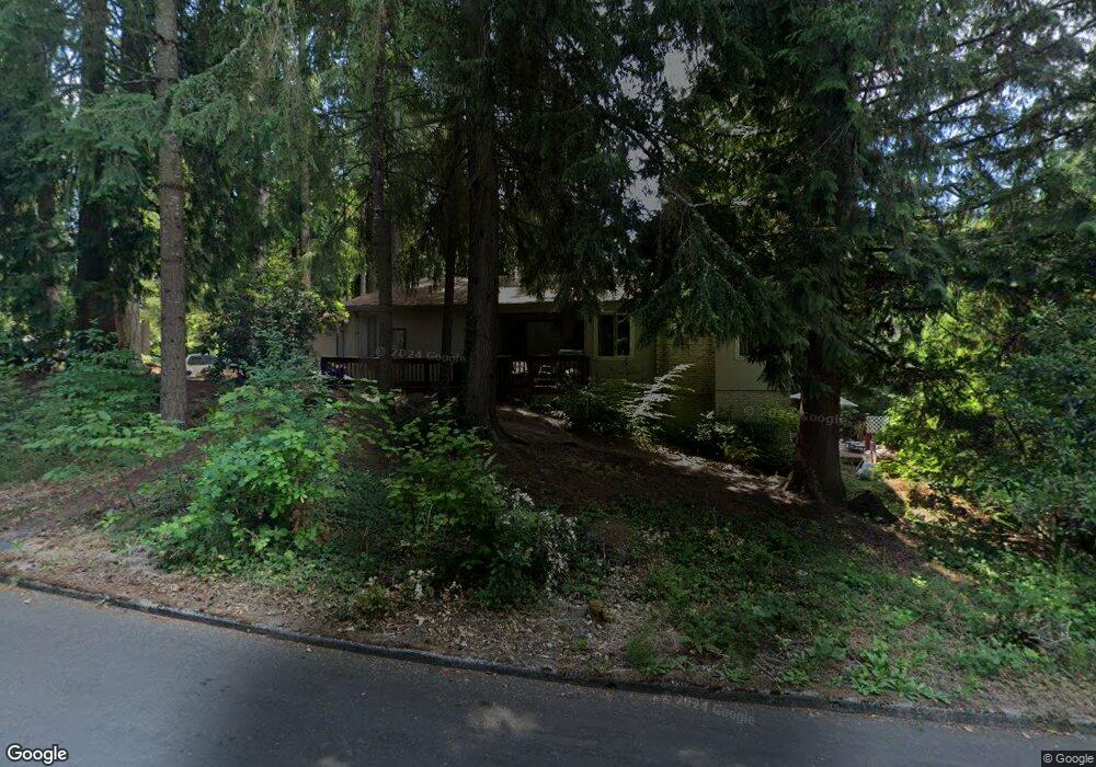
1985 SW Pheasant Dr Beaverton, OR 97006
Estimated Value: $650,406 - $722,000
5
Beds
3
Baths
3,212
Sq Ft
$216/Sq Ft
Est. Value
About This Home
This home is located at 1985 SW Pheasant Dr, Beaverton, OR 97006 and is currently estimated at $694,602, approximately $216 per square foot. 1985 SW Pheasant Dr is a home located in Washington County with nearby schools including Beaver Acres Elementary School, Meadow Park Middle School, and Aloha High School.
Ownership History
Date
Name
Owned For
Owner Type
Purchase Details
Closed on
Nov 21, 2025
Sold by
Craigmile Iris S
Bought by
Craigmile Kevin and Craigmile Iris S
Current Estimated Value
Home Financials for this Owner
Home Financials are based on the most recent Mortgage that was taken out on this home.
Original Mortgage
$207,998
Outstanding Balance
$207,998
Interest Rate
5.52%
Mortgage Type
New Conventional
Estimated Equity
$486,604
Purchase Details
Closed on
Feb 27, 2003
Sold by
Asset Corp
Bought by
Craigmile Michael M and Craigmile Iris S
Home Financials for this Owner
Home Financials are based on the most recent Mortgage that was taken out on this home.
Original Mortgage
$140,000
Interest Rate
5.85%
Purchase Details
Closed on
Jun 12, 2002
Sold by
Hillman Paul E and Hillman Peggy Lou
Bought by
Assetcorp Inc
Purchase Details
Closed on
May 23, 2002
Sold by
Johnson Von Ray
Bought by
Torgerson Donald C
Purchase Details
Closed on
Apr 17, 2002
Sold by
Hillman Paul H
Bought by
Johnson Von Ray
Create a Home Valuation Report for This Property
The Home Valuation Report is an in-depth analysis detailing your home's value as well as a comparison with similar homes in the area
Home Values in the Area
Average Home Value in this Area
Purchase History
| Date | Buyer | Sale Price | Title Company |
|---|---|---|---|
| Craigmile Kevin | -- | Priority Title | |
| Craigmile Michael M | $273,500 | Fidelity Natl Title Co Of Or | |
| Assetcorp Inc | $187,001 | -- | |
| Torgerson Donald C | -- | -- | |
| Johnson Von Ray | -- | -- |
Source: Public Records
Mortgage History
| Date | Status | Borrower | Loan Amount |
|---|---|---|---|
| Open | Craigmile Kevin | $207,998 | |
| Previous Owner | Craigmile Michael M | $140,000 |
Source: Public Records
Tax History Compared to Growth
Tax History
| Year | Tax Paid | Tax Assessment Tax Assessment Total Assessment is a certain percentage of the fair market value that is determined by local assessors to be the total taxable value of land and additions on the property. | Land | Improvement |
|---|---|---|---|---|
| 2026 | $6,400 | $364,020 | -- | -- |
| 2025 | $6,400 | $353,420 | -- | -- |
| 2024 | $6,010 | $343,130 | -- | -- |
| 2023 | $6,010 | $333,140 | $0 | $0 |
| 2022 | $5,815 | $333,140 | $0 | $0 |
| 2021 | $5,606 | $314,020 | $0 | $0 |
| 2020 | $5,437 | $304,880 | $0 | $0 |
| 2019 | $5,259 | $296,000 | $0 | $0 |
| 2018 | $5,087 | $287,380 | $0 | $0 |
| 2017 | $4,904 | $279,010 | $0 | $0 |
| 2016 | $4,729 | $270,890 | $0 | $0 |
| 2015 | $4,547 | $263,000 | $0 | $0 |
| 2014 | $4,431 | $255,340 | $0 | $0 |
Source: Public Records
Map
Nearby Homes
- 1920 SW Pheasant Dr
- 18240 SW Jay St
- 17529 SW Beaver Ct
- 17723 SW Falling Leaf Ct
- 18541 SW Takena Ct
- 18626 SW Judith Ln
- 1550 SW 175th Ave
- 17615 SW Falling Leaf Ct
- 1558 SW 175th Ave
- 18254 SW Smokette Ln
- 17645 SW Jay St
- 17257 SW Berkeley Ln
- 17670 SW September Ln
- 1892 SW Willowview Terrace
- 18795 SW Vista St
- 1082 SW 179th Ave
- 1079 SW 179th Ave
- 18568 SW Muirfield St
- 1706 SW 172nd Terrace
- 18665 SW Honeywood Dr
- 18035 SW Pheasant Ct
- 18055 SW Pheasant Ct
- 1990 SW Pheasant Dr
- 18020 SW Pheasant Ln
- 18020 SW Pheasant Ct
- 1935 SW Pheasant Dr
- 1970 SW Pheasant Dr
- 2010 SW Pheasant Dr
- 1905 SW Pheasant Dr
- 18075 SW Pheasant Ct
- 1950 SW Pheasant Dr
- 2030 SW Pheasant Dr
- 18060 SW Pheasant Ct
- 1940 SW Pheasant Dr
- 1895 SW Pheasant Dr
- 2090 SW Pheasant Dr
- 18120 SW Pheasant Ct
- 2095 SW Pheasant Dr
- 18080 SW Pheasant Ct
- 1885 SW Pheasant Dr