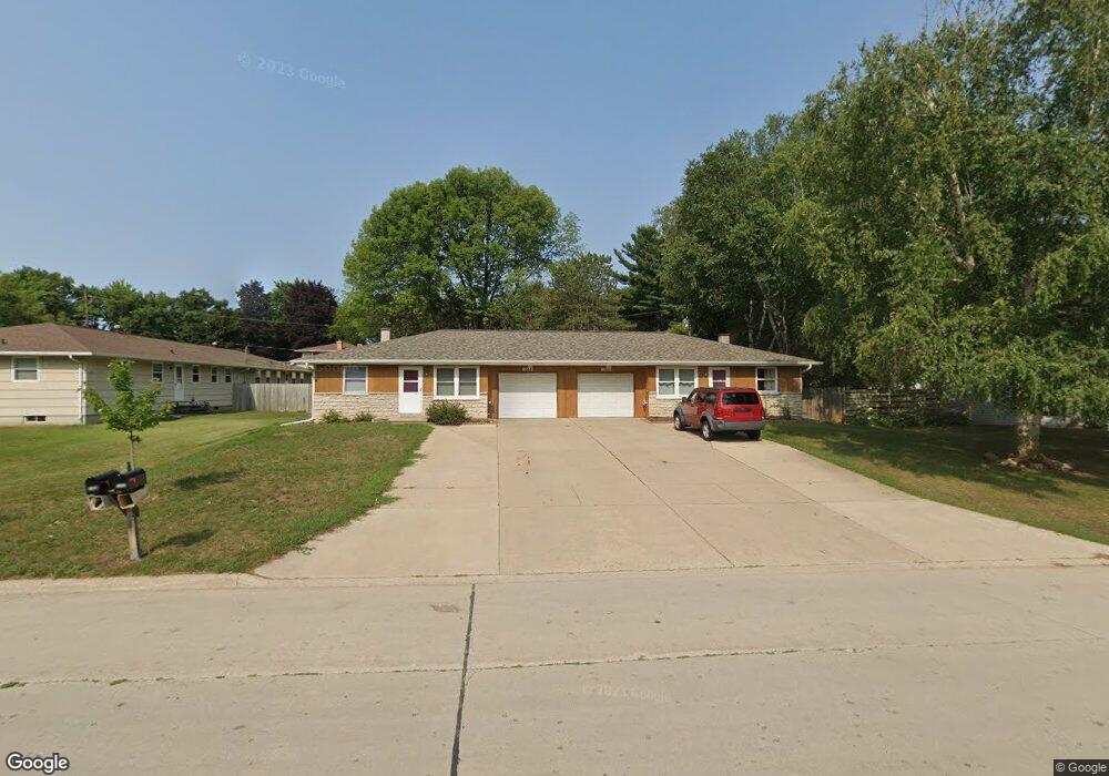
1986 Mulberry Ln Unit 1988 Green Bay, WI 54304
Westside NeighborhoodEstimated Value: $295,000 - $343,000
--
Bed
--
Bath
--
Sq Ft
0.29
Acres
About This Home
This home is located at 1986 Mulberry Ln Unit 1988, Green Bay, WI 54304 and is currently estimated at $325,667. 1986 Mulberry Ln Unit 1988 is a home located in Brown County with nearby schools including King Elementary School, Lombardi Middle School, and Southwest High School.
Ownership History
Date
Name
Owned For
Owner Type
Purchase Details
Closed on
Oct 8, 2012
Sold by
Us Bank National Association Nd
Bought by
Palma Carl P and Palma Michelle W
Current Estimated Value
Purchase Details
Closed on
Jul 9, 2012
Sold by
Berndt April A
Bought by
Us Bank Na
Purchase Details
Closed on
Oct 2, 2003
Sold by
White David D and White Patricia A
Bought by
Berndt April A
Home Financials for this Owner
Home Financials are based on the most recent Mortgage that was taken out on this home.
Original Mortgage
$153,000
Interest Rate
7.34%
Mortgage Type
Unknown
Create a Home Valuation Report for This Property
The Home Valuation Report is an in-depth analysis detailing your home's value as well as a comparison with similar homes in the area
Home Values in the Area
Average Home Value in this Area
Purchase History
| Date | Buyer | Sale Price | Title Company |
|---|---|---|---|
| Palma Carl P | $98,000 | None Available | |
| Us Bank Na | $111,920 | None Available | |
| Berndt April A | $153,000 | Bay Title & Abstract Inc |
Source: Public Records
Mortgage History
| Date | Status | Borrower | Loan Amount |
|---|---|---|---|
| Previous Owner | Berndt April A | $153,000 |
Source: Public Records
Tax History Compared to Growth
Tax History
| Year | Tax Paid | Tax Assessment Tax Assessment Total Assessment is a certain percentage of the fair market value that is determined by local assessors to be the total taxable value of land and additions on the property. | Land | Improvement |
|---|---|---|---|---|
| 2024 | $4,066 | $207,600 | $44,300 | $163,300 |
| 2023 | $3,940 | $207,600 | $44,300 | $163,300 |
| 2022 | $3,810 | $207,600 | $44,300 | $163,300 |
| 2021 | $3,595 | $147,700 | $37,700 | $110,000 |
| 2020 | $3,567 | $147,700 | $37,700 | $110,000 |
| 2019 | $3,485 | $147,700 | $37,700 | $110,000 |
| 2018 | $3,384 | $147,700 | $37,700 | $110,000 |
| 2017 | $3,297 | $147,700 | $37,700 | $110,000 |
| 2016 | $3,254 | $147,700 | $37,700 | $110,000 |
| 2015 | $3,226 | $147,700 | $37,700 | $110,000 |
| 2014 | $3,758 | $147,700 | $37,700 | $110,000 |
| 2013 | $3,758 | $147,700 | $37,700 | $110,000 |
Source: Public Records
Map
Nearby Homes
- 2067 S Point Rd
- 2581 Dunbar Ln
- 2640 He Nis Ra Ln
- 2060 Wintergreen Ct
- 1956 Belmont Dr
- 1437 Baumgart Rd
- 2048 Muirwood Ct
- 2957 Timberline Dr
- 2466 Parkwood Dr
- 2060 Trissino Way
- 2479 Valiant Ln
- 2441 Matchwood Ln
- 3023 Crusade Ln
- 2439 W Point Rd
- 1973 Knotty Pine Dr
- 1514 Ashley Ct
- 3097 S Sandstone Ct
- 3096 S Sandstone Ct
- 1471 Parkway Dr
- 2031 Bradbury Ln
- 2724 Hazelwood Ln Unit 2726
- 1976 Mulberry Ln
- 1972 Mulberry Ln
- 1985 Strawberry Ln
- 2706 Hazelwood Ln
- 2744 Hazelwood Ln
- 1980 Strawberry Ln
- 2725 Hazelwood Ln
- 2731 Hazelwood Ln
- 2721 Hazelwood Ln
- 1973 Mulberry Ln
- 1962 Mulberry Ln Unit 1964
- 2700 Hazelwood Ln
- 2735 Hazelwood Ln
- 2711 Hazelwood Ln
- 1981 Strawberry Ln Unit 1983
- 1976 Strawberry Ln
- 1967 Mulberry Ln
- 1981 Candle Way
- 1989 Candle Way