Estimated Value: $2,240,787 - $2,581,000
3
Beds
1
Bath
2,302
Sq Ft
$1,062/Sq Ft
Est. Value
About This Home
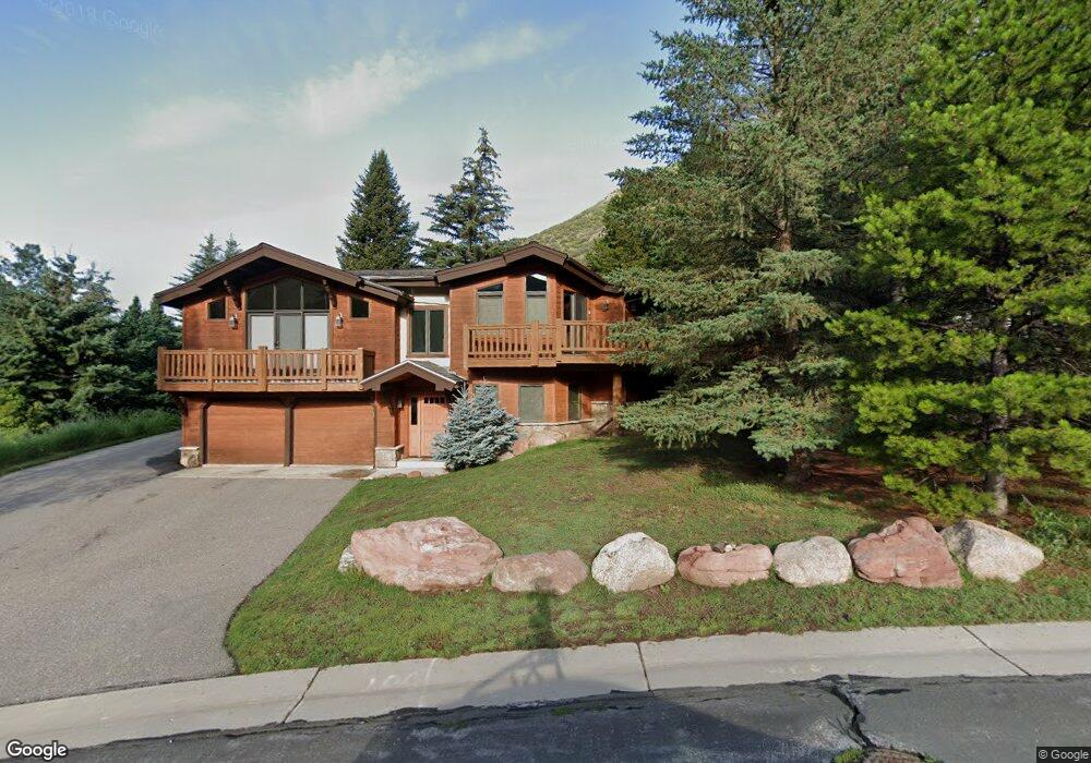
This home is located at 1987 Circle Dr, Vail, CO 81657 and is currently estimated at $2,444,447, approximately $1,061 per square foot. 1987 Circle Dr is a home located in Eagle County with nearby schools including Red Sandstone Elementary School and Battle Mountain High School.
Ownership History
Date
Name
Owned For
Owner Type
Purchase Details
Closed on
Jun 8, 2022
Sold by
Amy G Burnett Trust
Bought by
Amy G Burnett Trust
Current Estimated Value
Home Financials for this Owner
Home Financials are based on the most recent Mortgage that was taken out on this home.
Original Mortgage
$1,300,000
Outstanding Balance
$1,226,634
Interest Rate
5.3%
Mortgage Type
New Conventional
Estimated Equity
$1,217,813
Purchase Details
Closed on
Sep 26, 2019
Sold by
Campbell Robert and The Estate Of Jeannine Erickso
Bought by
Amy G Burnett Trust
Purchase Details
Closed on
Nov 4, 2005
Sold by
Burnett Amy G
Bought by
Amy G Burnett Trust
Purchase Details
Closed on
Nov 1, 2005
Sold by
Ulmer Simon W and Hauptman Sylvia E
Bought by
Burnett Amy G
Purchase Details
Closed on
Apr 9, 2002
Sold by
Ulmer Simon W
Bought by
Ulmer Simon W and Hauptman Sylvia E
Purchase Details
Closed on
Jul 30, 2001
Sold by
Rock Creek Canyon Llc
Bought by
Ulmer Simon W
Create a Home Valuation Report for This Property
The Home Valuation Report is an in-depth analysis detailing your home's value as well as a comparison with similar homes in the area
Home Values in the Area
Average Home Value in this Area
Purchase History
| Date | Buyer | Sale Price | Title Company |
|---|---|---|---|
| Amy G Burnett Trust | -- | None Listed On Document | |
| Amy G Burnett Trust | $1,135,000 | Land Title Guarantee Co | |
| Amy G Burnett Trust | -- | Land Title Guarantee Company | |
| Burnett Amy G | $950,000 | Land Title Guarantee Company | |
| Ulmer Simon W | -- | -- | |
| Ulmer Simon W | $381,804 | -- |
Source: Public Records
Mortgage History
| Date | Status | Borrower | Loan Amount |
|---|---|---|---|
| Open | Amy G Burnett Trust | $1,300,000 |
Source: Public Records
Tax History
| Year | Tax Paid | Tax Assessment Tax Assessment Total Assessment is a certain percentage of the fair market value that is determined by local assessors to be the total taxable value of land and additions on the property. | Land | Improvement |
|---|---|---|---|---|
| 2024 | $6,081 | $127,860 | $33,220 | $94,640 |
| 2023 | $6,081 | $127,860 | $33,220 | $94,640 |
| 2022 | $3,154 | $61,370 | $26,130 | $35,240 |
| 2021 | $3,247 | $63,130 | $26,880 | $36,250 |
| 2020 | $3,712 | $73,140 | $21,120 | $52,020 |
| 2019 | $3,724 | $73,140 | $21,120 | $52,020 |
| 2018 | $3,420 | $65,830 | $18,370 | $47,460 |
| 2017 | $3,403 | $65,830 | $18,370 | $47,460 |
| 2016 | $3,483 | $68,120 | $18,170 | $49,950 |
Source: Public Records
Map
Nearby Homes
- 2079 Chamonix Ln Unit 5
- 1890 Lions Ridge Loop Unit 11
- 1854 Glacier Ct Unit A
- 2199 Chamonix Ln Unit 9
- 1400 Lions Ridge Loop Unit 5
- 1400 Lions Ridge Loop Unit 1
- 1677 Buffehr Creek Rd
- 2254 S Frontage Rd W Unit 106/week 51
- 1476 Westhaven Dr Unit 20
- 1476 Westhaven Dr Unit 12
- 1476 Westhaven Dr Unit 22
- 2417 Garmisch Dr Unit B
- 1461 Greenhill Ct Unit A and B
- 2448 Garmisch Dr Unit 7
- 2448 Garmisch Dr Unit 4
- 1455 Greenhill Ct Unit West
- 1488 Blue Rose Ln Unit B2
- 1488 Blue Rose Ln Unit A3
- 1488 Blue Rose Ln Unit C3
- 1488 Blue Rose Ln Unit A1
- 1987 Circle Dr Unit B
- 1987 Circle Dr Unit A
- 1977 Circle Dr
- 1995 Chamonix Ln
- 1969 Circle Dr
- 2009 Chamonix Ln
- 1967 Circle Dr
- 1956 Circle Dr
- 1970 Chamonix Ln Unit A
- 1970 Chamonix Ln Unit B
- 1970 Chamonix Ln
- 2019 Chamonix Ln Unit B
- 2019 Chamonix Ln Unit A
- 1992 Chamonix Ln Unit 36E
- 1992 Chamonix Ln Unit East
- 1957 Circle Dr
- 2000 Chamonix Ln
- 2000 Chamonix Ln Unit All
- 1990 Chamonix Ln
- 1947 Circle Dr
Your Personal Tour Guide
Ask me questions while you tour the home.