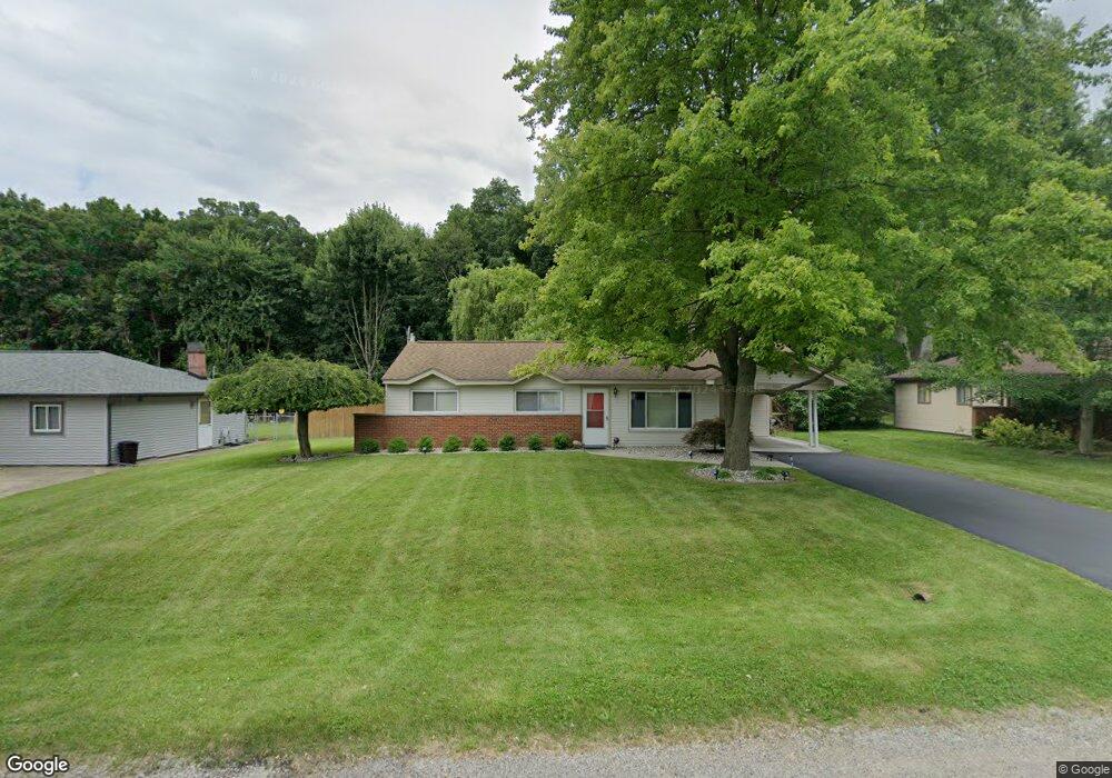
1987 Henbert Rd West Bloomfield, MI 48324
Estimated Value: $214,745 - $247,000
3
Beds
1
Bath
1,016
Sq Ft
$231/Sq Ft
Est. Value
About This Home
This home is located at 1987 Henbert Rd, West Bloomfield, MI 48324 and is currently estimated at $234,686, approximately $230 per square foot. 1987 Henbert Rd is a home located in Oakland County with nearby schools including Haviland Elementary School, Pierce Middle School, and Waterford Mott High School.
Ownership History
Date
Name
Owned For
Owner Type
Purchase Details
Closed on
Sep 9, 1997
Sold by
Federico Frank
Bought by
Ratiu Elena A
Current Estimated Value
Home Financials for this Owner
Home Financials are based on the most recent Mortgage that was taken out on this home.
Original Mortgage
$88,650
Outstanding Balance
$12,207
Interest Rate
7.54%
Estimated Equity
$222,479
Create a Home Valuation Report for This Property
The Home Valuation Report is an in-depth analysis detailing your home's value as well as a comparison with similar homes in the area
Home Values in the Area
Average Home Value in this Area
Purchase History
| Date | Buyer | Sale Price | Title Company |
|---|---|---|---|
| Ratiu Elena A | $98,500 | -- |
Source: Public Records
Mortgage History
| Date | Status | Borrower | Loan Amount |
|---|---|---|---|
| Open | Ratiu Elena A | $88,650 |
Source: Public Records
Tax History
| Year | Tax Paid | Tax Assessment Tax Assessment Total Assessment is a certain percentage of the fair market value that is determined by local assessors to be the total taxable value of land and additions on the property. | Land | Improvement |
|---|---|---|---|---|
| 2025 | $1,688 | $92,190 | $48,600 | $43,590 |
| 2024 | $977 | $78,570 | $0 | $0 |
| 2022 | $932 | $73,970 | $36,000 | $37,970 |
| 2021 | $1,449 | $62,020 | $0 | $0 |
| 2020 | $854 | $58,250 | $26,570 | $31,680 |
| 2018 | $1,385 | $48,650 | $21,000 | $27,650 |
| 2015 | -- | $40,580 | $0 | $0 |
| 2014 | -- | $37,370 | $0 | $0 |
| 2011 | -- | $35,760 | $0 | $0 |
Source: Public Records
Map
Nearby Homes
- 1763 Henbert Rd
- 6313 Kiev St
- 6620 Red Cedar Ln Unit 37
- 2275 Forest Glen
- 5920 Greer Rd
- 5699 Applegrove Dr
- Lot 94 Hiller Rd
- 2110 Peachtree Ct
- VAC Mercedes Ave
- 1860 Hiller Rd
- 2833 Hiller Rd
- 2501 Doleman Dr
- 0000 Hiller Rd
- 5617 Millpointe Dr
- 1150 Jay St
- 2150 Mapesbury Dr
- 9999 Cooley Lake Rd
- 1701 Marylestone Dr
- 1901 Midchester Dr
- 1630 Weymouth St
- 1971 Henbert Rd
- 1997 Henbert Rd
- 1955 Henbert Rd
- 1996 Henbert Rd
- 1980 Henbert Rd
- 2012 Henbert Rd
- 1964 Henbert Rd
- 1939 Henbert Rd
- 2007 Henbert Rd
- 2017 Henbert Rd
- 1948 Henbert Rd
- 2028 Henbert Rd
- 1923 Henbert Rd
- 1945 Sarona Ln
- 1957 Sarona Ln
- 1979 Sarona Ln
- 2027 Henbert Rd
- 2044 Henbert Rd
- 1933 Sarona Ln
- 1907 Henbert Rd
Your Personal Tour Guide
Ask me questions while you tour the home.