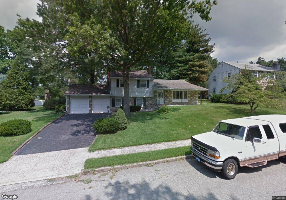
1987 Virginia Ln Norristown, PA 19403
Estimated Value: $467,000 - $550,000
3
Beds
3
Baths
1,885
Sq Ft
$277/Sq Ft
Est. Value
About This Home
This home is located at 1987 Virginia Ln, Norristown, PA 19403 and is currently estimated at $522,253, approximately $277 per square foot. 1987 Virginia Ln is a home located in Montgomery County with nearby schools including Charles Blockson Middle School, Paul V Fly Elementary School, and East Norriton Middle School.
Ownership History
Date
Name
Owned For
Owner Type
Purchase Details
Closed on
Apr 30, 2008
Sold by
Russo James J and Russo Charles A
Bought by
Harbison Madeline M and Harbison William E
Current Estimated Value
Home Financials for this Owner
Home Financials are based on the most recent Mortgage that was taken out on this home.
Original Mortgage
$132,000
Interest Rate
6.11%
Create a Home Valuation Report for This Property
The Home Valuation Report is an in-depth analysis detailing your home's value as well as a comparison with similar homes in the area
Home Values in the Area
Average Home Value in this Area
Purchase History
| Date | Buyer | Sale Price | Title Company |
|---|---|---|---|
| Harbison Madeline M | $282,000 | None Available |
Source: Public Records
Mortgage History
| Date | Status | Borrower | Loan Amount |
|---|---|---|---|
| Previous Owner | Harbison Madeline M | $132,000 |
Source: Public Records
Tax History Compared to Growth
Tax History
| Year | Tax Paid | Tax Assessment Tax Assessment Total Assessment is a certain percentage of the fair market value that is determined by local assessors to be the total taxable value of land and additions on the property. | Land | Improvement |
|---|---|---|---|---|
| 2025 | $7,041 | $144,110 | $48,160 | $95,950 |
| 2024 | $7,041 | $144,110 | $48,160 | $95,950 |
| 2023 | $6,962 | $144,110 | $48,160 | $95,950 |
| 2022 | $6,916 | $144,110 | $48,160 | $95,950 |
| 2021 | $6,874 | $144,110 | $48,160 | $95,950 |
| 2020 | $6,669 | $144,110 | $48,160 | $95,950 |
| 2019 | $6,520 | $144,110 | $48,160 | $95,950 |
| 2018 | $5,074 | $144,110 | $48,160 | $95,950 |
| 2017 | $6,155 | $144,110 | $48,160 | $95,950 |
| 2016 | $6,099 | $144,110 | $48,160 | $95,950 |
| 2015 | $5,651 | $144,110 | $48,160 | $95,950 |
| 2014 | $5,651 | $144,110 | $48,160 | $95,950 |
Source: Public Records
Map
Nearby Homes
- 1992 Keswick Way
- 618 Brandon Rd
- 1924 Juniata Rd
- 443 Brandon Rd
- 1914 Yorktown S
- 391 Rittenhouse Blvd
- 570 Canterbury Rd
- 2060 Yorktown S
- 143 Riversedge Dr Unit CONDO 143
- 121 Woodstream Dr Unit CONDO 121
- 68 Jefferson Ave
- 2044 Mill Rd
- 37 Burnside Ave
- 2055 W Marshall St
- 32 Miami Rd
- 392 Joseph St
- 1633 Williams Way
- 1107 Middleton Place
- 1749 W Marshall St
- 0 Roosevelt Blvd
- 1981 Virginia Ln
- 1993 Virginia Ln
- 1986 Keswick Way
- 1975 Virginia Ln
- 1980 Keswick Way
- 1999 Virginia Ln
- 1986 Virginia Ln
- 1980 Virginia Ln
- 1992 Virginia Ln
- 1998 Keswick Way
- 1969 Virginia Ln
- 1998 Virginia Ln
- 1974 Virginia Ln
- 2004 Keswick Way
- 1968 Keswick Way
- 2004 Virginia Ln
- 1968 Virginia Ln
- 2011 Virginia Ln
- 2010 Keswick Way
- 1999 Keswick Way