Estimated Value: $703,000 - $813,000
4
Beds
3
Baths
3,483
Sq Ft
$213/Sq Ft
Est. Value
About This Home
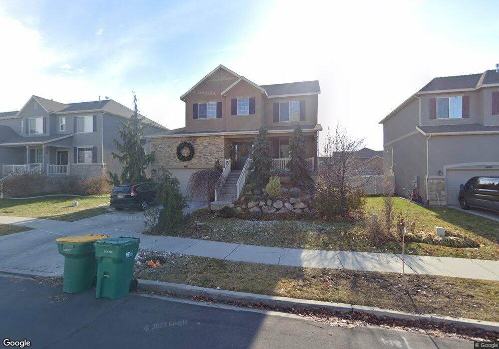
This home is located at 1987 W Grays Dr Unit 501, Lehi, UT 84043 and is currently estimated at $741,232, approximately $212 per square foot. 1987 W Grays Dr Unit 501 is a home located in Utah County with nearby schools including Snow Springs Elementary, Willowcreek Middle School, and Lehi High School.
Ownership History
Date
Name
Owned For
Owner Type
Purchase Details
Closed on
Jun 11, 2025
Sold by
Funk Jason and Funk Stefanie
Bought by
Jason And Stefanie Funk Living Trust and Funk
Current Estimated Value
Purchase Details
Closed on
Dec 19, 2018
Sold by
Hughes R Scott and Hughes Natalie
Bought by
Funk Jason and Funk Stefanie
Home Financials for this Owner
Home Financials are based on the most recent Mortgage that was taken out on this home.
Original Mortgage
$420,718
Interest Rate
4.9%
Mortgage Type
New Conventional
Purchase Details
Closed on
Feb 7, 2013
Sold by
Richmond American Homes Of Utah Inc
Bought by
Hughes R Scott and Hughes Natalie
Home Financials for this Owner
Home Financials are based on the most recent Mortgage that was taken out on this home.
Original Mortgage
$272,627
Interest Rate
3.32%
Mortgage Type
New Conventional
Create a Home Valuation Report for This Property
The Home Valuation Report is an in-depth analysis detailing your home's value as well as a comparison with similar homes in the area
Home Values in the Area
Average Home Value in this Area
Purchase History
| Date | Buyer | Sale Price | Title Company |
|---|---|---|---|
| Jason And Stefanie Funk Living Trust | -- | None Listed On Document | |
| Funk Jason | -- | Pinnacle Title | |
| Hughes R Scott | -- | First American Title Compan |
Source: Public Records
Mortgage History
| Date | Status | Borrower | Loan Amount |
|---|---|---|---|
| Previous Owner | Funk Jason | $420,718 | |
| Previous Owner | Hughes R Scott | $272,627 |
Source: Public Records
Tax History Compared to Growth
Tax History
| Year | Tax Paid | Tax Assessment Tax Assessment Total Assessment is a certain percentage of the fair market value that is determined by local assessors to be the total taxable value of land and additions on the property. | Land | Improvement |
|---|---|---|---|---|
| 2025 | $2,941 | $361,295 | $205,900 | $451,000 |
| 2024 | $2,941 | $344,190 | $0 | $0 |
| 2023 | $2,789 | $354,420 | $0 | $0 |
| 2022 | $2,703 | $332,915 | $0 | $0 |
| 2021 | $2,454 | $457,100 | $119,100 | $338,000 |
| 2020 | $2,315 | $426,200 | $110,300 | $315,900 |
| 2019 | $2,227 | $426,200 | $110,300 | $315,900 |
| 2018 | $1,997 | $361,200 | $95,600 | $265,600 |
| 2017 | $1,933 | $185,900 | $0 | $0 |
| 2016 | $1,951 | $174,130 | $0 | $0 |
| 2015 | $1,912 | $161,975 | $0 | $0 |
| 2014 | $1,906 | $160,545 | $0 | $0 |
Source: Public Records
Map
Nearby Homes
- 202 S 2035 W
- 131 S 1900 W Unit 2
- 1784 W Grays Place
- 1743 W Grays Place
- 2162 W Main St Unit E303
- 2178 W Main St Unit D301
- 210 S Tamarak Cir
- 41 N 2150 W
- 380 S 1500 W
- 161 S 1475 W
- 603 S 2500 W
- 581 S 1500 W
- 811 S 2300 W
- 1664 W 800 S
- 928 Gander Way
- 2190 W Cape Fox Way Unit 219
- 105 N 2430 W
- The Roslyn Plan at Carla's Cove
- The Tracie Plan at Carla's Cove
- The Brooke Plan at Carla's Cove