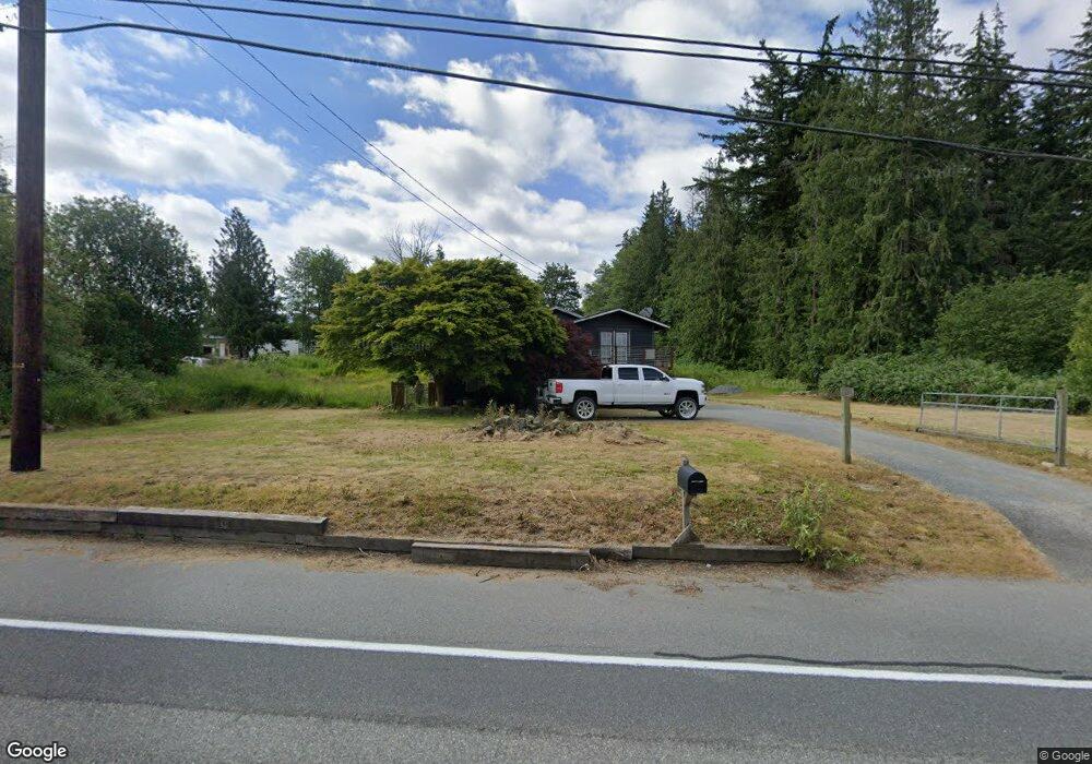
19878 State Route 534 Mount Vernon, WA 98274
Estimated Value: $475,000 - $773,000
2
Beds
2
Baths
1,765
Sq Ft
$347/Sq Ft
Est. Value
About This Home
This home is located at 19878 State Route 534, Mount Vernon, WA 98274 and is currently estimated at $613,139, approximately $347 per square foot. 19878 State Route 534 is a home located in Skagit County with nearby schools including Conway School.
Ownership History
Date
Name
Owned For
Owner Type
Purchase Details
Closed on
Dec 23, 2009
Sold by
Howard Kirk J and Howard Blake J
Bought by
Omalley Tyrel
Current Estimated Value
Home Financials for this Owner
Home Financials are based on the most recent Mortgage that was taken out on this home.
Original Mortgage
$221,415
Outstanding Balance
$144,271
Interest Rate
4.88%
Mortgage Type
FHA
Estimated Equity
$468,868
Purchase Details
Closed on
Aug 23, 2004
Sold by
Howard Susannah
Bought by
Howard Kirk J
Home Financials for this Owner
Home Financials are based on the most recent Mortgage that was taken out on this home.
Original Mortgage
$134,400
Interest Rate
5.37%
Mortgage Type
Purchase Money Mortgage
Create a Home Valuation Report for This Property
The Home Valuation Report is an in-depth analysis detailing your home's value as well as a comparison with similar homes in the area
Home Values in the Area
Average Home Value in this Area
Purchase History
| Date | Buyer | Sale Price | Title Company |
|---|---|---|---|
| Omalley Tyrel | $225,780 | Land Title & Escrow | |
| Howard Kirk J | -- | Land Title Company Of Skagit | |
| Howard Blake J | -- | Land Title Company Of Skagit | |
| Howard Kirk J | $167,977 | Land Title Company Of Skagit |
Source: Public Records
Mortgage History
| Date | Status | Borrower | Loan Amount |
|---|---|---|---|
| Open | Omalley Tyrel | $221,415 | |
| Previous Owner | Howard Kirk J | $134,400 | |
| Closed | Howard Kirk J | $25,200 |
Source: Public Records
Tax History Compared to Growth
Tax History
| Year | Tax Paid | Tax Assessment Tax Assessment Total Assessment is a certain percentage of the fair market value that is determined by local assessors to be the total taxable value of land and additions on the property. | Land | Improvement |
|---|---|---|---|---|
| 2024 | $4,357 | $518,200 | $233,800 | $284,400 |
| 2023 | $4,357 | $479,200 | $218,600 | $260,600 |
| 2022 | $3,737 | $484,100 | $212,500 | $271,600 |
| 2021 | $3,737 | $373,500 | $160,300 | $213,200 |
| 2020 | $3,487 | $345,200 | $0 | $0 |
| 2019 | $2,974 | $320,800 | $0 | $0 |
| 2018 | $3,356 | $277,500 | $0 | $0 |
| 2017 | $3,082 | $264,700 | $0 | $0 |
| 2016 | $2,973 | $244,400 | $111,000 | $133,400 |
| 2015 | $2,655 | $228,100 | $103,600 | $124,500 |
| 2013 | $2,732 | $188,600 | $0 | $0 |
Source: Public Records
Map
Nearby Homes
- 20616 Bulson Rd
- 19687 Trophy Ln
- 18520 Main St
- 22414 Bulson Rd
- 22539 Fieldstone Ln
- 0 Milltown Crossing Rd Unit NWM2358059
- 20434 Benson Ridge
- 20519 Benson Ridge Ln
- 20555 Benson Ridge
- 23158 Bonnieview Rd
- 17406 Fir Island Rd
- 0 XX 00
- 21314 Starbird Rd
- 0 Cedardale Rd Unit 11749606
- 18340 Osprey Ct
- 18345 Osprey Ct
- 18524 Swanson Ln
- 33020 84th Ave NW
- 16498 Fir Island Rd
- 17609 S Skyridge Dr
- 19940 State Route 534
- 20960 Bulson Rd
- 21086 Bulson Rd
- 21060 Bulson Rd
- 21110 Bulson Rd
- 19716 E Conway Hill Ln
- 20971 Bulson Rd
- 21121 Bulson Rd
- 19712 E Conway Hill Ln
- 21166 Bulson Rd
- 21154 Bulson Rd
- 21178 Bulson Rd
- 19907 Karla Ct
- 19710 E Conway Hill Ln
- 21047 Bulson Rd
- 21159 Bulson Rd
- 19975 Karla Ct
- 19702 E Conway Hill Ln
- 19902 Karla Ct