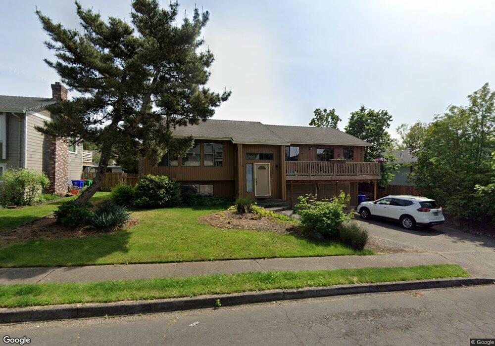
1988 SW 26th Ct Gresham, OR 97080
Southwest Gresham NeighborhoodEstimated Value: $539,866 - $578,000
3
Beds
3
Baths
1,660
Sq Ft
$336/Sq Ft
Est. Value
About This Home
This home is located at 1988 SW 26th Ct, Gresham, OR 97080 and is currently estimated at $557,217, approximately $335 per square foot. 1988 SW 26th Ct is a home located in Multnomah County with nearby schools including Dexter McCarty Middle School, Gresham High School, and Portland Adventist Elementary School.
Ownership History
Date
Name
Owned For
Owner Type
Purchase Details
Closed on
Jul 6, 2010
Sold by
Welch Richard L
Bought by
Welch Richard L and Welch Jeannine M
Current Estimated Value
Home Financials for this Owner
Home Financials are based on the most recent Mortgage that was taken out on this home.
Original Mortgage
$162,000
Outstanding Balance
$107,609
Interest Rate
4.79%
Mortgage Type
New Conventional
Estimated Equity
$449,608
Purchase Details
Closed on
Feb 15, 1996
Sold by
Va
Bought by
Welch Richard L and Autry Jeannine M
Create a Home Valuation Report for This Property
The Home Valuation Report is an in-depth analysis detailing your home's value as well as a comparison with similar homes in the area
Home Values in the Area
Average Home Value in this Area
Purchase History
| Date | Buyer | Sale Price | Title Company |
|---|---|---|---|
| Welch Richard L | -- | First American | |
| Welch Richard L | $81,008 | First American Title Ins Co |
Source: Public Records
Mortgage History
| Date | Status | Borrower | Loan Amount |
|---|---|---|---|
| Open | Welch Richard L | $162,000 |
Source: Public Records
Tax History
| Year | Tax Paid | Tax Assessment Tax Assessment Total Assessment is a certain percentage of the fair market value that is determined by local assessors to be the total taxable value of land and additions on the property. | Land | Improvement |
|---|---|---|---|---|
| 2025 | $6,767 | $332,550 | -- | -- |
| 2024 | $6,478 | $322,870 | -- | -- |
| 2023 | $5,902 | $313,470 | $0 | $0 |
| 2022 | $5,737 | $304,340 | $0 | $0 |
| 2021 | $5,592 | $295,480 | $0 | $0 |
| 2020 | $5,262 | $286,880 | $0 | $0 |
| 2019 | $5,124 | $278,530 | $0 | $0 |
| 2018 | $4,886 | $270,420 | $0 | $0 |
| 2017 | $4,688 | $262,550 | $0 | $0 |
| 2016 | $4,133 | $254,910 | $0 | $0 |
Source: Public Records
Map
Nearby Homes
- 2520 SW Towle Ave
- 3120 SW Orchard Place
- 2791 SW Myers Dr
- 1441 SW 23rd Ct
- 1278 SW 27th Ct
- 1320 SW 31st St
- 1880 SW Heiney Rd
- 1261 SW Binford Lake Pkwy
- 1859 SW Angeline Ave
- 1721 SW Butler Rd
- 3506 SW Battaglia Ave
- 3512 SW Battaglia Ave
- 3503 SW Battaglia Ave
- 1963 SW Myers Place
- 3536 SW Battaglia Ave
- 3558 SW Battaglia Ave
- 3504 SW Binford Ave
- 3582 SW Battaglia Ave
- 3539 SW Battaglia Ave
- 3510 SW Binford Ave
- 1976 SW 26th Ct
- 2656 SW Wonderview Dr
- 2075 SW 27th Dr
- 2680 SW Wonderview Dr
- 2055 SW 27th Dr
- 1952 SW 26th Ct
- 1983 SW 26th Ct
- 2572 SW Wonderview Dr
- 1969 SW 26th Ct
- 2035 SW 27th Dr
- 2649 SW Wonderview Dr
- 1946 SW 26th Ct
- 1955 SW 26th Ct
- 2681 SW Wonderview Dr
- 2092 SW 27th Dr
- 2005 SW 27th Dr
- 2062 SW 27th Dr
- 2065 SW 26th St
- 1974 SW 25th St
- 2550 SW Wonderview Dr
Your Personal Tour Guide
Ask me questions while you tour the home.